Jul
20
Daily Forecast July 21, 2020
Have a good day!
Tuesday
Mostly sunny, with a high near 95.
Tuesday Night
A chance of showers and thunderstorms after 2am. Mostly cloudy, with a low around 74
Have a good day!
Tuesday
Mostly sunny, with a high near 95.
Tuesday Night
A chance of showers and thunderstorms after 2am. Mostly cloudy, with a low around 74
EXCESSIVE HEAT WARNING REMAINS IN EFFECT UNTIL 8 PM EDT
Monday
A slight chance of showers and thunderstorms after 1pm. Partly sunny and hot, with a high near 99. Heat index values as high as 106.
Monday Night
Partly cloudy, with a low around 73
Have a good weekend. Excessive Heat Watch in effect Sunday until Tuesday.
Saturday
Patchy fog before 8am. Otherwise, sunny, with a high near 95. Calm wind becoming northwest around 5 mph.
Saturday Night
Mostly clear, with a low around 73. Calm wind becoming south around 5 mph after midnight.
Sunday
Sunny and hot, with a high near 97. Calm wind becoming southwest around 5 mph in the afternoon.
Sunday Night
Mostly clear, with a low around 77.

Have a great Friday! Today we will see some showers and thunderstorms. Also it will be HOT HOT HOT HOT over the next few days!
Friday
A chance of showers and thunderstorms. Mostly cloudy, with a high near 88.
Friday Night
A chance of showers and thunderstorms, mainly before 2am. Mostly cloudy, with a low around 72
Have a GREAT Thursday!
Thursday
|Partly sunny, with a high near 84
Thursday Night
A slight chance of showers and thunderstorms. Mostly cloudy, with a low around 69
Have a GREAT Day!
Wednesday
Mostly sunny, with a high near 87.
Wednesday Night
Partly cloudy, with a low around 67
Have a great Tuesday!
Tuesday
Sunny, with a high near 89. Light northwest wind increasing to 5 to 10 mph in the morning.
Tuesday Night
Mostly clear, with a low around 67
Have a GREAT Monday!
Monday
A chance of showers and thunderstorms. Partly sunny, with a high near 88.
Monday Night
A chance of thunderstorms. Partly cloudy, with a low around 68.
Have a great weekend.
Saturday
A slight chance of showers, then a chance of showers and thunderstorms after noon. Mostly sunny, with a high near 90.
Saturday Night
Showers and thunderstorms likely, mainly before 9pm. Partly cloudy, with a low around 72.
Sunday
A chance of showers thunderstorms. Sunny, with a high near 90.
Sunday Night
A slight chance of showers and thunderstorms. Partly cloudy, with a low around 73
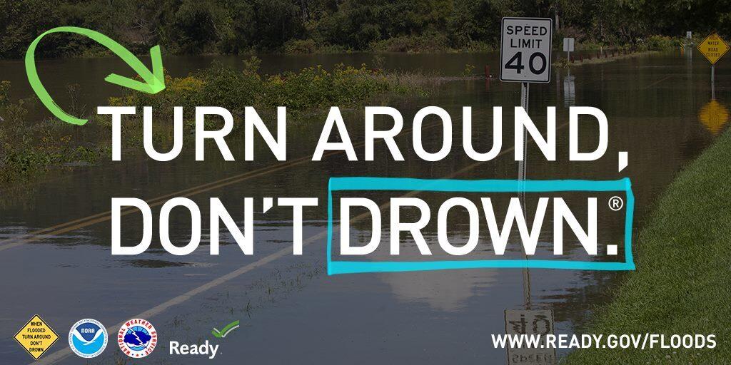
Today will be a good day to stay inside. 2-4″ of rain possible for some parts of the area. Do NOT travel if you do not have to venture out. Flooding is possible in parts of the area.
Tropical Storm Fay will bring heavy rain to the area. Tropical force winds look to mainly be along the coast.
Friday
Showers and possibly a thunderstorm. Some of the storms could produce heavy rainfall. High near 82. New rainfall amounts between 1 and 2 inches possible.
Friday Night
Showers likely and possibly a thunderstorm. Some of the storms could produce heavy rainfall. Mostly cloudy, with a low around 71. New precipitation amounts between a three quarters of an inch and an inch possible.
SITUATION OVERVIEW
——————
Heavy rain leading to flooding will be possible, especially along and southeast of the Interstate 95 corridor due to Tropical Storm Fay. Tropical Storm Fay is currently off the Virginia coast. It is expected to progress north over our region through Friday. Heavy rain is possible beginning very late tonight and continuing through Friday evening. The threat for tropical storm winds over land is very low except right along the New Jersey coast.
POTENTIAL IMPACTS
—————–
* FLOODING RAIN:
Protect against dangerous rainfall flooding having possible significant
impacts along and southeast of the Interstate 95 corridor. Potential
impacts include:
– Moderate rainfall flooding may prompt several evacuations and rescues.
– Rivers and tributaries may quickly become swollen with swifter currents and overspill their banks in a few places, especially in usually vulnerable spots. Small streams, creeks, canals, arroyos, and ditches overflow.
– Flood waters can enter some structures or weaken foundations.
Several places may experience expanded areas of rapid Linundation at underpasses, low-lying spots, and poor drainage areas. Some streets and parking lots take on moving water as storm drains and retention ponds overflow. Driving conditions become hazardous. Some road and bridge closures.
* TORNADOES:
Protect against a tornado event having possible limited impacts across
New Jersey and southeastern Pennsylvania. Potential impacts include:
– The occurrence of isolated tornadoes can hinder the execution of emergency plans during tropical events.
– A few places may experience tornado damage, along with power and communications disruptions.
– Locations could realize roofs peeled off buildings, chimneys toppled, mobile homes pushed off foundations or overturned,large tree tops and branches snapped off, shallow-rooted trees knocked over, moving vehicles blown off roads, and small boats pulled from moorings.
* WIND:
Protect against hazardous wind having possible limited impacts across
coastal New Jersey. Potential impacts in this area include:
– Damage to porches, awnings, carports, sheds, and unanchored mobile homes. Unsecured lightweight objects blown about.
– Many large tree limbs broken off. A few trees snapped or uprooted, but with greater numbers in places where trees are shallow rooted. Some fences and roadway signs blown over.
– A few roads impassable from debris, particularly within urban or heavily wooded places. Hazardous driving conditions on bridges and other elevated roadways.
– Scattered power and communications outages.