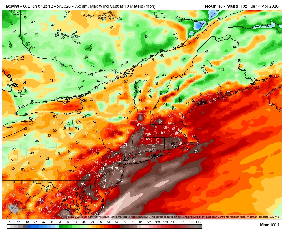
- As we have mentioned earlier today, severe weather will impact the area late tonight through Monday evening. Areas along i95 could see between 1 and 2 inches of rain. Some areas may see over 2 inches. Scattered thunderstorms could produce hail, wind gust up to 65 to 80mph. Isolated tornados are possible as well.
- The area will also see winds 25-30 Mph with gust 45 to 70 mph on Monday which could being down tress and utility wires. Expect widespread power outages.
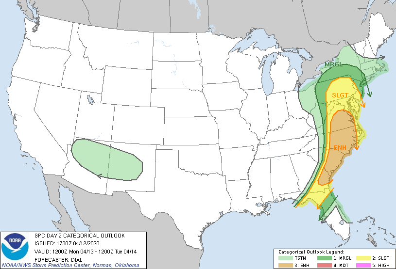
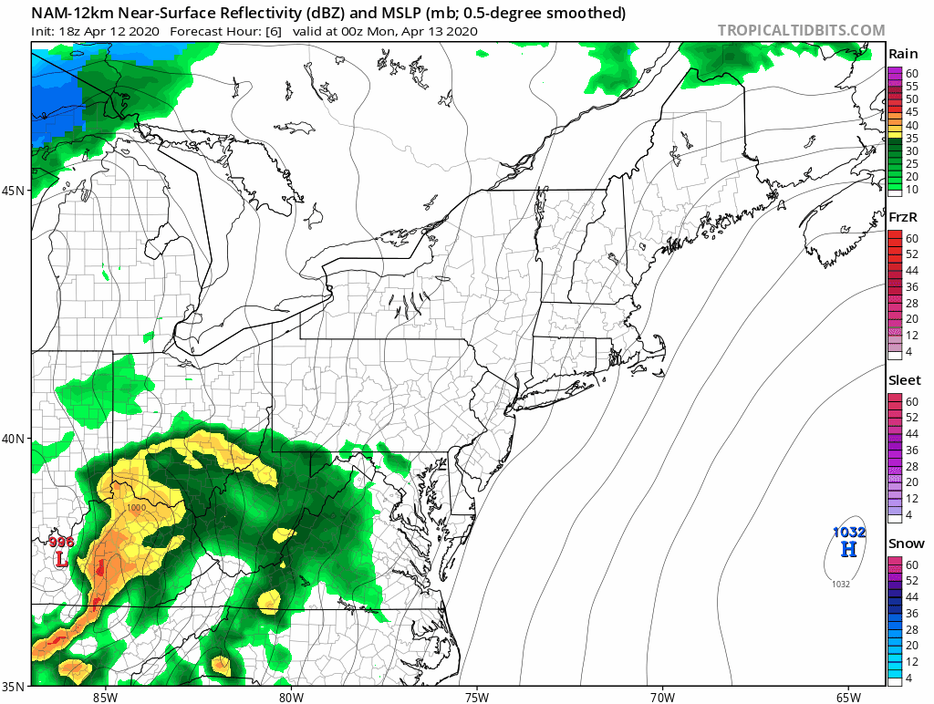
- The Storm Prediction Center has placed the area in a SLIGHT chance for severe weather. As you can see with the NAM 12k model above. A line of heavy storms will move across the area between 2pm and 4pm.
- We will provide updates throughout the day.