Monday A chance of freezing drizzle before 10am, then a chance of rain. Mostly cloudy, with a high near 39. Northeast wind around 5 mph.
Monday Night A chance of rain before 4am, then a slight chance of freezing rain and sleet. Mostly cloudy, with a low around 29. Northwest wind around 5 mph. Chance of precipitation is 30%. Little or no sleet accumulation expected.
Friday Rain. Temperature falling to around 35 by 5pm. Southwest wind around 10 mph becoming north in the afternoon. Winds could gust as high as 25 mph.
Friday Night Rain, snow, and sleet likely Cloudy, then gradually becoming partly cloudy, with a low around 20. Northwest wind around 10 mph.
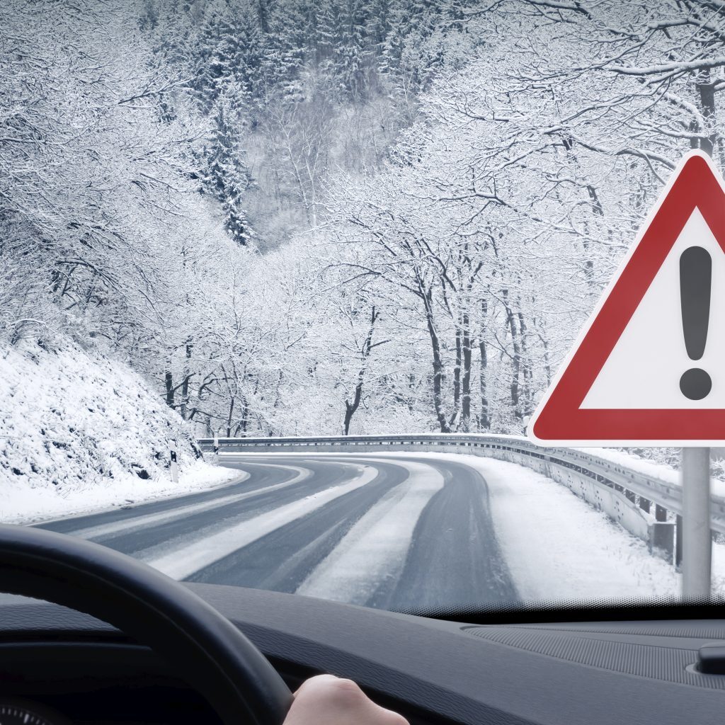
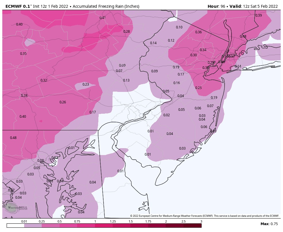
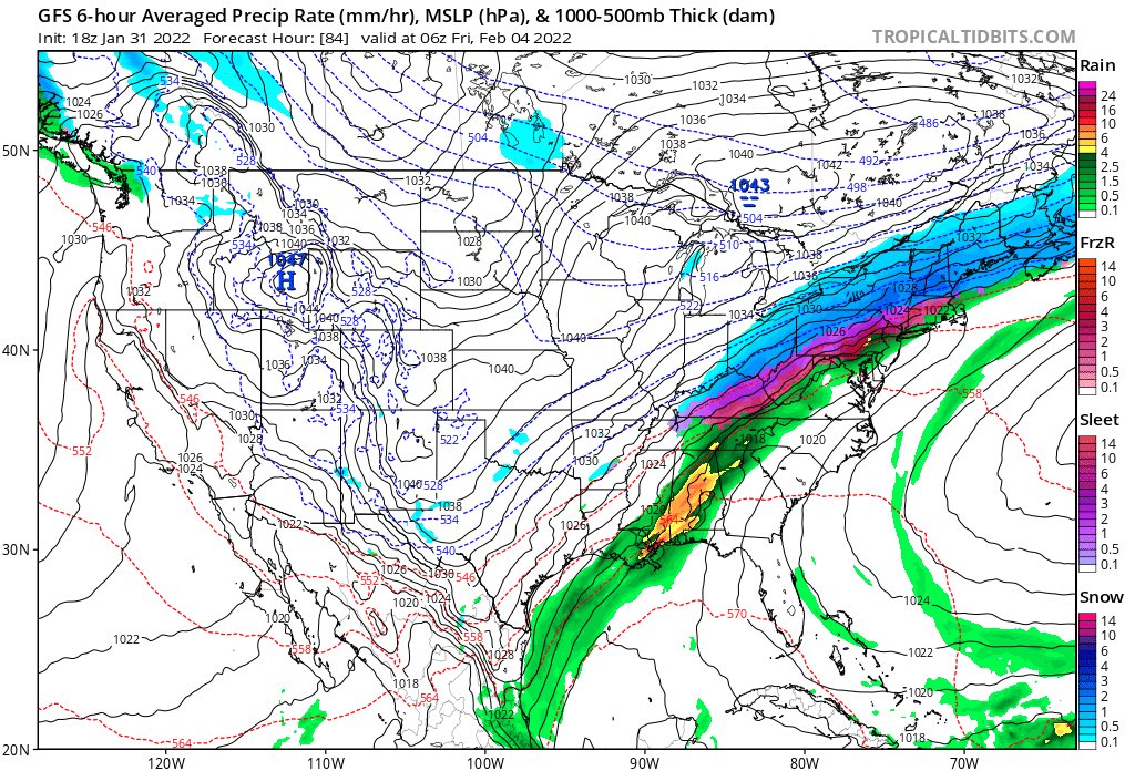
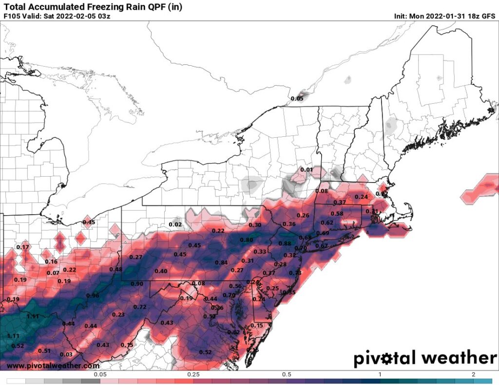
The threat of ICE that we have mentioned yesterday is still growing on Friday. As of this afternoon the Euro model is now starting to trend colder. Both the GFS and Euro are showing a major ice event for locations to our west.
Friday afternoon could be a icy mess if these were to verify. Also Friday afternoon we will see big drop in temps creating a flash freeze where any wet surfaces could turn to black ice later Friday afternoon/evening. Even if you do not change over to the ZR on Friday, you will see ice develop as temps crash.
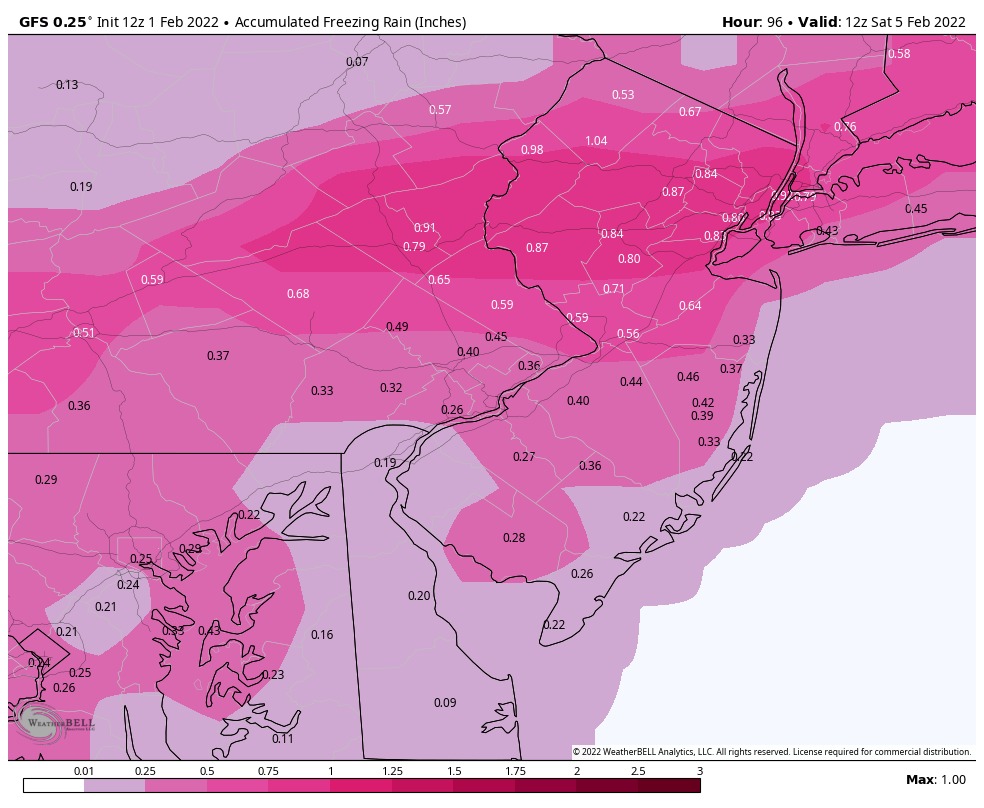
Here is this afternoons EURO and GFS Model.
We are following this very carefully and will keep you updated as we get closer.
This week we will see temps hit around 50º BUT a wintery mix/ice event might follow these warmer temps.
While I usually don’t like to talk about a system 5 days out, but I want to put it out that some could from the central plains to the north east could see a ice storm event. While we are not sure of who will see what around here. Models are hinting that ice/freezing rain could make its way towards the Philadelphia area. Anytime I have to mention ICE it scares me as this is no joke. I am hoping this system gets colder faster or stays warm and we are in rain or just snow, but NO ICE.
The GFS paints a icy picture but after the GFS did not do well with our storm last week, I am hoping it stays the same and we do not see this happen. Now the 18z which is pictured below is slightly north from the 12z runs.
Timing: Wed. we could see some freezing fog, then Rain on Thursday. Then a winter mix on Friday that could bring snow and a mix to the area.
Again this is in no way a forecast, I want to get the word out of a possible ICE event later in the week. This would cause major issues.
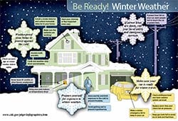
How to prepare for a Major Winter Storm:
Weatherproof your home tips from the CDC and Weather.Gov
Insulate any water lines that run along exterior walls so your water supply will be less likely to freeze.
Caulk and weather-strip doors and windows.
Insulate walls and attic.
Install storm or thermal-pane windows or cover windows with plastic from the inside.
Repair roof leaks and cut away tree branches that could fall on your home or other structure during a storm.
Have your chimney or flue inspected each year.
If you plan to use a fireplace or wood stove for emergency heating, have your chimney or flue inspected each year. Ask your local fire department to recommend an inspector or find one online.Featured Resource
Install a smoke detector and a battery-operated carbon monoxide detector.
If you’ll be using a fireplace, wood stove, or kerosene heater, install a smoke detector and a battery-operated carbon monoxide detector near the area to be heated. Test them monthly and replace batteries twice a year.
Keep a multipurpose, dry-chemical fire extinguisher nearby.
All fuel-burning equipment should be vented to the outside.
Each winter season have your furnace system and vent checked by a qualified technician to ensure they are functioning properly.
For older adults, keep an easy-to-read thermometer inside your home.
If you or a loved one are over 65 years old, place an easy-to-read thermometer in an indoor location where you will see it frequently. Our ability to feel a change in temperature decreases with age. Older adults are more susceptible to health problems caused by cold. Check the temperature of your home often during the winter months.
Create an emergency car kit.
It is best to avoid traveling, but if travel is necessary
Cell phone, portable charger, and extra batteries
Items to stay warm such as extra hats, coats, mittens, and blankets
Windshield scraper
Shovel
Battery-powered radio with extra batteries
Flashlight with extra batteries
Water and snack food
First aid kit with any necessary medications and a pocket knife
Tow chains or rope
Tire chains
Canned compressed air with sealant for emergency tire repair
Cat litter or sand to help tires get traction, or road salt to melt ice
Booster cables with fully charged battery or jumper cables
Hazard or other reflectors
Bright colored flag or help signs, emergency distress flag, and/or emergency flares
Road maps
Waterproof matches and a can to melt snow for water
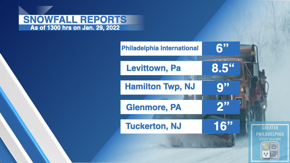
Here are the unofficial snowfall totals that are being reported via social media as well as the NWS. Snow will began to taper off this afternoon. Across the Philly/i95 area a general 6-12″ has fallen depending on location. Our final calls are inline with that has fallen across most of the area.
The following are UNOFFICIAL totals reported via social media and NWS. These totals were as of 11am this morning. We will update these late today.