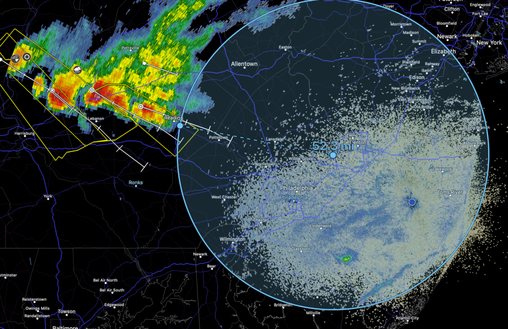
Scattered showers and thunderstorms are moving towards the area. Some of these thunderstorms cold be capable fo becoming severe. Our team will be you the latest info as these storms move towards the area.
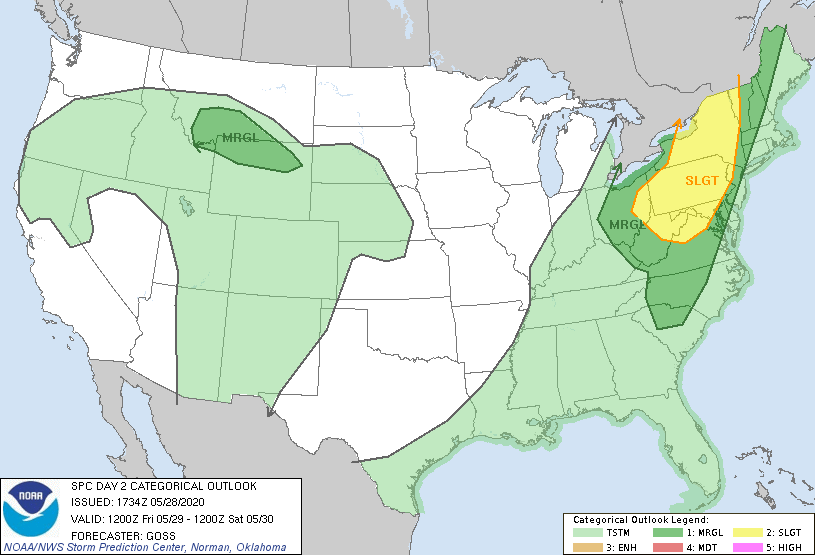
The area is under a Slight risk for severe weather today by the SPC.
Thursday A slight chance of showers between 11am and 3pm, then a chance of showers and thunderstorms after 3pm. Partly sunny, with a high near 87.
Thursday Night Showers and thunderstorms likely before 3am, then a slight chance of showers. Some of the storms could produce heavy rainfall. Cloudy, with a low around 69.
Have a great day. Potential for severe weather this afternoon.
Wednesday A chance of showers, with thunderstorms also possible after 11am. Some storms could be severe, with damaging winds. Mostly cloudy, with a high near 89. West wind 10 to 15 mph, with gusts as high as 25 mph.
Wednesday Night A chance of showers and thunderstorms before 2am. Some of the storms could be severe. Mostly cloudy, with a low around 68.
Have a GREAT Friday! The SPC has put the area in a Marginal Risk of Severe Thunderstorms this afternoon.
Friday A chance of showers, with thunderstorms also possible after 2pm. Patchy fog before 8am. Otherwise, mostly cloudy, with a high near 83. South wind 5 to 10 mph, with gusts as high as 20 mph.
Friday Night Showers likely and possibly a thunderstorm before 2am, then a chance of showers. Mostly cloudy, with a low around 69.
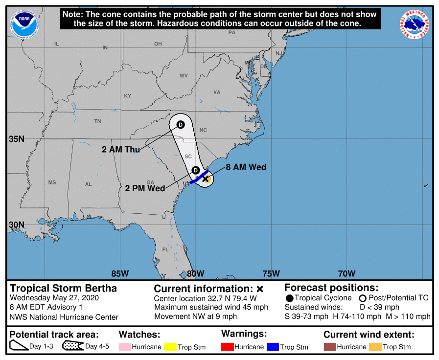
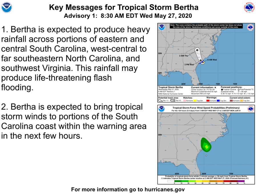
MIAMI (AP) — Tropical Storm Bertha made landfall on South Carolina’s coast Wednesday morning shortly after it formed, becoming the second named storm before the official start of this year’s Atlantic hurricane season.
A tropical storm warning was issued for South Carolina’s coast and the storm was expected to bring heavy rainfall, the U.S. National Hurricane Center said.
Bertha’s maximum sustained winds were near 50 mph (80 kph) as it came ashore but it was expected to weaken to a tropical depression after moving inland. The storm was centered about 20 miles (40 kilometers) east of Charleston, South Carolina, and was moving northwest near 9 mph (15 kph).
Earlier this month, Tropical Storm Arthur brought rain to North Carolina before moving out to sea. It was the sixth straight year that a named storm has developed before June 1, the official start of the Atlantic hurricane season.