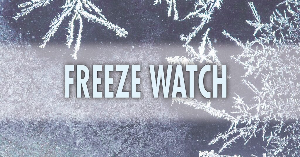
FREEZE WATCH REMAINS IN EFFECT FROM LATE TUESDAY NIGHT THROUGH
WEDNESDAY MORNING...

* WHAT...Sub-freezing temperatures as low as 24 possible.

* WHERE...Portions of central, northern, and southern Delaware,
  northeast Maryland, central and southern New Jersey, and east
  central and southeast Pennsylvania.

* WHEN...From late Tuesday night through Wednesday morning.

* IMPACTS...Frost and freeze conditions could kill crops, other
  sensitive vegetation and possibly damage unprotected outdoor
  plumbing.

PRECAUTIONARY/PREPAREDNESS ACTIONS...

Take steps now to protect tender plants from the cold.
URGENT – WINTER WEATHER MESSAGE National Weather Service Mount Holly NJ 256 AM EST Sun Feb 22 2026
…POTENTIALLY HISTORIC WINTER STORM WILL IMPACT THE REGION THROUGH MONDAY…
.A major winter storm is expected to develop today, impacting the region with very heavy, crippling snowfall and areas of blizzard conditions. Precipitation will develop today, changing to all snow this afternoon and evening. The most severe conditions and heaviest snowfall will occur tonight, with snow gradually tapering off during the daytime Monday. Record breaking snowfall totals are possible.
Delaware-Philadelphia-Eastern Montgomery-Upper Bucks-Lower Bucks- Including the cities of Chalfont, Doylestown, Lansdale, Philadelphia, Morrisville, Media, Perkasie, and Norristown 256 AM EST Sun Feb 22 2026
…BLIZZARD WARNING IN EFFECT FROM 10 AM THIS MORNING TO 6 PM EST MONDAY…
WHAT…Blizzard conditions expected. Total snow accumulations between 16 and 22 inches. Winds gusting as high as 45 mph.
WHERE…Delaware, Eastern Montgomery, Lower Bucks, Philadelphia, and Upper Bucks Counties.
WHEN…From 10 AM this morning to 6 PM EST Monday.
IMPACTS…Travel could be very difficult to impossible. Areas of blowing snow could significantly reduce visibility. The hazardous conditions will impact the Monday morning and evening commutes. Gusty winds could bring down tree branches and result in isolated power outages.
ADDITIONAL DETAILS…Snowfall rates could exceed 2 inches per hour. Locally higher snowfall amounts and significant drifting of snow possible.
PRECAUTIONARY/PREPAREDNESS ACTIONS…
Travel should be restricted to emergencies only. If you must travel, have a winter survival kit with you. If you get stranded, stay with your vehicle. The latest road conditions for the state you are calling from can be obtained by calling 5 1 1.
This snow will be heart attack snow. PLEASE use caution and take breaks when shoveling.
Safety Preparedness
Officials urge residents to take early precautions:
Avoid travel if possible during the storm’s peak.
Prepare emergency supplies (flashlights, water, food) in case of power outages.
Check on vulnerable neighbors, particularly older adults and those with limited mobility.
Emergency management teams are coordinating with local public works departments to pre-treat roads and deploy snow-removal equipment, but crews may face challenges once heavy snow and winds arrive.
A Major Winter Storm is set to bring over 12″ of snow to most of the area. Blizzard Warnings and Winter Storm Warnings are in effect for all of the area.
The storm will move in around mid day on Sunday and exit Monday. We will see snowfall rates of 1-2″ per hour which will cause very dangerous travel. Also remember to shovel any fire hydrants out.
Here is the latest NWS projections:
This snow will be heart attack snow. PLEASE use caution and take breaks when shoveling.
Safety Preparedness
Officials urge residents to take early precautions:
Avoid travel if possible during the storm’s peak.
Prepare emergency supplies (flashlights, water, food) in case of power outages.
Check on vulnerable neighbors, particularly older adults and those with limited mobility.
Emergency management teams are coordinating with local public works departments to pre-treat roads and deploy snow-removal equipment, but crews may face challenges once heavy snow and winds arrive.
A major winter storm is set to impact the Philadelphia area beginning Sunday morning and continuing through Monday, bringing heavy snow and strong winds to the region. The greatest snowfall accumulations are expected just north of the city along the I-95 corridor, including Lower Bucks County and Trenton, as well as areas east of the Delaware River. The rest of the region can expect moderate to locally heavy snowfall. We are forecasting 12″ plus along the i95 corridor in Lower Bucks, Trenton and into NJ. Philadelphia we are thinking 8-12″ as of now.
As a coastal low tracks just offshore Sunday night, winds will intensify, with interior areas seeing sustained winds of 15 to 25 mph, while eastern and southeastern locations may experience winds of 25 to 35 mph with gusts exceeding 35 mph. The combination of strong winds and falling snow could produce localized near-blizzard conditions, particularly in the hardest-hit eastern and southeastern areas.
Travel conditions are expected to deteriorate significantly from Sunday into Monday, and residents are strongly encouraged to stay home if possible. School closures are also likely on Monday due to the anticipated hazardous conditions.
I will have updates throughout the day tomorrow.
Emergency Supplies & Home Prep
Safety Items: Keep a fire extinguisher and ensure smoke/carbon monoxide detectors are working. Have salt/sand ready for walkways
Essential Items: Stock up on non-perishable food, flashlights, batteries, a battery-powered radio, and extra prescription medication.
Water & Food: Keep extra water and food that requires no cooking (canned goods, granola bars).
Heating/Power: Charge all phones and power banks. If you have a generator, check it is properly serviced and fuel is available. Ensure you have heating fuel (wood, oil, gas).
Protect Your Home: Insulate pipes, allow faucets to drip to prevent freezing, and clear gutters.
While the Philadelphia area did not see a White Christmas, The best we can get is a post-Christmas winter storm that is expected to impact the Greater Philadelphia area from Friday evening, December 26 through early Saturday morning, December 27, bringing a mix of snow, sleet, and freezing rain as moisture overruns cold air across the Northeast.
Snow and wintry precipitation are likely to begin Friday afternoon and continue into the overnight hours, with the highest confidence for snow and potential plowable totals in the Philadelphia metro area and suburbs but also a notable risk for sleet and ice, especially closer to the I-95 corridor and southern parts of the region.
Preliminary snowfall projections for the broader area suggest a widespread 3 – 6 inches of snow, with isolated higher amounts possible in parts of northeastern Pennsylvania and interior areas.
TRAVEL ADVISORY: This storm arrives during peak travel times late Friday and could lead to hazardous travel conditions, slick roads, and delays into Saturday as the system departs the region.
FIRST CALLS: We will have an update to these total late tonight or tomorrow.
If the NWS issues any watches or advisories we will provide an update.
A fast moving system will bring 2-4" of snow to the area late Saturday night into Sunday morning. My first call is going to be a general 2-4" of snow across most of the area. Full report will be posted this evening.


* WHAT...Snow expected. Total snow accumulations between 2 and 4
  inches.

* WHERE...Portions of central and northern Delaware, northeast
  Maryland, central, northern, northwest, and southern New Jersey,
  and southeast Pennsylvania.

* WHEN...From 7 PM Saturday to 1 PM EST Sunday.

* IMPACTS...Plan on slippery road conditions.

PRECAUTIONARY/PREPAREDNESS ACTIONS...

Slow down and use caution while traveling. The latest road
conditions for the state you are calling from can be obtained by
calling 5 1 1.

Be prepared for slippery roads. Slow down and use caution while
driving. If you are going outside, watch your first few steps taken
on stairs, sidewalks, and driveways. These surfaces could be icy and
slippery, increasing your risk of a fall and injury.
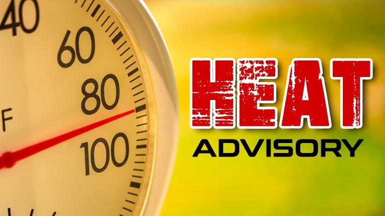
HEAT ADVISORY REMAINS IN EFFECT UNTIL 8 PM EDT WEDNESDAY...

* WHAT...Heat index values up to 104.

* WHERE...Portions of northern Delaware, New Jersey, and southeast
  Pennsylvania.

* WHEN...Until 8 PM EDT Wednesday.

* IMPACTS...Hot temperatures and high humidity may cause heat
  illnesses.

PRECAUTIONARY/PREPAREDNESS ACTIONS...

Drink plenty of fluids, stay in an air-conditioned room, stay out of
the sun, and check up on relatives and neighbors.

Take extra precautions when outside. Wear lightweight and loose
fitting clothing. Try to limit strenuous activities to early morning
or evening. Take action when you see symptoms of heat exhaustion and
heat stroke.

To reduce risk during outdoor work, the Occupational Safety and
Health Administration recommends scheduling frequent rest breaks in
shaded or air conditioned environments. Anyone overcome by heat
should be moved to a cool and shaded location. Heat stroke is an
emergency! Call 9 1 1.
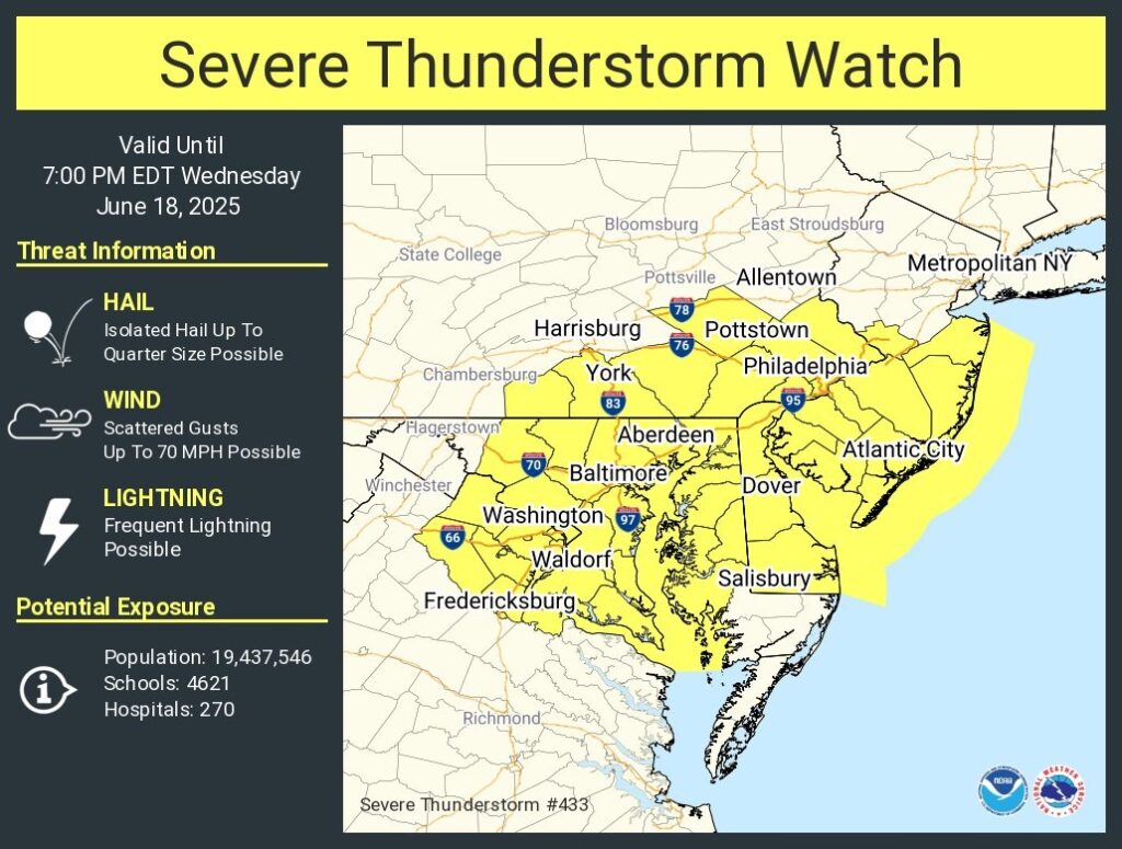
Severe Thunderstorm Watch for portions of District Of Columbia Delaware Eastern Maryland Southern New Jersey Southeast Pennsylvania Northern Virginia Coastal Waters
Effective this Wednesday afternoon and evening from 1245 PM until 700 PM EDT.
Primary threats include… Scattered damaging wind gusts to 70 mph possible
SUMMARY…Scattered thunderstorms will spread eastward across the watch area through the afternoon. The strongest cells will be capable of localized damaging wind gusts.
The severe thunderstorm watch area is approximately along and 80 statute miles east and west of a line from 30 miles northwest of Philadelphia PA to 55 miles southeast of Washington DC. For a complete depiction of the watch see the associated watch outline update (WOUS64 KWNS WOU3).
PRECAUTIONARY/PREPAREDNESS ACTIONS…
REMEMBER…A Severe Thunderstorm Watch means conditions are favorable for severe thunderstorms in and close to the watch area. Persons in these areas should be on the lookout for threatening weather conditions and listen for later statements and possible warnings. Severe thunderstorms can and occasionally do produce tornadoes.
&&
OTHER WATCH INFORMATION…CONTINUE…WW 432…
AVIATION…A few severe thunderstorms with hail surface and aloft to 1 inch. Extreme turbulence and surface wind gusts to 60 knots. A few cumulonimbi with maximum tops to 500. Mean storm motion vector 27025.