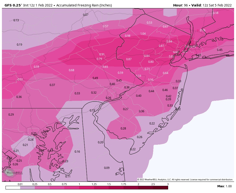
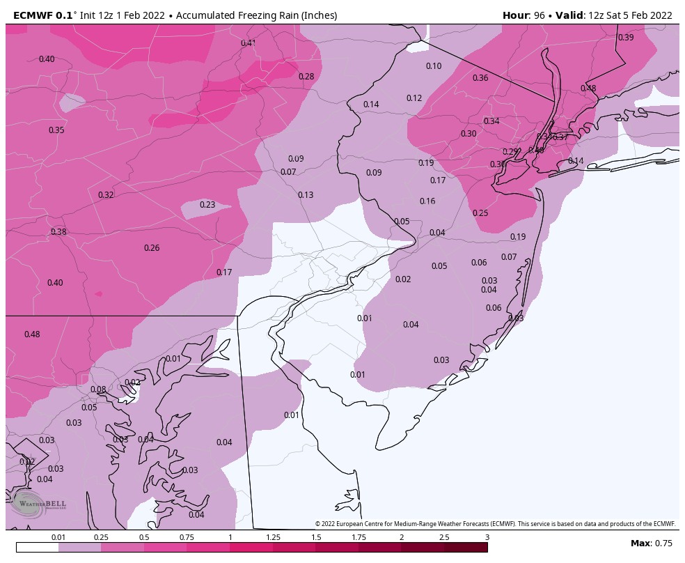
The threat of ICE that we have mentioned yesterday is still growing on Friday. As of this afternoon the Euro model is now starting to trend colder. Both the GFS and Euro are showing a major ice event for locations to our west.
Friday afternoon could be a icy mess if these were to verify. Also Friday afternoon we will see big drop in temps creating a flash freeze where any wet surfaces could turn to black ice later Friday afternoon/evening. Even if you do not change over to the ZR on Friday, you will see ice develop as temps crash.
Here is this afternoons EURO and GFS Model.


We are following this very carefully and will keep you updated as we get closer.
