CURRENT WATCHS/WARNINGS:
FLASH FLOOD WATCH until 12am on Aug 5th.
Tropical Storm Watch
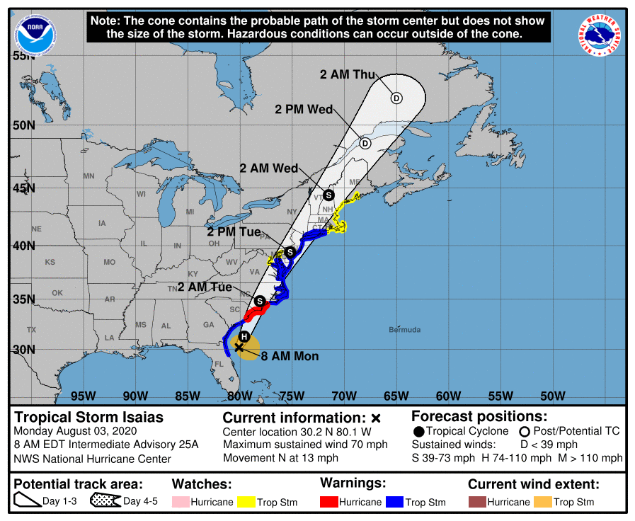
| ISAIAS FORECAST TO MAKE LANDFALL TONIGHT AS A HURRICANE… …EXPECTED TO BRING STRONG WINDS AND HEAVY RAINFALL FROM THE EASTERN CAROLINAS TO THE MID-ATLANTIC COAST TONIGHT AND TUESDAY… |
| 11:00 AM EDT Mon Aug 3 Location: 30.7°N 80.1°W Moving: N at 13 mph Min pressure: 998 mb Max sustained: 70 mph |

Tropical Storm Isaias is currently located just offshore of the northeast Florida coast. The storm is expected to continue northward along the East Coast. It will likely move inland over the Carolinas this evening and approach our region by late tonight and especially Tuesday. Impacts should diminish by Wednesday morning.

The main threats with this system are heavy rainfall leading to flash flooding and some river flooding, strong winds especially near the coast, minor to potentially moderate coastal flooding, and dangerous marine conditions.

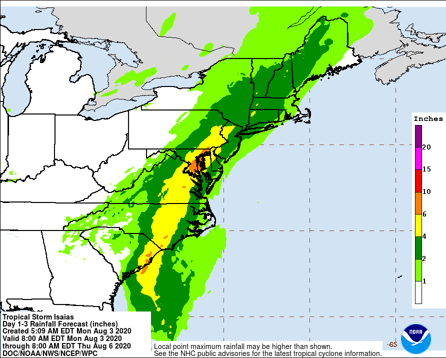
We are most concerned about flash flooding caused by 4 to 6 inches of rain, as well as strong winds along the New Jersey and Delaware coasts with wind gusts of 60 to 70 mph possible. Secondary threats include minor to locally moderate coastal flooding, especially in Chesapeake Bay, as well as the potential for isolated tornadoes. Dangerous rip currents and 8 to 12 foot seas are also expected over the waters.
Along the river and ocean expect to see 1 to 3 feet of storm surge inundation along those area. The Philadelphia metro area will have the greatest threat for FLASH FLOODING rain late tonight into tomorrow.
Tornados: The main threat of isolated tornadoes will be during the day hours on Tuesday. The best chance of an isolated tornado will be along/southeast of i95.
