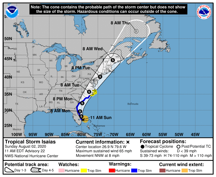
11:00 AM EDT Sun Aug 2
Location: 26.9°N 79.6°W
Moving: NNW at 8 mph
Min pressure: 995 mb
Max sustained: 65 mph
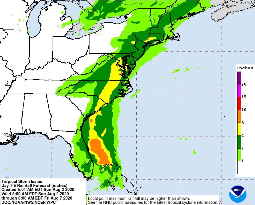
At this hour Isaias have been downgraded to a tropical storm, while the storm was downgraded please note that this is a strong powerful storm. Isaias will bring between 2-5″ of rain (locally higher amounts) to most of the area.
We will see tropical storm force winds as early as late Monday night into Tuesday night. The current track has Isaias moving up the east coast and bringing the storm center right over parts of the area. The NHC “cone” has the center of the storm just off the New Jersey Coast.
Some uncertainty continues regarding the future track, intensity, and timing of this storm which will also affect the ultimate impacts for our region.
Confidence is high that increased swells and rip current risk along the coasts will arrive this weekend and continue through at least Wednesday.
Tropical storm conditions are possible, primarily for coastal locations and the adjacent waters Tuesday into Tuesday night.
Heavy rain leading to flooding is a concern even for areas outside the tropical storm force wind conditions, and is our greatest concern with this storm.

