Severe Weather Outlook: Tornado Watch Issued

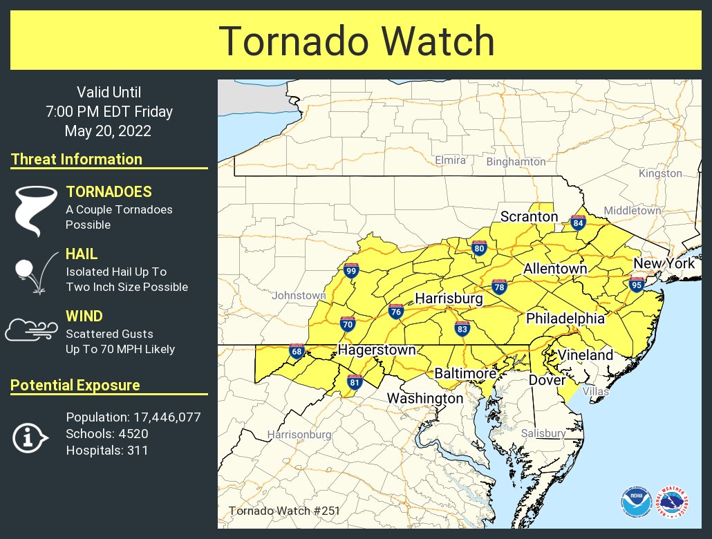
This afternoon confidence has increased for the potential for severe weather into this evening. Most of the area from i-95 northwest is now in a SLIGHT risk. The key factors today will be damaging winds, hail and tornados are also possible.

The NWS has issued a TORNADO WATCH for the entire area until 7pm.

This graphic displays Tornado Watch watch number 251 plotted on a map. The watch is in effect until 7:00 PM EDT. The watch includes parts of Delaware, Maryland, New Jersey, Pennsylvania, Virginia and West Virginia. The threats associated with this watch are a couple tornadoes possible, isolated hail up to two inch size possible and scattered gusts up to 70 mph likely. There are 17,446,077 people in the watch along with 4520 schools and 311 hospitals.


Here is a link to our current weather alerts. https://greaterphilaseverewx.com/active-alerts/

CURRENT RADAR


Our team will bring you the latests updates as the storms move closer to the area.