Incase you didn’t know, its going to snow this week. This is something we have been talking about for the past few days, expect major to significant impact from the Nor’easter on Wednesday. At this point we are confident this storm will begin around midday/early afternoon on Wednesday and continue until early Thursday AM.
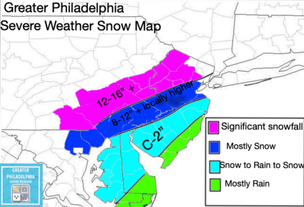
Areas near i95 will see some sleeting and mixing. We are sorry to say, but the shore points it’s mostly rain for you. The rest of the area will see significant snowfall (some areas could peak over 16” plus of snowfall). We expect the NWS to upgrade the current Winter Storm Watch to a Warning. Once that happens we will pass that information along. I will be issuing our final call map tomorrow afternoon if needed.
Our map below you will see it has a lot of different totals on it for the areas.
Purple – 12-16”+
Dark Blue Mostly 8-12+” (some areas could see higher amounts. Closer to i95 could see lower due to mixing issues)
Light Blue – C-2”
Green -All Rain

Here is the IMPACT threat from the NWS
