
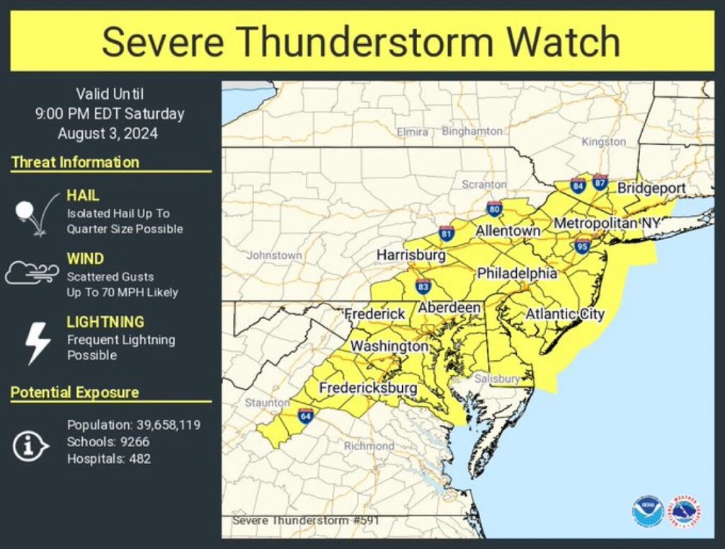
A severe thunder storm watch and flood watch have been issued until 9pm. The heat advisory is still in effect until 8pm
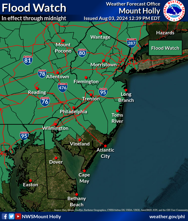
FLOOD WATCH IN EFFECT UNTIL MIDNIGHT EDT TONIGHT...

* WHAT...Flash flooding caused by excessive rainfall is possible.

* WHERE...Portions of northern Delaware, including the following
  area, New Castle, New Jersey, including the following areas,
  Camden, Coastal Ocean, Eastern Monmouth, Gloucester, Hunterdon,
  Mercer, Middlesex, Morris, Northwestern Burlington, Ocean, Salem,
  Somerset, Southeastern Burlington, Sussex, Warren and Western
  Monmouth, and Pennsylvania, including the following areas, Berks,
  Carbon, Delaware, Eastern Chester, Eastern Montgomery, Lehigh,
  Lower Bucks, Monroe, Northampton, Philadelphia, Upper Bucks,
  Western Chester and Western Montgomery.

* WHEN...Until midnight EDT tonight.

* IMPACTS...Excessive runoff may result in flooding of rivers,
  creeks, streams, and other low-lying and flood-prone locations.

* ADDITIONAL DETAILS...
  - Storms this afternoon will be capable of heavy rain. Some
    locations could get multiple rounds of storms, increasing the
    potential for flash flooding, especially in urban areas and
    other areas with poor drainage. Although storms may linger
    past midnight, overnight storms aren`t expected to have as
    much potential for heavy rainfall.
  - http://www.weather.gov/safety/flood

PRECAUTIONARY/PREPAREDNESS ACTIONS...

You should monitor later forecasts and be prepared to take action
should Flash Flood Warnings be issued.