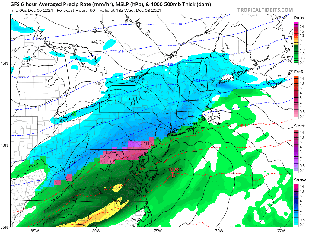
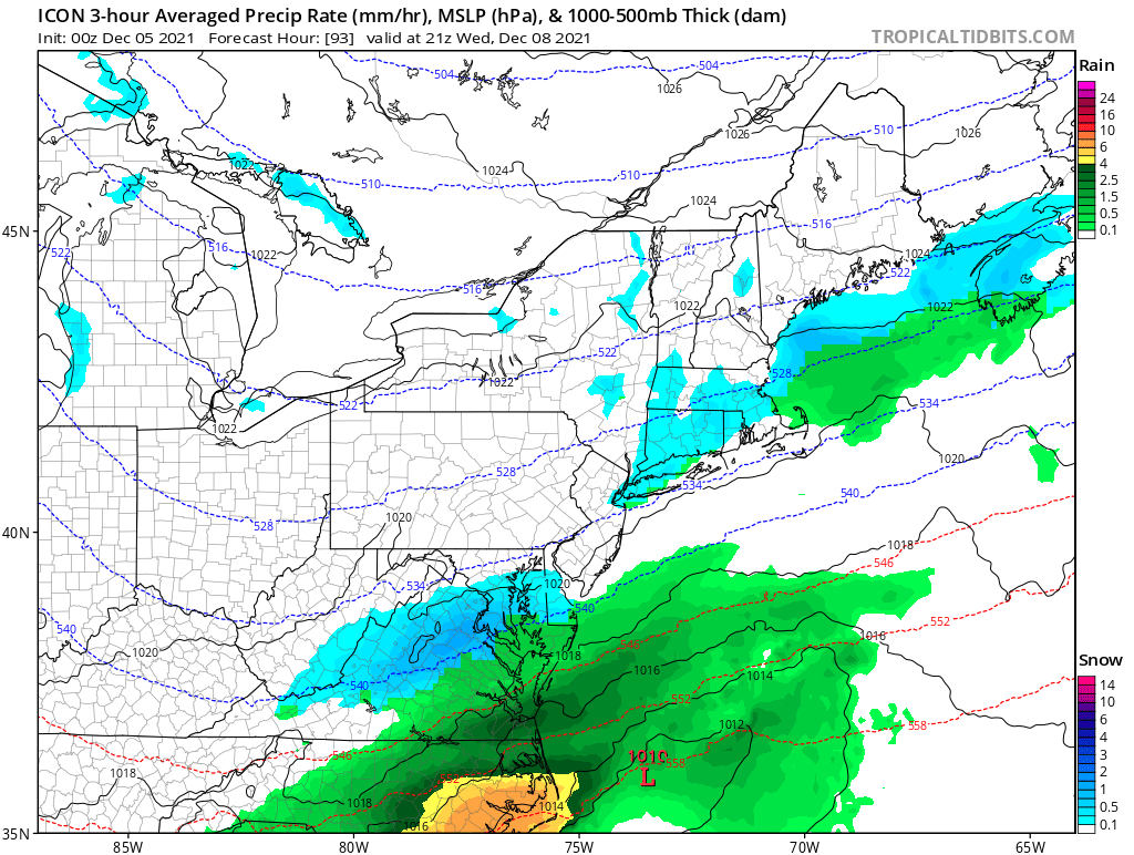
A low pressure system could bring some winter weather to parts of the Northeast late Tuesday night into Wednesday. While at this point the track is highly uncertain but the threat of winter weather is possible. How much and what type of precipitation is too early to tell at this point but some signs are starting to develop.
If this system tracks to our southeast we might not see much warm air in which case could bring more snow to the area. If the storm tracks over the closer to our region it will bring in warmer air resulting in rain for most of the area. A third option is the track takes the storm further off the coast which would keep most of the precipitation off shore.
The timing in which the precipitation will fall also places a huge factor. If it is a majority falls in the daytime hours we will see more potentially more rain. However if the storm moves into the area in the overnight hours some would potentially see more snow/mix. At this time please take this with a grain of salt.
We are going to be keeping a very close eye on this developing storm and will bring you the latest updates as models run.
The 0zGFS run is showing the Rain/Snow Mix line very close to i95 corridor. While a lot of things can happen between now and Wed. We are going to keep a close eye on this storm and bring you the latest tomorrow afternoon after the 12z runs.


