Jan
04
WINTER STORM WATCH HAS BEEN ISSUED
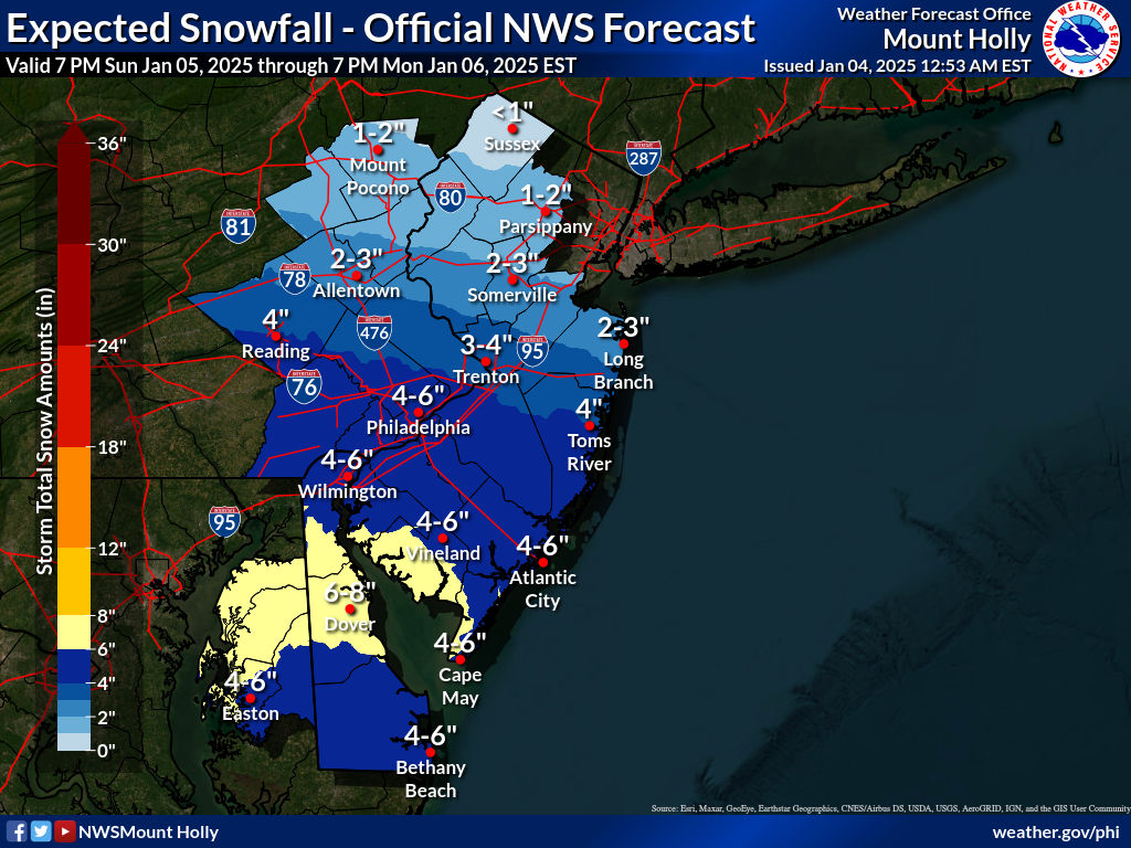
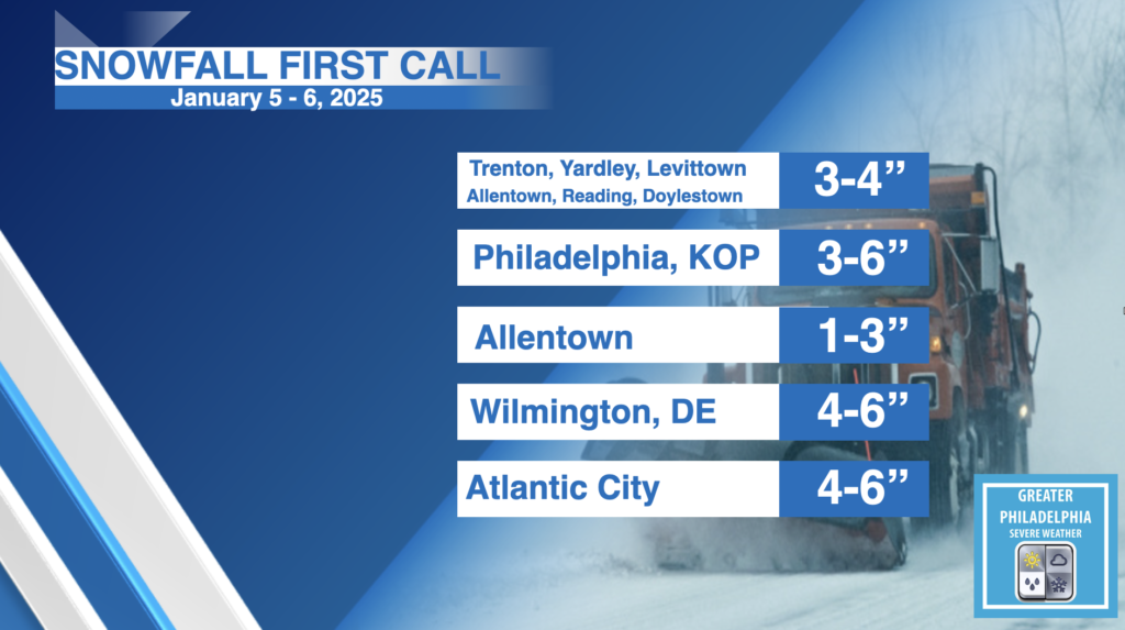
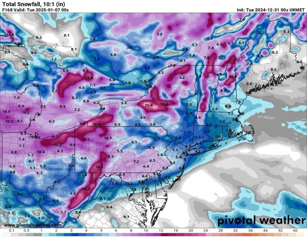
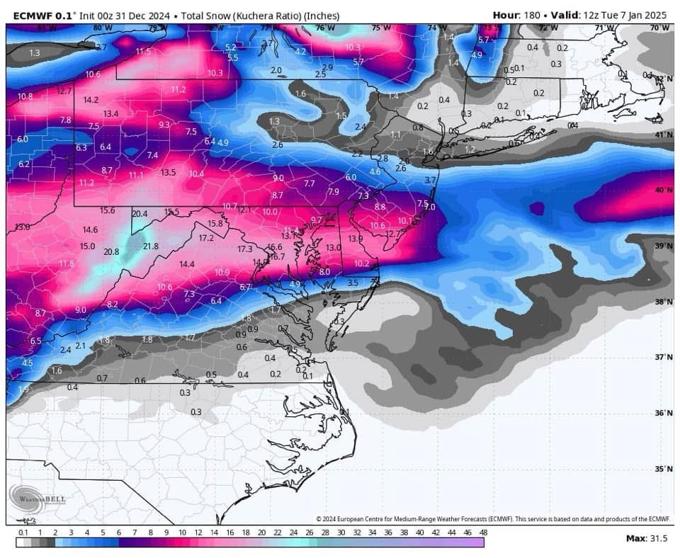
A Winter Storm Watch has been issued for Philadelphia south and east.
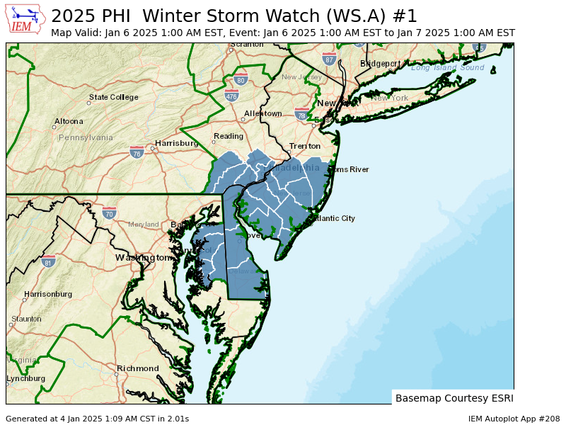
WINTER STORM WATCH IN EFFECT FROM LATE SUNDAY NIGHT THROUGH LATE
MONDAY NIGHT…
* WHAT…Heavy snow is possible. Total snow accumulations between 3 and
6 inches possible.
* WHERE…Portions of southern New Jersey and southeast Pennsylvania.
* WHEN…From late Sunday night through late Monday night.
* IMPACTS…Travel could be very difficult. The hazardous conditions
could impact the Monday morning and evening commutes.
* ADDITIONAL DETAILS…Snow will overspread the region late Sunday
night and intensify through midday Monday. It will then gradually
taper off Monday night.
PRECAUTIONARY/PREPAREDNESS ACTIONS…
Monitor the latest forecasts for updates on this situation.