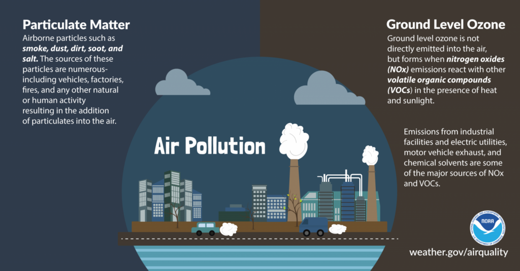
Daily Forecast October 30, 2020
FREEZE WARNING is in effect late tonight into Saturday Morning.
Friday
Rain, mainly before 11am. High near 46.
Friday Night
Areas of frost after 2am. Otherwise, partly cloudy, with a low around 30.
FREEZE WARNING is in effect late tonight into Saturday Morning.
Friday
Rain, mainly before 11am. High near 46.
Friday Night
Areas of frost after 2am. Otherwise, partly cloudy, with a low around 30.
The first widespread freeze of the season is likely Friday night into Saturday morning across inland central and south Jersey, the urban corridor of Southeast Pennsylvania, and northern Delmarva.
RAIN RAIN RAIN RAIN and RAIN
Thursday
Rain. The rain could be heavy at times. High near 55.
Thursday Night
Rain. The rain could be heavy at times. Low around 41.
Have a GREAT Day! Chance of showers this morning. Heavy flooding rain will begin to overtake the area tomorrow into Friday form Tropical Storm Zeta.
Wednesday
A slight chance of showers before 2pm. Mostly cloudy, with a high near 61. Calm wind becoming west around 5 mph in the afternoon.
Wednesday Night
A chance of rain after 2am. Mostly cloudy, with a low around 50. Southwest wind around 5 mph becoming calm after midnight.
Have a GREAT Day!
Tuesday
Mostly cloudy, with a high near 61.
Tuesday Night
A slight chance of showers. Mostly cloudy, with a low around 47.
Tropical Storm Zeta was on the verge of strengthening into a hurricane on Monday as it swirled over the Caribbean Sea. While Zeta will make landfall along the gulf coast, Our area could see heavy rain as early as Thursday and continue into Friday night. At this point locations to our well north near the NY/PA border could see snow as this system moves north.
Our team will bring you the latest as the week goes on but Thursday and Friday will be washouts with the sun returning for Halloween this coming Saturday.
Have a great Monday!
Monday
A chance of rain before 2pm, then a slight chance of showers after 2pm. Cloudy, with a high near 64.
Monday Night
Mostly cloudy, with a low around 51
Warm start to the weekend, cooler temps by Sunday!
Saturday
A slight chance of showers after noon. Areas of fog before 10am. Otherwise, mostly cloudy, with a high near 71.
Saturday Night
Partly cloudy, with a low around 43. North wind 5 to 10 mph.
Sunday
Partly sunny, with a high near 55.
Sunday Night
A chance of showers. Mostly cloudy, with a low around 48.
Have a great Friday!
Friday
A slight chance of showers before 2pm. Areas of fog before 2pm. Otherwise, mostly cloudy, with a high near 71.
Friday Night
Patchy drizzle and fog after 2am. Mostly cloudy, with a low around 57.
Thursday
Partly sunny, with a high near 75.
Thursday Night
Mostly cloudy, with a low around 57