May
02
Daily Forecast Friday May 3, 2024
Have a GREAT Friday!
Friday
Mostly sunny, with a high near 68. East wind around 10 mph.
Friday Night
Mostly cloudy, with a low around 49

Have a GREAT Friday!
Friday
Mostly sunny, with a high near 68. East wind around 10 mph.
Friday Night
Mostly cloudy, with a low around 49
Have a great Thursday! Another great day on tap!
Thursday
Patchy fog before 8am. Otherwise, mostly sunny, with a high near 87. Southwest wind 5 to 15 mph becoming west in the afternoon.
Thursday Night
Mostly clear, with a low around 57
Have a GREAT Wednesday!
Wednesday
A chance of showers, mainly before 7am. Cloudy, then gradually becoming mostly sunny, with a high near 75.
Wednesday Night
Partly cloudy, with a low around 53.
Tuesday
A chance of showers, mainly after 5pm. Patchy fog before 8am. Otherwise, partly sunny, with a high near 75. Northeast wind 5 to 10 mph. Chance of precipitation is 30%. New precipitation amounts of less than a tenth of an inch possible.
Tuesday Night
A chance of showers, mainly before 11pm. Mostly cloudy, with a low around 56.
The HEAT is on! Today we will have temps near 90º
Monday
Mostly sunny, with a high near 88. Northwest wind around 5 mph.
Monday Night
Partly cloudy, with a low around 59. East wind around 5 mph.
Frost Advisory in effect until 9am but this should be the last one until Winter.
Saturday
Increasing clouds, with a high near 63. Light southeast wind becoming south 5 to 10 mph in the morning.
Saturday Night
Isolated showers before 8pm, then a slight chance of showers after 2am. Mostly cloudy, with a low around 47. South wind 5 to 10 mph. Chance of precipitation is 20%.
Sunday
Partly sunny, with a high near 79. West wind around 5 mph.
Sunday Night
Partly cloudy, with a low around 58
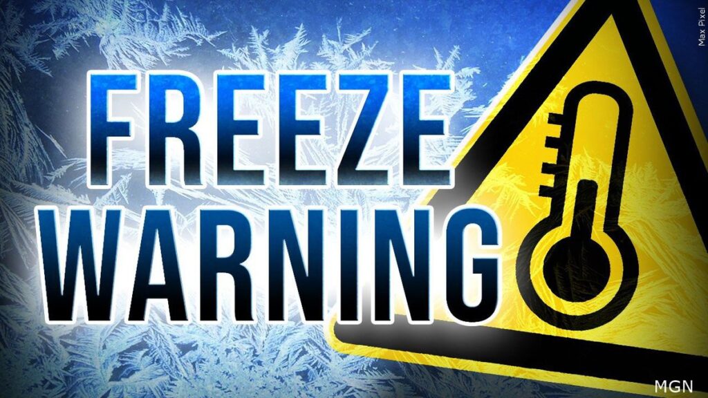
FREEZE WARNING IN EFFECT FROM 2 AM TO 9 AM EDT FRIDAY...

* WHAT...Sub-freezing temperatures as low as 29 expected.

* WHERE...Portions of central, northern, northwest and southern
  New Jersey and east central and southeast Pennsylvania.

* WHEN...From 2 AM to 9 AM EDT Friday.

* IMPACTS...Frost and freeze conditions will kill crops and
  other sensitive vegetation.

PRECAUTIONARY/PREPAREDNESS ACTIONS...

Take steps now to protect tender plants from the cold.
A freeze warning is in effect until 9am. BIG warm up later this weekend into Monday
Friday
Widespread frost before 9am. Otherwise, sunny, with a high near 63. East wind around 5 mph becoming southeast in the afternoon.
Friday Night
Mostly clear, with a low around 37
Have a great day!
Thursday
Sunny, with a high near 58. Northeast wind 5 to 10 mph.
Thursday Night
Mostly clear, with a low around 36.

Have a great day!
Wednesday
A chance of showers, with thunderstorms also possible after 2pm. Cloudy, then gradually becoming mostly sunny, with a high near 69. Southwest wind 10 to 15 mph becoming northwest in the afternoon. Chance of precipitation is 30%. New rainfall amounts of less than a tenth of an inch, except higher amounts possible in thunderstorms.
Wednesday Night
Partly cloudy, with a low around 37