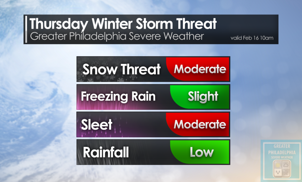
After some boring winters the past few years, This year is non-stop. We are tracking our next winter storm that will bring moderate snowfall to the area. While this storm does appear to start out as snow for everyone, we will see a changeover to an icy mix and even rain for some. How strong does the low get? That is yet to be determined. If the arctic air that will move in tonight is able to stay in place during this Thursday storm most of the area will see all snow with little changeover, but we need a few things to work out perfectly for that to happen. At this time it looks like a general 4-6″ is POSSIBLE across most of the region with 6″ + in the Lehigh Valley, as well as 1-3″ across Southern parts of NJ BEFORE a changeover to ICE/Rain. A lot of factors are in play but we will be tracking this storm and bring you the latest information as it progresses. Until then, enjoy the near 50º today and get ready for cold air to move in this morning.
but wait there’s MORE!