Tropical Depression 14 has formed. Depression 13 expected to be upgraded today.
Early next week the United States could see TWO tropical systems along the Gulf of Mexico. In the event anything changes with this forecast we will bring you the latest information. As of this time the track is uncertain and we do expect some changes are possible. Folks along the Gulf should start to prepare for a Hurricane and Tropical Storm.
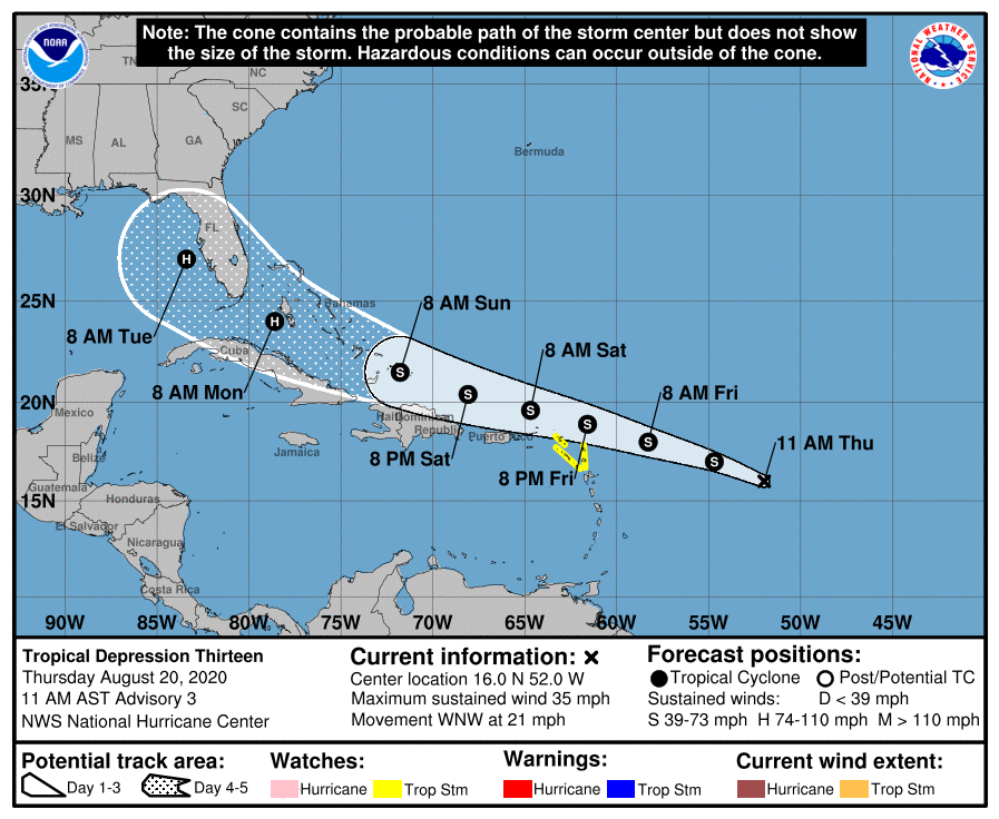
Tropical Depression 13 is expected to be upgraded to a Tropical Storm today. The forecast suggest that this storm will become a HURRICANE and is forecast to enter the Gulf of Mexico on Tuesday.
11:00 AM AST Thu Aug 20
Location: 16.0°N 52.0°W
Moving: WNW at 21 mph
Min pressure: 1008 mb
Max sustained: 35 mph
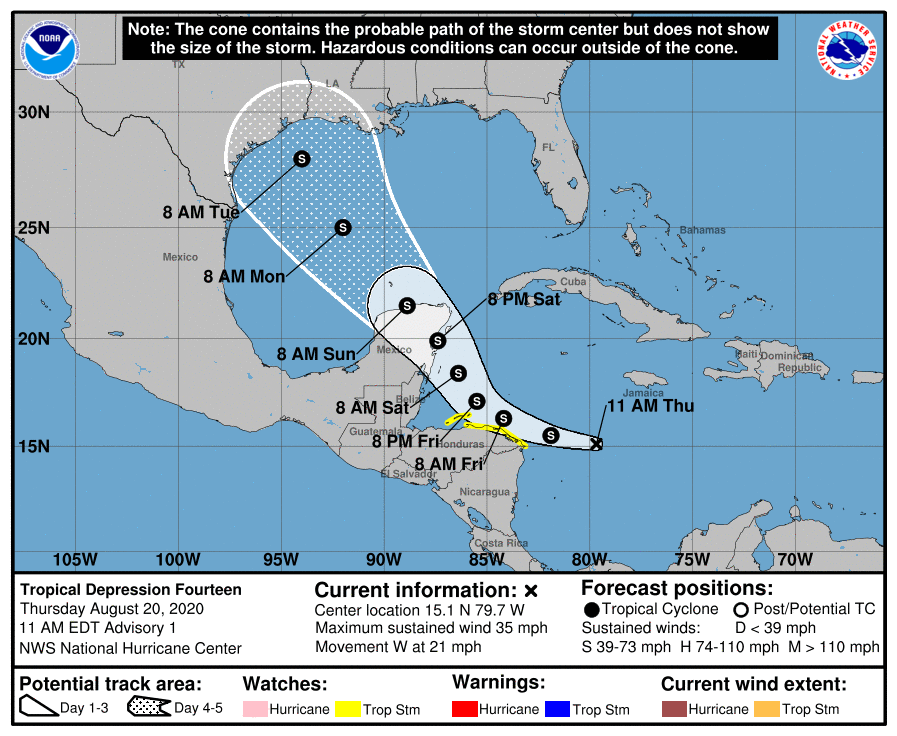
Tropical Depression 14 has formed over the West/Central Caribbean Sea this morning. This storm is forecasted to hit the Tx/LA coast as early as Tuesday.
11:00 AM EDT Thu Aug 20
Location: 15.1°N 79.7°W
Moving: W at 21 mph
Min pressure: 1007 mb
Max sustained: 35 mph