Jul
12
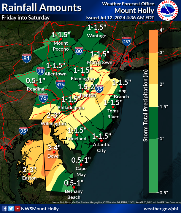
Showers and thunderstorms capable of producing heavy rain through Saturday
A stationary front will plague the region into Saturday with several waves of heavy showers and thunderstorms expected. The overall threat for severe weather is low, but heavy rain could cause some localized flash flooding, especially in urbanized areas.
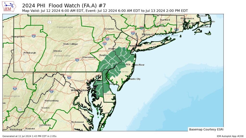
A Flood Watch has been issued for the Eastern Shore of Maryland, up through the I-95 corridor, and into northern New Jersey.
Although it has been hot and dry across much of the forecast area, the flood threat through tomorrow will come from slow moving storms and the redevelopment of storms over the same area.
Mainstem river flooding is not expected, but smaller and quicker responding streams could leave their banks.
By the time the rain ends tomorrow, there are signals suggesting that localized rainfall amounts near 5.00 inches could occur.
If you're on the road and come across flooding, turn around. Most flooding injuries and fatalities occur in vehicles. Move to higher ground.