
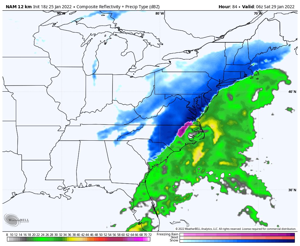
So after this afternoons Euro run, the GFS and NAM look like they want to join in on the fun. While the GFS and NAM are not showing totals that the Euro did, they are showing a potential major winter storm for Baltimore to Maine. At this point confidence is growing but not locked in 100% just yet. This afternoons trends are HUGE for team snow.
Also we are seeing the “B” word being thrown around, we are not going to throw that out just yet. Someone along the East Coast could see those conditions. If we keep seeing these trends tomorrow afternoon it will be time to prepare for significant storm. Until then we will bring you updates throughout the night and into tomorrow.
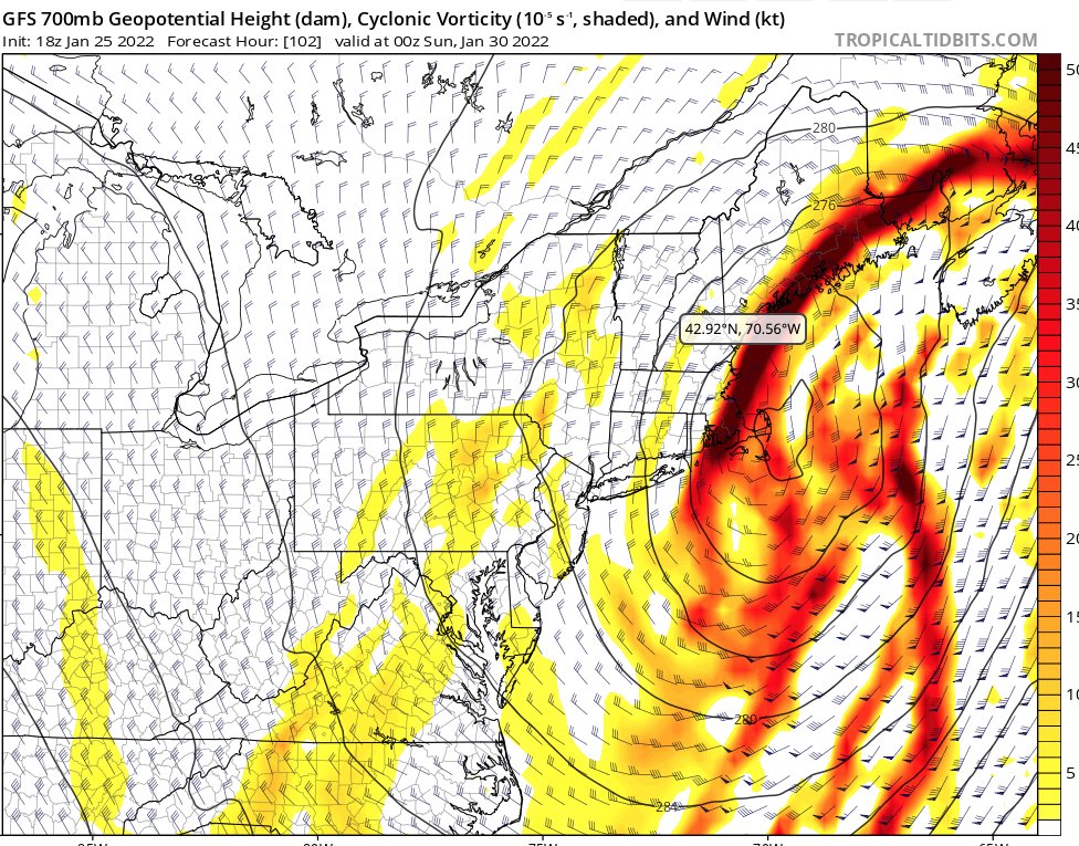
At this point timing looks to be Friday afternoon until Saturday afternoon.
The 18z nam which is OUT of its normal range is painting a picture that lines with this afternoons euro run. While we the nam is out of range it does look very good for snow lovers. We will have an update tomorrow on the NAM once it gets into its range.
The GFS has moved a bit west which is great for snow lovers. We are going to keep a close eye on this to see if it catches up with the Euro/NAM.
We have added new features to our website, check them out in the menu bar above!