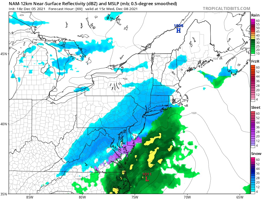
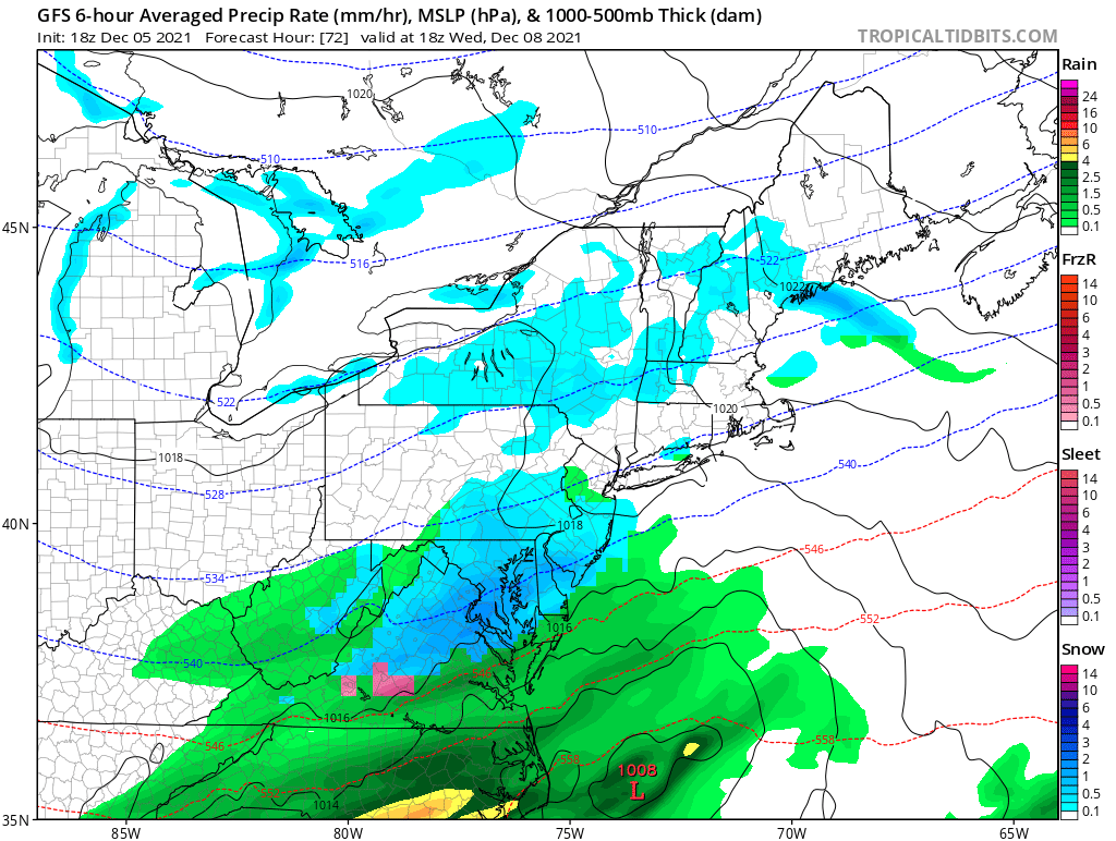
The low pressure system that will pass by on Wednesday could bring a few inches of snow to parts of the area highest chance right now is to our south. While at this time things are still very uncertain on how much precip will fall. Take everything with a grain of salt.
The latest model trends have began to keep the low to our southeast which would favor any precipitation to be mostly snow, tho along the coast it could be a rain/snow mix. BUT if this continues to trend to the southeast then most of the precip will be over the ocean and not much over land. The third option is that it moves further northwest resulting in a rain/snow mix for most of us. As you will see below we have two snapshots of two models around the same time, two completely different forecast.
At this point it appears most of this will fall during the day on Wednesday. The big concern would be the wet driving conditions on Wednesday morning. While it is unclear how much snow will fall but if I had to guess right now a general 1-2″ is possible. We will be following the trends overnight and have more on this post updated as models run.
18z Models


