The Winter Storm Threat for this weekend is growing but how close will the Rain/Snow line come to the Philadelphia area? Will it be all snow/rain, will we have a blizzard?
Our team is monitoring the track and models for the Sunday into Monday Winter Storm. At this point we are still in “threat” mode as the threat is there but for who? The models have been going back and forth and we are hoping to see more agreement either today or tomorrow.
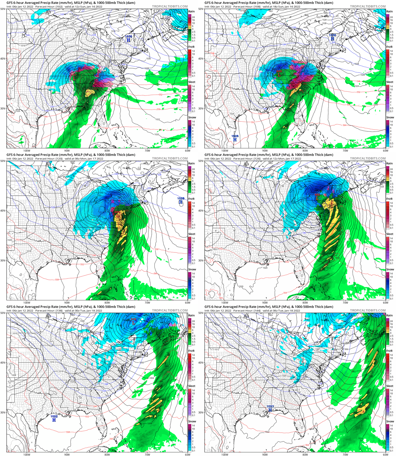
Here is the latest GFS that just ran this morning. Some areas could see a lot of snow, some will see snow to rain and some will see rain. At this point it appears we will see some snow on Sunday afternoon then a wintery mix/rain on Monday but again this can and will change over the next few days.
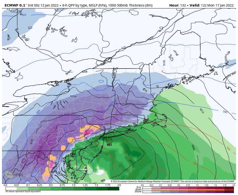
The Euro above shows interior PA getting CRUSHED while areas along i95 are mix/rain.
The 06z GFS is NOT a forecast from us, we are just showing the latest model run for this storm.

Here is a guide that we tend to follow with winter storms to bring you the latest information. 7-10 Days out – Pattern Recognition and watching for THREATS 5-7 days out- Paying close attention to TRENDS3 days out- Timing and precip type detailed out 1-2 days out- final calls, detailed timing, nowcasting.
Updates will come throughout the next few days, and a full detailed post will come as early as late tomorrow/Friday.
