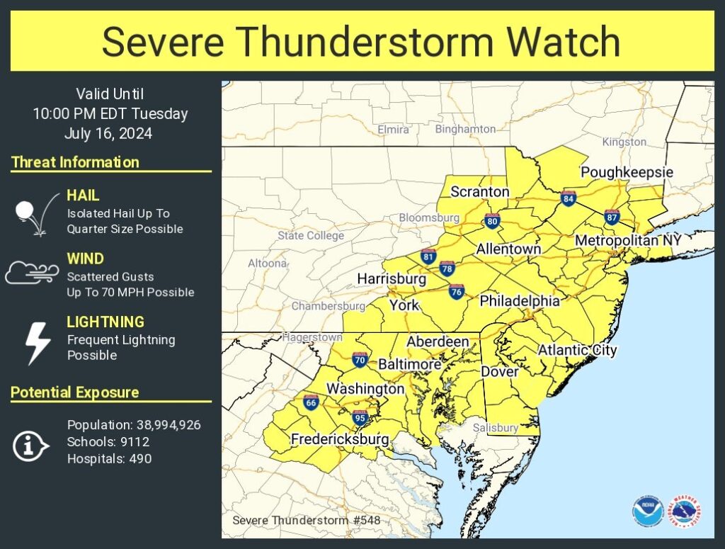
* Effective this Tuesday afternoon and evening from 335 PM until 1000 PM EDT.

* Primary threats include... Scattered damaging wind gusts to 70 mph possible Isolated large hail events to 1 inch in diameter possible

SUMMARY...Widely scattered thunderstorms are expected to develop this afternoon in a hot and humid air mass. Sufficiently strong westerly flow aloft will promote a risk of locally damaging wind gusts in the strongest cells.

The severe thunderstorm watch area is approximately along and 65 statute miles east and west of a line from 15 miles west southwest of Patuxent River MD to 55 miles east northeast of Wilkesbarre PA. For a complete depiction of the watch see the associated watch outline update (WOUS64 KWNS WOU8).

PRECAUTIONARY/PREPAREDNESS ACTIONS...

REMEMBER...A Severe Thunderstorm Watch means conditions are favorable for severe thunderstorms in and close to the watch area. Persons in these areas should be on the lookout for threatening weather conditions and listen for later statements and possible warnings. Severe thunderstorms can and occasionally do produce tornadoes.