Our biggest snowstorm in the past few years is knocking on our doorstep. Late Sunday night the area will see snow begin to move into the area. As the storm moves out on Monday afternoon locations south of Philly could see some mixing. The area will see temperatures below freezing through at least
Friday at this time. Below is our FIRST CALL for this system!
TIMING:
Snow will move into the area Late Sunday and start to taper off late Monday afternoon/ early evening.
SNOW AMOUNTS:
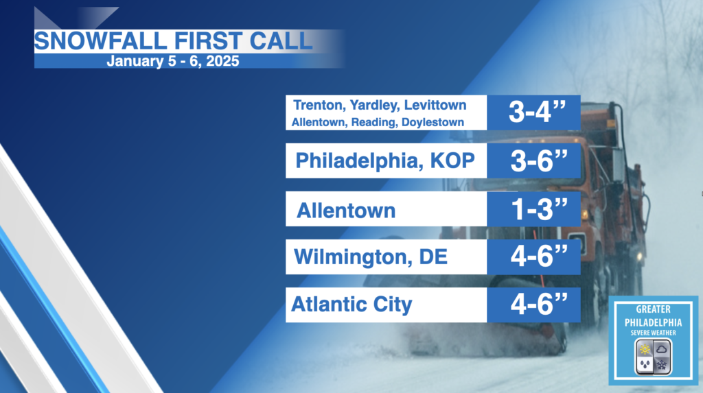
FIRST CALL SNOW TOTALS. We will release a second and finaly snowfall map late Saturday/Early Sunday. A general 3-6″ will fall across most of the area with localized higher amounts. We do expect to see higher amounts for some areas.
IMPACTS:
Widespread accumulating snowfall could create dangerous driving conditions. We expect that schools will be closed on Monday for much of the area. Let the kids have a SNOW day and not a “online school”
Current Radar:
