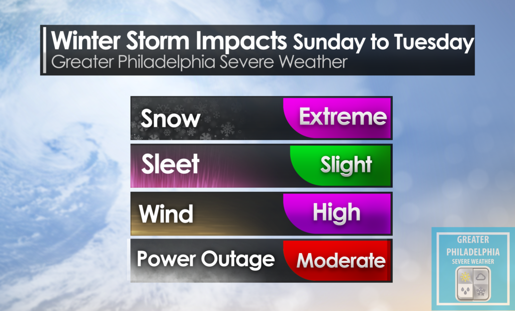
As we move into now casting on this storm. Here are some of the latest details we have.
Snow will begin to move into the area over the next few hours. We expect to see a minor lull in the overnight hours from about 3am-7am. Total snowfall amounts will be between 2-5” from this timeframe. Tomorrow the snow is really going to get going between 7-10am until about 10-11pm and areas will see snowfall rates of over 1”+ an hour at times. Try to avoid any travel on Monday during the storm.
Tuesday morning the snow will taper off than it is possible Tuesday afternoon a few additional snow showers are possible. We are advising everyone to stay off the roads tomorrow during the storm. One thing to note is that while this is now a nowcasting event. We are watching hour by hour the progress as well as any changes to the forecast. In the event the warmer air moves into the mid level there is a chance of mixing and dry air reducing total accumulation. While at this point not certain it will happen but the possibility is there and we don’t want to rule it out.
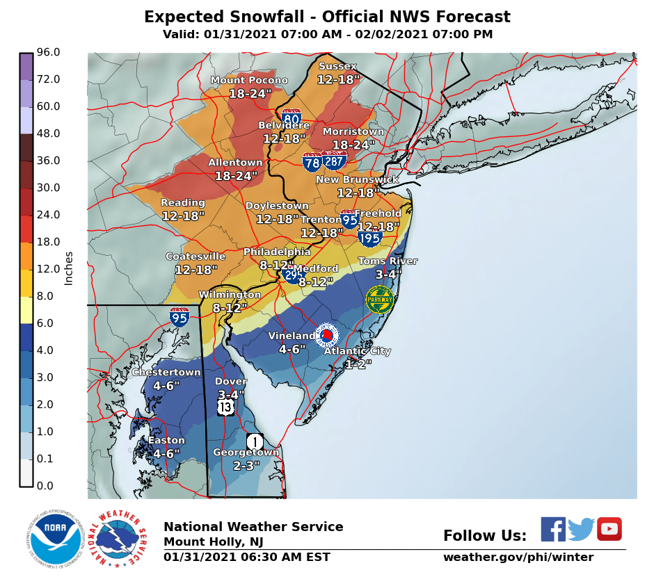
The NWS has updated the winter storm warning which now calls for 13-18” of snow with wind gust as high as 35mph. This will expire at 1pm Tuesday.
Philadelphia | Lower Bucks | Trenton | Princeton Significant snowfall is expected in these areas. 10-14” + Could see additional snowfall where CCB sets up.
Central/ Upper Bucks 10-14” could see higher amounts depending on ccb placement.
Allentown | Lehigh Valley 12-18”
Lancaster | KOP 10-14” could see more depending on setup.
Atlantic City | Wildwood 1-3” Snow to mix to rain and possibly ending as snow on the backend.

