A winter storm that was just going to bring some snow showers to the area has been moving trending north on the latest model runs. At this time the NWS has issued a Winter Storm Warning for South NJ and Delaware. A Winter Weather Advisory for Philly south and east.
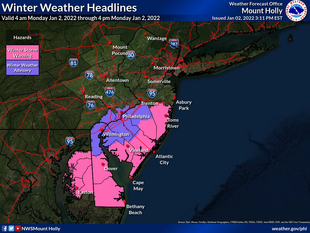
While the ground is very warm the snow will start very heavy towards the beginning of the storm and it will help cool the surface down. Monday morning commute will be a mess, it might be good to stay home if you are in areas under the Winter Storm Warning.
The latest 12z GFS model and 12z Euro.
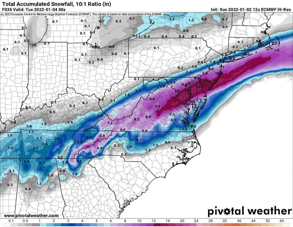
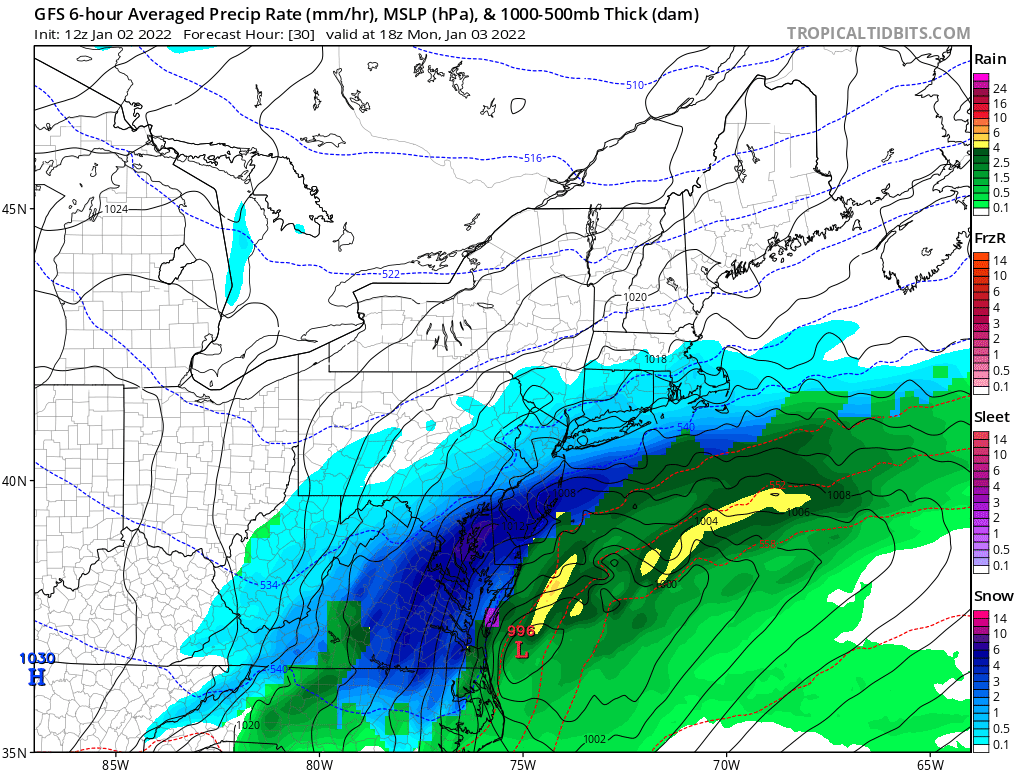
TIMING:
The snow will move in into South NJ around 2/3am and we can see snow in the Philly Metro area around 4/5am. Once the snow starts it will become heavy at times. We will see the snow move out in the afternoon West to East.
SNOWFALL TOTALS:
The further north you are the less snow you will see.
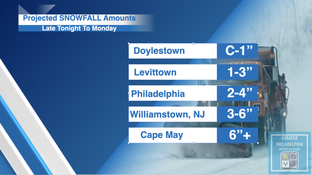
You will see SHARP cutoffs to the north. In Bucks County anything NORTH of i295 in Yardley will see less snow than Fairless Hills/Bristol/Bensalem will see. These numbers could change depending on where bands set up. We will have an update call if needed later this evening.
Here is the NWS map
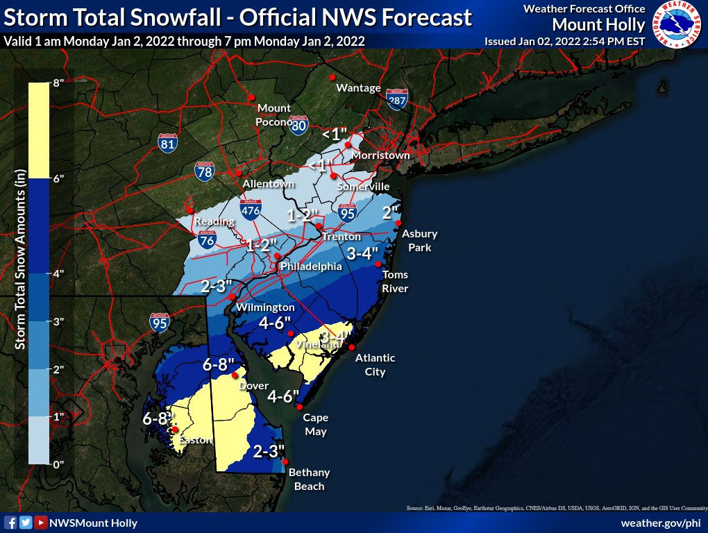
The snow totals above could be locally higher depending on where the heavy banding sets up.
School Closing Projections:
We will post any school closing information here : https://greaterphilaseverewx.com/school-closings/