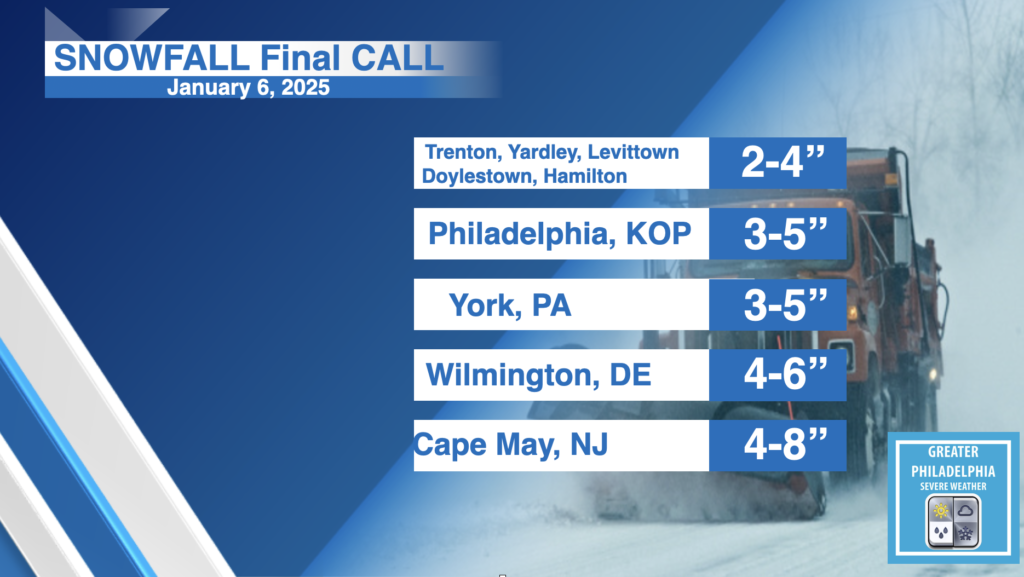
Our biggest snowstorm in the past few years is knocking on our doorstep. Early Monday morning the area will see snow begin to move into the area. The area will see temps below freezing until at last the end of the week. This system will bring more snow to the south, a general 2-5″ of snow will fall across most of the area with pockets of 4-6/4-8″ south of Philly. A tick north could raise the totals a little higher. We are also keeping an eye on the system for next weekend which could bring plowable snow to EVERYONE! But one system at a time.
TIMING:
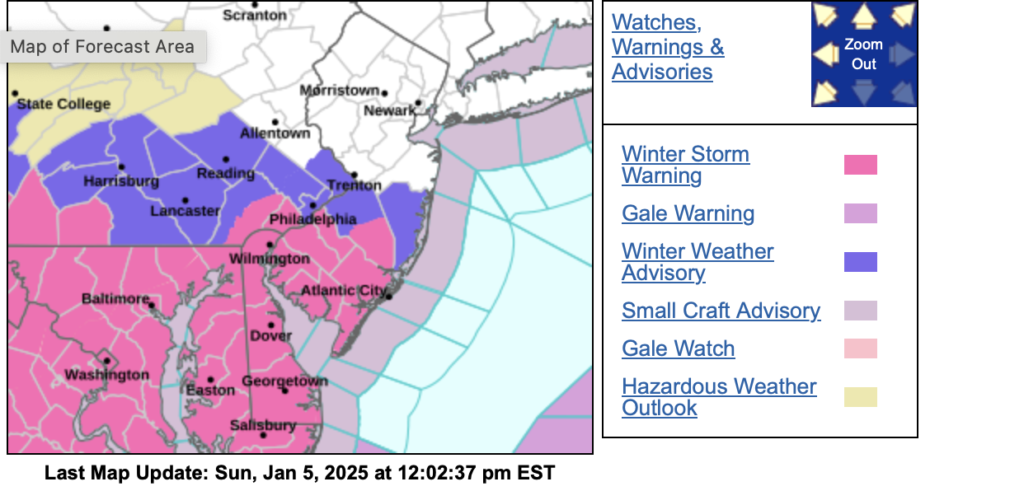
Snow will move into the area Early Monday morning and start to taper off late Monday afternoon/ early evening. The warnings and advisories will go into effect at 1am
SNOW AMOUNTS:
FINAL CALL SNOW TOTALS: A general 2-5″ will fall across most of the area with localized higher amounts. We do expect to see higher amounts to the south.
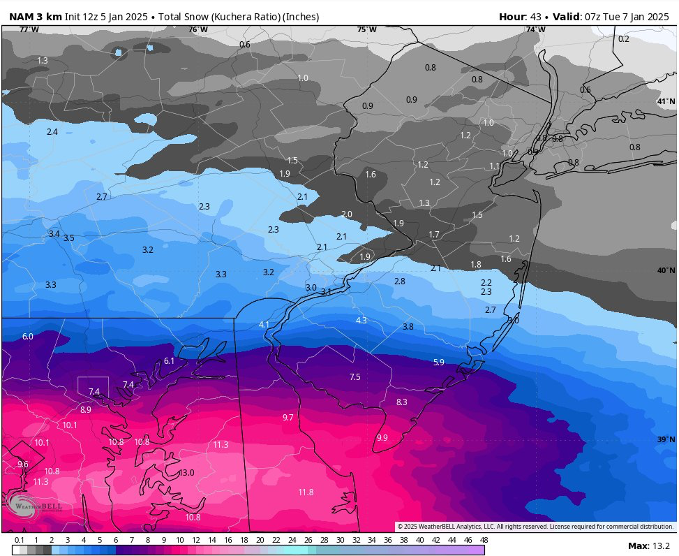
HERE is the latest NAM from Today.

IMPACTS:
Widespread accumulating snowfall could create dangerous driving conditions.

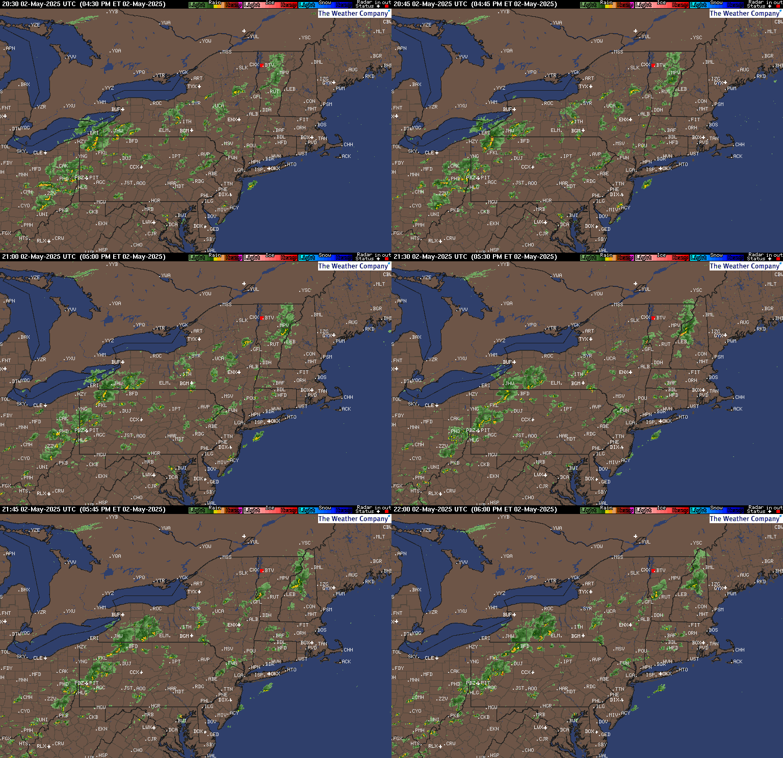
Current Radar:

WINTER WEATHER ADVISORY REMAINS IN EFFECT FROM 1 AM TO 10 PM EST
MONDAY…
* WHAT…Snow expected. Total snow accumulations between 2 and 4
inches.
* WHERE…Portions of southern New Jersey and east central and
southeast Pennsylvania.
* WHEN…From 1 AM to 10 PM EST Monday.
* IMPACTS…Plan on slippery road conditions. The hazardous
conditions will impact the Monday morning and evening commutes.
* ADDITIONAL DETAILS…Snow will overspread the region late Sunday
night and intensify through Monday morning. It will then gradually
taper off Monday afternoon and evening.
PRECAUTIONARY/PREPAREDNESS ACTIONS…
Slow down and use caution while traveling. The latest road
conditions for the state you are calling from can be obtained by
calling 5 1 1.