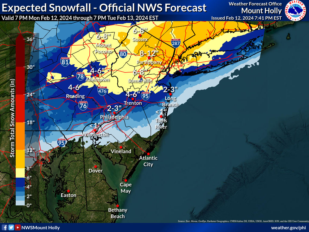
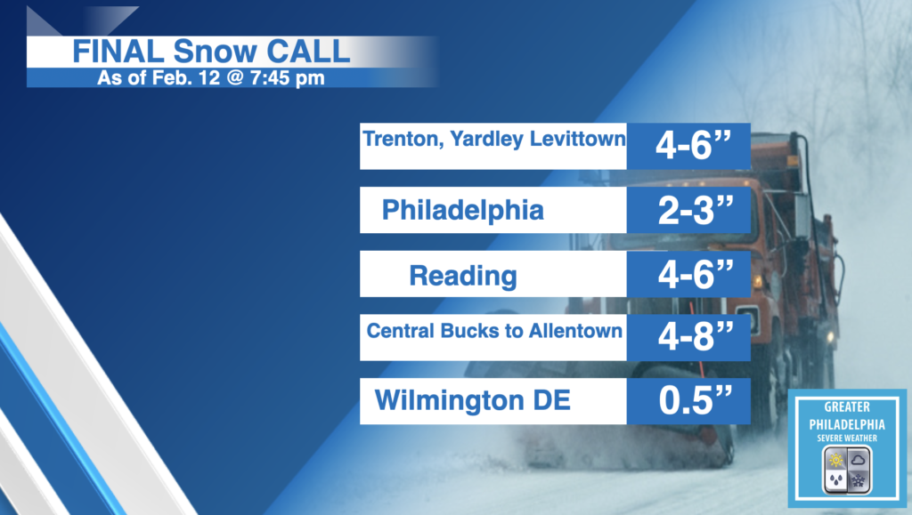
The National Weather Service has upgraded the area to a Winter Storm WARNING. Schools are starting to close or goto all virtual for tomorrow. We will see snow fall rates of 1″ per hour at some points during the day. Use Caution if driving in the morning. A General 4-6″ will fall across the areas north of Philadelphia. Less towards Philly and more to the north. Our final call is below. Sharp cut offs are possible with this storm. If the storm wiggles NORTH or SOUTH totals can and will change. This has been a tough storm to forecast. The SNOW will be a wet heavy snow. Please use caution when shoveling and take breaks.
The NWS Map is at the end of the post
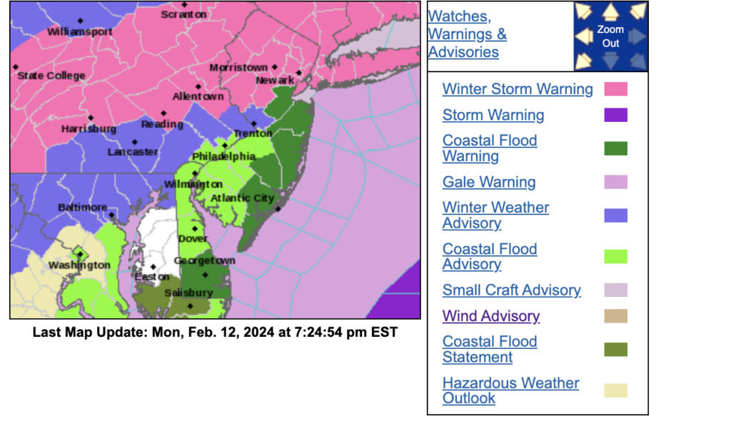
WINTER STORM WARNING:
* WHAT…Heavy snow expected. Total snow accumulations of 4 to 7 inches.
Winds gusting as high as 40 mph.
* WHERE…In New Jersey, Middlesex, Western Monmouth and Mercer. In Pennsylvania, Lower Bucks.
* WHEN…From midnight tonight to 3 PM EST Tuesday.
* IMPACTS…Travel could be very difficult. The hazardous conditions could impact the morning commute.
* ADDITIONAL DETAILS…Briefly heavy snow will be possible around the time of the morning commute, with snowfall rates of up to 1 inch per hour possible. There is uncertainty regarding snow amounts and how efficiently the snow will accumulate on roads, given mild temperatures with precipitation starting as rain overnight.
PRECAUTIONARY/PREPAREDNESS ACTIONS… If you must travel, keep an extra flashlight, food, and water in your vehicle in case of an emergency. The latest road conditions for the state you are calling from can be obtained by calling 5 1 1.
Current Watches, Warnings and Advisories.