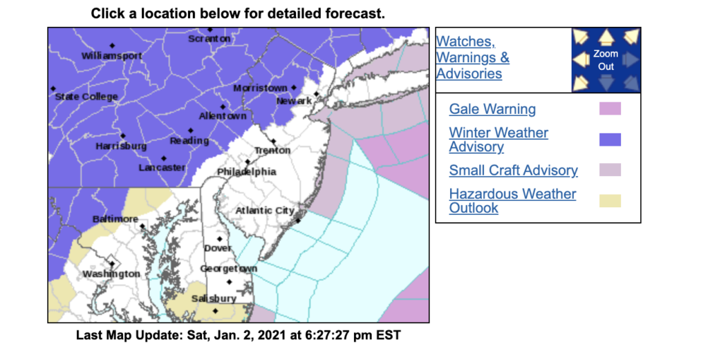
Winter Weather Advisory In Effect for Parts of the Area
Winter Weather Advisory In Effect for Parts of the Area
NJZ007>010-PAZ060>062-101-103-105-030900-
/O.NEW.KPHI.WW.Y.0001.210103T1400Z-210104T0600Z/
Warren-Morris-Hunterdon-Somerset-Berks-Lehigh-Northampton-
Western Chester-Western Montgomery-Upper Bucks-
Including the cities of Washington, Morristown, Flemington,
Somerville, Reading, Allentown, Bethlehem, Easton, Honey Brook,
Oxford, Collegeville, Pottstown, Chalfont, and Perkasie
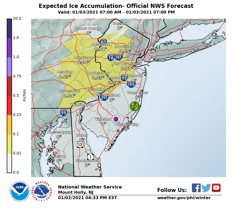
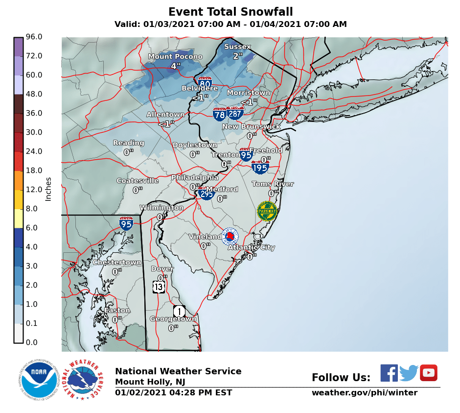
* WHAT...Mixed precipitation expected. Total snow accumulations
of up to one inch and ice accumulations of a light glaze.
* WHERE...Portions of northern and northwest New Jersey and east
central and southeast Pennsylvania.
* WHEN...From 9 AM Sunday to 1 AM EST Monday.
* IMPACTS...Plan on slippery road conditions.
* ADDITIONAL DETAILS...Precipitation may start as a mixture of
freezing rain and sleet before transitioning to mostly plain
rain into the afternoon. A brief transition to snow is possible
Sunday night before the system exits the region.
PRECAUTIONARY/PREPAREDNESS ACTIONS...
Slow down and use caution while traveling.
The latest road conditions for the state you are calling from can
be obtained by calling 5 1 1.