
A Winter Storm will bring snow, rain and a mix to the area. This will start Saturday Afternoon into Sunday. At this point the i95 corridor is going to be close to where the rain/snow line set up. I will say at this point the area could see inches or snow or just a little due to placement of the rain/snow line.
Team SNOW is not going to like our call but things could be trending south, which would bring more snow to the area. This will be a HEAVY WET snow!
First Call:
Lower Bucks, Central Bucks, Philly, Trenton – C-2″ Snow changing to Rain/Mix
Doylestown, Reading, Lancaster – 3-6″ Snow changing to Rain/Mix
Quakertown, Allentown, Harrisburg, Pottsville – 4-8″ Heavy wet snow.
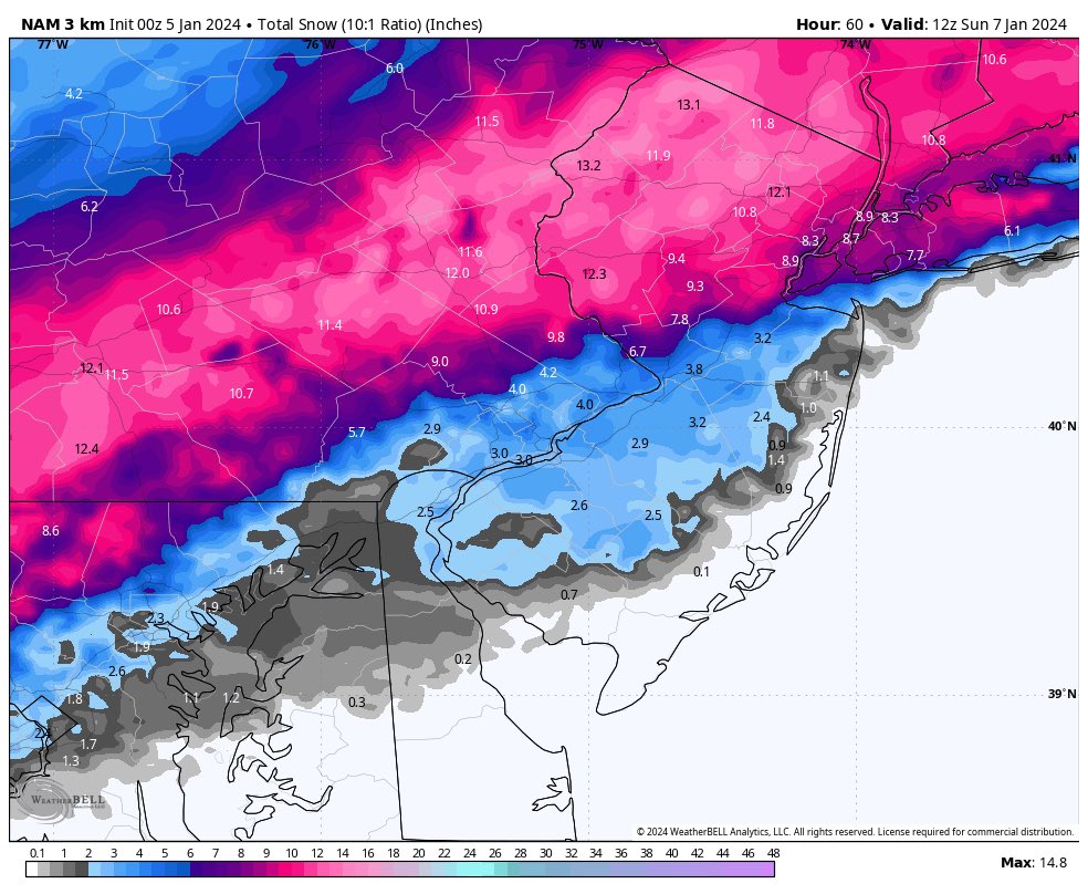
All snow will be a wet heavy snow. The NAM above is trending south will this keep up on the overnight runs? We will watch closely and if I need to update the numbers below I will in our second call around mid day tomorrow.
Please NOTE: New Model guidance coming in from the NAM model shows that the storm is trending south. If this keeps up in the overnight models we will be RAISING snow totals for most of the area around the i95 corridor. We are going to keep close eye on this as well as dynamics. I will update late morning with second call if needed.
[location-weather id=”4380″]