Jan
02
Daily Forecast Jan 02, 2026
Have a great day!
Friday
Partly sunny, with a high near 33. West wind 5 to 10 mph.
Friday Night
Partly cloudy, with a low around 19.
Have a great day!
Friday
Partly sunny, with a high near 33. West wind 5 to 10 mph.
Friday Night
Partly cloudy, with a low around 19.
Have a happy and safe NYE
Wednesday
Cloudy, then gradually becoming mostly sunny, with a high near 35. Southwest wind around 10 mph, with gusts as high as 20 mph.
Wednesday Night
A chance of snow showers, mainly after 1am. Mostly cloudy, with a low around 24
A wind advisory is in effect until 1pm Tuesday.
Tuesday
Partly sunny, with a high near 33. Breezy, with a west wind 15 to 20 mph, with gusts as high as 40 mph.
Tuesday Night
Mostly cloudy, with a low around 24.
Dense fog Advisory is in effect until 10am. A wind advisory will go into effect at 10am until 1pm Tuesday.
Monday
Showers, mainly before 2pm. Widespread fog, mainly before 8am. High near 53. Winds could gust as high as 45 mph.
Monday Night
Partly cloudy, with a low around 26. Breezy, with a west wind around 20 mph, with gusts as high as 45 mph.
Winter Weather Advisory is in effect until 10am Saturday. Use extreme caution due to icy conditions
Saturday
Cloudy, with a high near 32. Northeast wind 5 to 10 mph.
Saturday Night
Mostly cloudy, with a low around 22. Calm wind.
Sunday
A chance of rain after 1pm. Cloudy, with a high near 39. Calm wind becoming southwest around 5 mph. Chance of precipitation is 40%. New precipitation amounts of less than a tenth of an inch possible.
Sunday Night
Rain. Low around 33

Winter Weather Advisory is in effect from 1pm until 10am Saturday.
Friday
Snow likely, mainly after 5pm. Increasing clouds, with a high near 30.
Friday Night
Snow, possibly mixed with sleet before 4am, then snow and freezing rain. Low around 25.
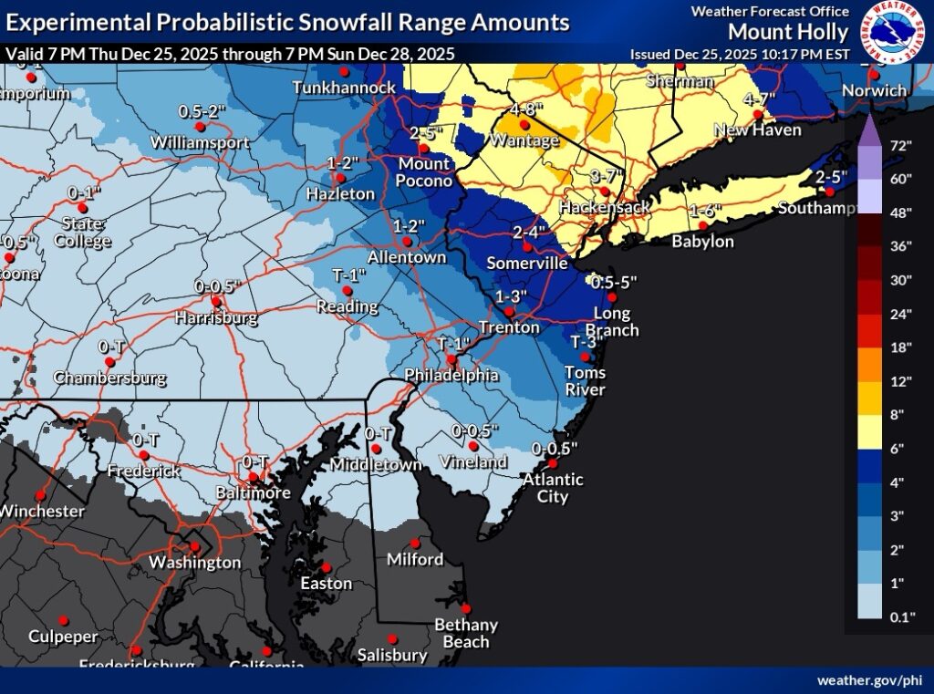
New snow and sleet accumulation of 2 to 4 inches possible.

Winter Storm Watch has been issued for Friday afternoon

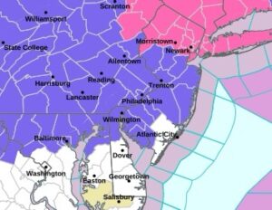
* WHAT…Heavy mixed precipitation possible. Total snow accumulations between 4 and 6 inches and ice accumulations up to two tenths of an inch possible.
* WHERE…Portions of east central, northeast, and southeast Pennsylvania.
* WHEN…From Friday afternoon through Saturday morning.
* IMPACTS…Travel could be very difficult. The hazardous conditions could impact the Friday evening commute.
FIRST CALLS: We will have an update to these total late tonight or tomorrow.

If the NWS issues any watches or advisories we will provide an update.
Here is the latest NWS thinking on the storm.

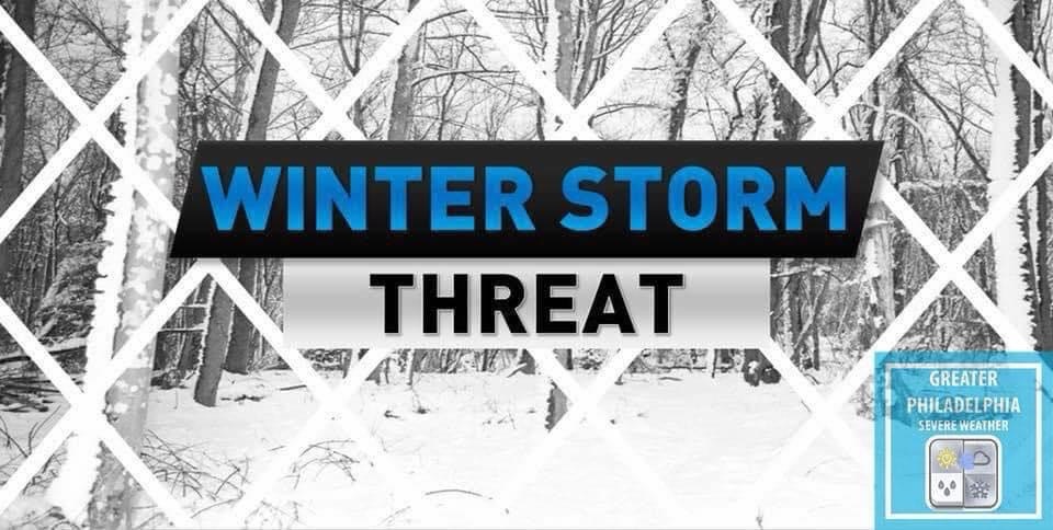
While the Philadelphia area did not see a White Christmas, The best we can get is a post-Christmas winter storm that is expected to impact the Greater Philadelphia area from Friday evening, December 26 through early Saturday morning, December 27, bringing a mix of snow, sleet, and freezing rain as moisture overruns cold air across the Northeast.
Snow and wintry precipitation are likely to begin Friday afternoon and continue into the overnight hours, with the highest confidence for snow and potential plowable totals in the Philadelphia metro area and suburbs but also a notable risk for sleet and ice, especially closer to the I-95 corridor and southern parts of the region.
Preliminary snowfall projections for the broader area suggest a widespread 3 – 6 inches of snow, with isolated higher amounts possible in parts of northeastern Pennsylvania and interior areas.
TRAVEL ADVISORY: This storm arrives during peak travel times late Friday and could lead to hazardous travel conditions, slick roads, and delays into Saturday as the system departs the region.
FIRST CALLS: We will have an update to these total late tonight or tomorrow.
If the NWS issues any watches or advisories we will provide an update.
Here is the latest NWS thinking on the storm.
Merry Christmas Everyone!
Christmas Day
A slight chance of snow and rain before 2pm. Mostly cloudy, with a high near 44.
Thursday Night
Mostly cloudy, with a low around 21
Have a very Merry Christmas
Wednesday
Sunny, with a high near 44. Northwest wind 10 to 15 mph, with gusts as high as 30 mph.
Wednesday Night
Increasing clouds, with a low around 28