Winter Storm Watches In Effect Southern Areas

A Winter Storm Watch is in effect for the following areas including the following cities of Dover, Georgetown, Rehoboth Beach, Centreville, Easton, Denton, Millville, Hammonton, Cape May Court House, Ocean City, and Atlantic City


...WINTER STORM WATCH IN EFFECT FROM LATE TONIGHT THROUGH MONDAY
AFTERNOON...

* WHAT...Heavy snow possible. Total snow accumulations of at least
  4 to 6 inches possible. Winds could gust as high as 35 mph.

* WHERE...Portions of southern New Jersey, northeast Maryland
  and central and southern Delaware.

* WHEN...From late tonight through Monday afternoon.

* IMPACTS...Travel could be very difficult. Hazardous conditions
  including snow-covered roads will likely impact the Monday
  morning commute, potentially lingering into the evening commute.

* ADDITIONAL DETAILS...Snowfall rates could exceed one inch per
  hour at times Monday morning. Users should closely monitor the
  forecast today, as additional changes, potentially significant,
  are possible.

PRECAUTIONARY/PREPAREDNESS ACTIONS...

Monitor the latest forecasts for updates on this situation.

Bucks County Christmas Light Tour


The Lower Bucks Drive-Thru Holiday House Tour is a community event in Lower Bucks County. Your neighbors who love to decorate have signed up to be included on a special tour list. The great folks at Lower Bucks Drive-Thru Holiday House Tour have compiled all the houses and made suggested driving routes so you can enjoy the sights and know exactly where the holiday lights are in your town.

They have put together all five routes below and be sure to click on the suggested GPS link so you can maximize your tour time! Please go like The Lower Bucks Drive-Thru Holiday House Tour at: https://www.facebook.com/lbdrivethruhousetours

At the end of the article we have PDF copies so you can download to view.

Mistletoe Route: Levittown

The Mistletoe route will take around 33 minutes.


Polar Bear Route: Levittown & Langhorne

The Polar Bear Route will take approx 48 minutes. Here are the GPS trips for this route.

Polar bear route 1: https://goo.gl/maps/P1r1CpUBeM2cvam3A


Snowman Route: Warrington, Warminster, Hatboro, Richboro, and Feasterville

The Snowman route will take around 1 hour and 15 minutes to complete, here is the GPS trip for this route.

Snowman route 1: https://goo.gl/maps/UQQRNpPw6PpRcvcG8
Snowman route 2: https://goo.gl/maps/JqjdrEMJ3jVYDtV67

Santa Claus Route: Bensalem, Croydon, & Bristol

The Santa Claus Route will take approx 1 hour. Here is the GPS trip:

Santa clause route 1: https://goo.gl/maps/CyncSk2c7fsYyrnN7
Santa clause route 2: https://goo.gl/maps/fvZYRHz4V1rMJ5T39


Candy Cane Route: Morrisville, Fairless Hills, Yardley, New Hope, & Doylestown

The Candy Cane Route will take approx 1 hour and 20 minutes. Here is the map for this route including GPS link. Candy cane lane: https://goo.gl/maps/ViiKfRYBrT1GjT4J6

Below you can download the route and print if needed.

All Eyes On Mid-Week Storm Threat…..

A low pressure system could bring some winter weather to parts of the Northeast late Tuesday night into Wednesday. While at this point the track is highly uncertain but the threat of winter weather is possible. How much and what type of precipitation is too early to tell at this point but some signs are starting to develop.

If this system tracks to our southeast we might not see much warm air in which case could bring more snow to the area. If the storm tracks over the closer to our region it will bring in warmer air resulting in rain for most of the area. A third option is the track takes the storm further off the coast which would keep most of the precipitation off shore.

The timing in which the precipitation will fall also places a huge factor. If it is a majority falls in the daytime hours we will see more potentially more rain. However if the storm moves into the area in the overnight hours some would potentially see more snow/mix. At this time please take this with a grain of salt.

We are going to be keeping a very close eye on this developing storm and will bring you the latest updates as models run.

The 0zGFS run is showing the Rain/Snow Mix line very close to i95 corridor. While a lot of things can happen between now and Wed. We are going to keep a close eye on this storm and bring you the latest tomorrow afternoon after the 12z runs.

As you can see the 00z GFS shows the Rain/Snow line close to the area. Again this is not a forecast from GPSW we are just sharing what the models are showing at this point.
Here is another model that is around the same time period but shows a different outcome.

Thanksgiving Week Travel Outlook

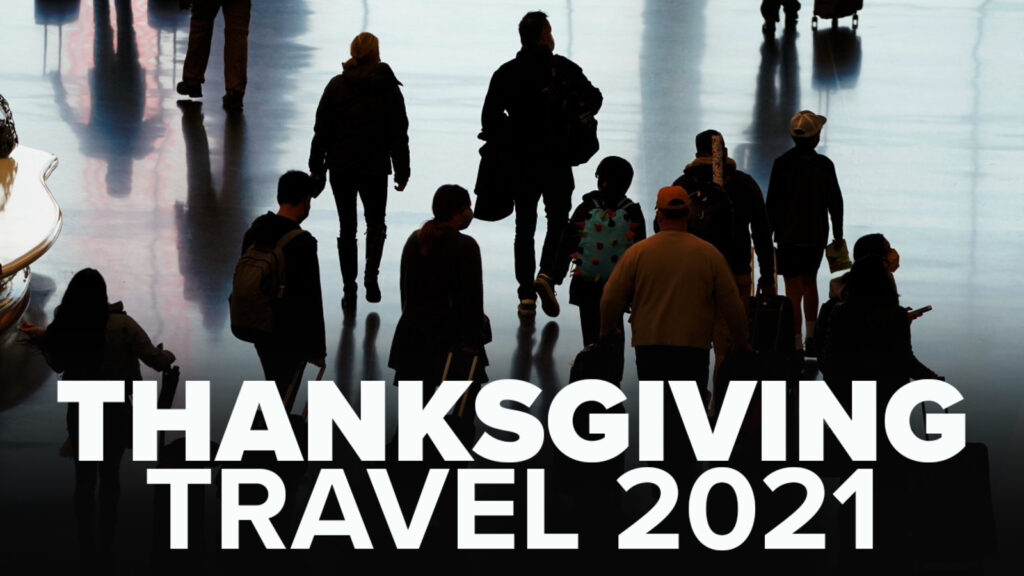
As we are now entering the Holiday Season and the busiest travel day of the year is almost here, We wanted to share an outlook on potential weather impacts across the country this week.

Today a cold front that brought showers to the area overnight and into this morning will be exiting off the coast this afternoon. A series of storms brought tornado warnings to parts of Mass early this morning. The Great Lakes region will see snow from upper Michigan to Central NY.

Today we might see some airport delays in some of the busier hubs such as Boston, New York, Philadelphia and perhaps Washington. There could also be delays in Miami and Fort Lauderdale, Florida, due to rain showers, low clouds and poor visibility.

Strong winds will develop behind this Eastern cold front, which could trigger some wind-related delays across the Great Lakes, Northeast and Southeast.

Now out west the Pacific Northwest, including Seattle, may also have to contend with weather-related delays on Monday as the threat of rain and snow returns to the region.

Much of California, the Rockies and the Plains should have mainly quiet conditions for holiday travelers

Tuesday

A High pressure will bring dry weather to much of the central and eastern U.S. on Tuesday.

Tho strong wind gusts will impact parts of New England and the Mid-Atlantic including Boston, New York, Phila and perhaps Washington/Baltimore airports, but i wouldn’t be too concerned.

Travelers in the Plains, Midwest and South should not face any significant weather issues.

Wednesday

The day before Thanksgiving is typically the busiest travel day of the year. The great news is most travelers will NOT run into any significant weather issues on Wednesday.

However, if your flight isn’t until later in the day or Wednesday night, there is threat of delays due to a storm system in the center of the country.

Thanksgiving Day

The system that is set to develop on Wednesday night could cause delays on Thanksgiving Day from Texas into the Ohio Valley.

Friday

Another cold front will exit the East Coast on Friday, but there may be some lingering rain showers along the immediate Eastern Seaboard. It will get COLD!

Much colder air behind the front will likely lead to the development of wind-whipped snow showers and isolated snow squalls in some areas of the interior northeast.

Strong winds will develop for the Mid-Atlantic and northward, this may cause some delays.

At this point Sunday looks to be the best day to travel home after the holiday weekend.

How to see the Almost Total Lunar Eclipse late tonight

Later tonight there will be a lunar eclipse. While a passing front will bring rain and clouds you still might be able to catch a glimpse of this eclipse. At this point the best change of seeing it are those to the west of Philadelphia.

Overnight, the moon will pass into the shadow of Earth cast by the sun, illuminating the gray orb with a red hue. It will be the second and final eclipse of the year.

NASA predicts the eclipse will last over 3 hours and 28 minutes. That would make it the longest partial lunar eclipse in 580 years, according to the Holcomb Observatory at Butler University.

Here’s how to see the eclipse:

The lunar eclipse will be visible in North America, as well as parts of South America, Polynesia, eastern Australia and northeastern Asia, according to NASA.

For U.S. viewers the peak of the eclipse — when the moon is the most covered by Earth’s shadow — will be at 4:03 a.m. ET.

But the moon will begin to pass into the Earth’s shadow much earlier, around 1 a.m. ET. At 2:19 a.m. ET, the moon will move into the umbra, the inner part of Earth’s shadow and begin to look like a chunk is missing from it. It will turn red around 3:45 a.m. ET.

Snowy Sunday Night for Mount Pocono

This afternoon as a cold front pushes across the area parts of the area will see strong to severe gusty thunderstorms. The biggest threat area will be in Eastern NJ. Timing is from around noon until 4pm. As the storms roll through you will feel a big difference as we head into this evening as temps will take a dive. Wind gust will be 40-50mph are possible, even small hail. While not everyone will see severe storms the threat is possible for many.


Hurricane Local Weather Statement

This morning the NHC has put out a LOCAL HURRICANE STATEMENT that includes our area. While we are NOT going to see major issues from the storm this is more of a “be alert” notification as changes are possible.

This is from the NWS Local Statement:

Tropical Storm Henri Local Statement Advisory Number 22
National Weather Service Mount Holly NJ  AL082021
509 AM EDT Sat Aug 21 2021

This product covers NEW JERSEY...DELAWARE...SOUTHEASTERN PENNSYLVANIA AND NORTHEAST MARYLAND

**Henri continues northward today**

NEW INFORMATION
---------------

* CHANGES TO WATCHES AND WARNINGS:
    - None

* CURRENT WATCHES AND WARNINGS:
    - A Tropical Storm Warning is in effect for Eastern Monmouth,
      Middlesex, and Western Monmouth

* STORM INFORMATION:
    - About 440 miles south of Atlantic City NJ or about 510 miles
      south of Sandy Hook NJ
    - 33.1N 73.2W
    - Storm Intensity 70 mph
    - Movement North-northeast or 15 degrees at 12 mph

SITUATION OVERVIEW
------------------

Tropical Storm Henri is approximately 450 miles south southeast of
Atlantic City. Henri will track north northeastward along the Eastern
Seaboard through tonight. Henri is expected to strengthen to hurricane
force before making landfall on Long Island or southern New England on
Sunday.

The main threat with this system is heavy rain leading to flooding and
flash flooding across much of the region. Tropical storm force winds
are possible in portions of East Central New Jersey. With a full moon
this weekend, minor coastal flooding is also expected, primarily with
the high tide this evening along the New Jersey Coast. Minor coastal
flooding may linger with the Sunday evening high tide.

Dangerous marine conditions will develop over the northern Atlantic
Waters with strong winds, rough seas, and dangerous rip currents. Seas
will build to six to ten feet. A high risk for rip currents is
expected to continue through at least Sunday for the New Jersey and
Delaware coasts.

POTENTIAL IMPACTS
-----------------

* FLOODING RAIN:
Protect against life-threatening rainfall flooding having possible
extensive impacts across Central and northern New Jersey. Potential
impacts include:
    - Major rainfall flooding may prompt many evacuations and rescues.
    - Rivers and tributaries may rapidly overflow their banks in
      multiple places. Small streams, creeks, canals, arroyos, and
      ditches may become dangerous rivers. In mountain areas,
      destructive runoff may run quickly down valleys while
      increasing susceptibility to rockslides and mudslides. Flood
      control systems and barriers may become stressed.
    - Flood waters can enter many structures within multiple
      communities, some structures becoming uninhabitable or washed
      away. Many places where flood waters may cover escape routes.
      Streets and parking lots become rivers of moving water with
      underpasses submerged. Driving conditions become dangerous.
      Many road and bridge closures with some weakened or washed out.

Protect against dangerous rainfall flooding having possible limited
to significant impacts across southern New Jersey, southeastern
Pennsylvania, and northern Delmarva.

* WIND:
Protect against dangerous wind having possible significant impacts
across East Central New Jersey. Potential impacts in this area
include:
    - Some damage to roofing and siding materials, along with damage
      to porches, awnings, carports, and sheds. A few buildings
      experiencing window, door, and garage door failures. Mobile
      homes damaged, especially if unanchored. Unsecured lightweight
      objects become dangerous projectiles.
    - Several large trees snapped or uprooted, but with greater
      numbers in places where trees are shallow rooted. Several
      fences and roadway signs blown over.
    - Some roads impassable from large debris, and more within urban
      or heavily wooded places. A few bridges, causeways, and access
      routes impassable.
    - Scattered power and communications outages, but more prevalent
      in areas with above ground lines.

Also, protect against hazardous wind having possible limited impacts
across other portions of New Jersey.

* OTHER COASTAL HAZARDS:
A high risk for rip currents will continue through at least Sunday.

* SURGE:
Little to no impacts are anticipated at this time across New Jersey,
southeastern Pennsylvania, and northern Delmarva. However, minor tidal
flooding is expected with the high tide this evening along portions of
the New Jersey coast.

* TORNADOES:
Little to no impacts are anticipated at this time across New Jersey,
southeastern Pennsylvania, and northern Delmarva.

PRECAUTIONARY/PREPAREDNESS ACTIONS
----------------------------------

Now is the time to complete all preparations to protect life and
property in accordance with your emergency plan. Ensure you are in a
safe location before the onset of strong winds or possible flooding.

Keep cell phones well charged. Cell phone chargers for automobiles can
be helpful, but be aware of your risk for deadly carbon monoxide
poisoning if your car is left idling in a garage or other poorly
ventilated area.

It is important to remain calm, informed, and focused during an
emergency. Be patient and helpful with those you encounter.

If you are a visitor, be sure to know the name of the city or town in
which you are staying and the name of the county or parish in which
it resides. Listen for these locations in local news updates. Pay
attention for instructions from local authorities.

Rapidly rising flood waters are deadly. If you are in a flood-prone
area, consider moving to higher ground. Never drive through a flooded
roadway. Remember, turn around don`t drown!

Closely monitor weather.gov, NOAA Weather radio or local news outlets
for official storm information. Be ready to adapt to possible changes
to the forecast. Ensure you have multiple ways to receive weather
warnings.

* ADDITIONAL SOURCES OF INFORMATION:
- For information on appropriate preparations see ready.gov
- For information on creating an emergency plan see getagameplan.org
- For additional disaster preparedness information see redcross.org

Tornado Outbreak Update

As of this time the National Weather Service in Mt Holly has confirmed 7 tornados

This is the first time an EF3 tornado hit in Bucks County.

This is the first F3/EF3 tornado in PA since July 17, 2004.

Here is a breakdown of the confirmed tornados within our area as of now:

EF0 Northeast Philadelphia (60-80mph)
EF1 Plumstead Twp (90mph)
An EF1 in Windsor, Mercer County NJ (100-105mph)
EF1 Cedar Bridge (100-105mph)
EF1 Windsor, Robbinsville Twp (105mph)
EF2 Waretown/Barnegat Light (115mph)
EF2 New Hope/Ewing (115mph)
EF3 in Bensalem/Trevose (140mph)

BREAKING: Disneyland and Disney World to require facemask


BREAKING: The Walt Disney Company has just published the following statement:

We are adapting our health and safety guidelines based on guidance from health and government officials, and will require Cast Members and Guests ages 2 and up, to wear face coverings in all indoor locations at Walt Disney World Resort and Disneyland Resort beginning Friday, July 30, regardless of vaccination status. At Walt Disney World Resort, this includes upon entering and throughout all attractions and in enclosed transportation vehicles, including shuttles, buses, monorails and at Disney Skyliner.