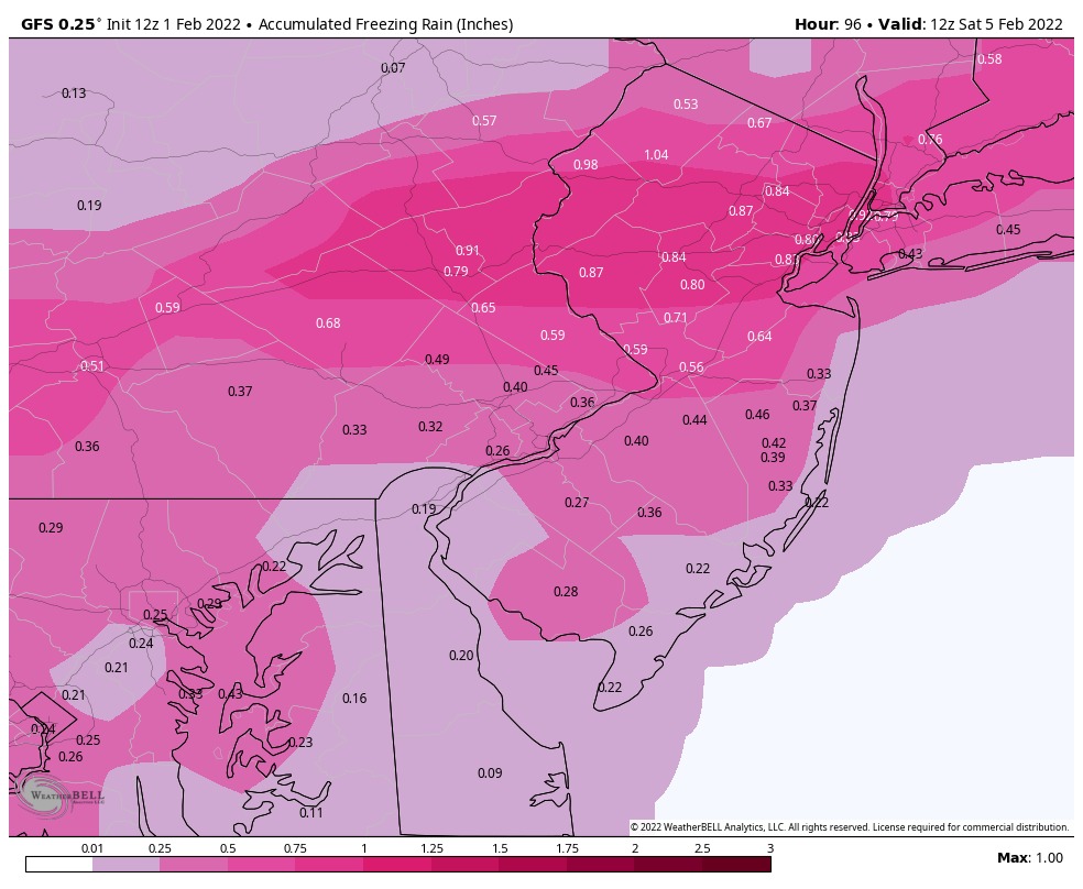
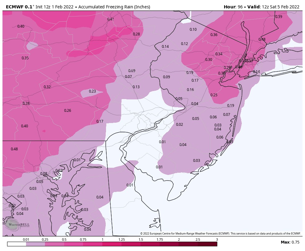
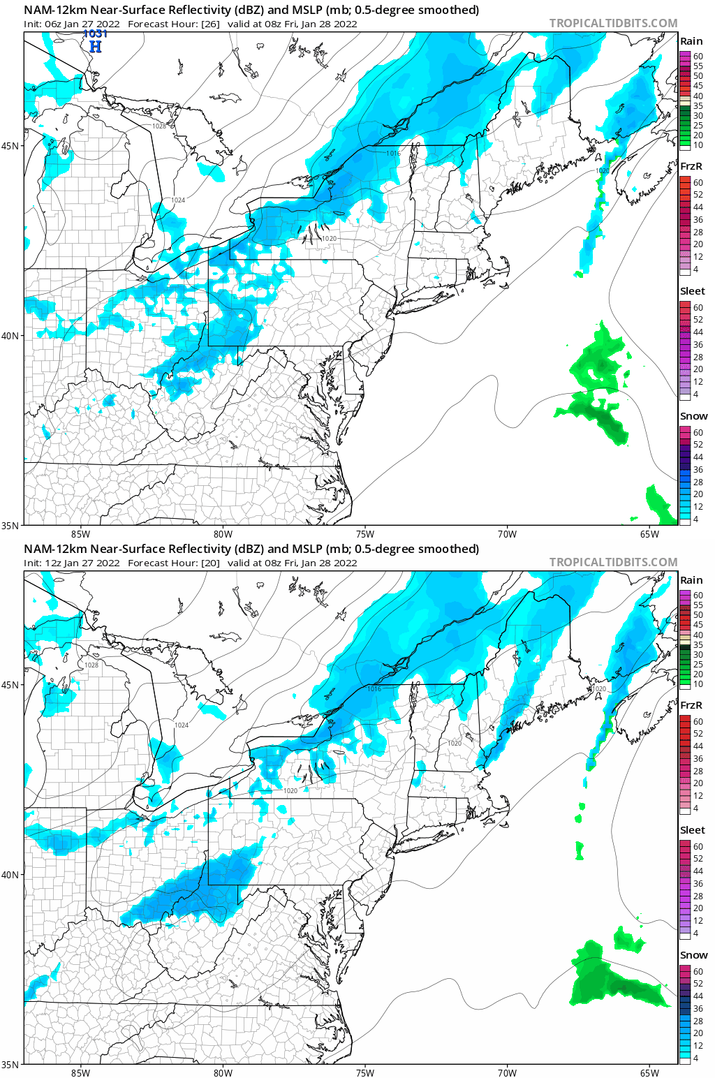
The threat of ICE that we have mentioned yesterday is still growing on Friday. As of this afternoon the Euro model is now starting to trend colder. Both the GFS and Euro are showing a major ice event for locations to our west.
Friday afternoon could be a icy mess if these were to verify. Also Friday afternoon we will see big drop in temps creating a flash freeze where any wet surfaces could turn to black ice later Friday afternoon/evening. Even if you do not change over to the ZR on Friday, you will see ice develop as temps crash.
Here is this afternoons EURO and GFS Model.
We are following this very carefully and will keep you updated as we get closer.
This week we will see temps hit around 50º BUT a wintery mix/ice event might follow these warmer temps.
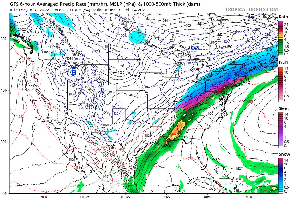
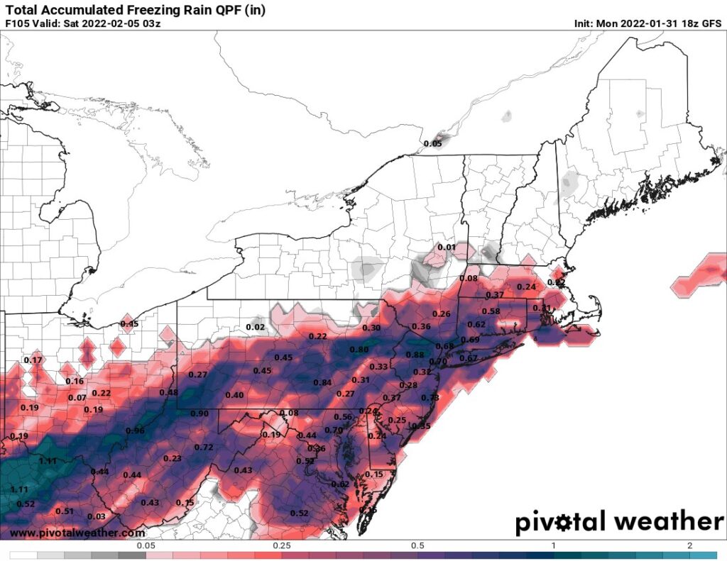
While I usually don’t like to talk about a system 5 days out, but I want to put it out that some could from the central plains to the north east could see a ice storm event. While we are not sure of who will see what around here. Models are hinting that ice/freezing rain could make its way towards the Philadelphia area. Anytime I have to mention ICE it scares me as this is no joke. I am hoping this system gets colder faster or stays warm and we are in rain or just snow, but NO ICE.
The GFS paints a icy picture but after the GFS did not do well with our storm last week, I am hoping it stays the same and we do not see this happen. Now the 18z which is pictured below is slightly north from the 12z runs.
Timing: Wed. we could see some freezing fog, then Rain on Thursday. Then a winter mix on Friday that could bring snow and a mix to the area.
Again this is in no way a forecast, I want to get the word out of a possible ICE event later in the week. This would cause major issues.
How to prepare for a Major Winter Storm:
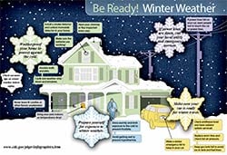
Weatherproof your home tips from the CDC and Weather.Gov
Insulate any water lines that run along exterior walls so your water supply will be less likely to freeze.
Caulk and weather-strip doors and windows.
Insulate walls and attic.
Install storm or thermal-pane windows or cover windows with plastic from the inside.
Repair roof leaks and cut away tree branches that could fall on your home or other structure during a storm.
Have your chimney or flue inspected each year.
If you plan to use a fireplace or wood stove for emergency heating, have your chimney or flue inspected each year. Ask your local fire department to recommend an inspector or find one online.Featured Resource
Install a smoke detector and a battery-operated carbon monoxide detector.
If you’ll be using a fireplace, wood stove, or kerosene heater, install a smoke detector and a battery-operated carbon monoxide detector near the area to be heated. Test them monthly and replace batteries twice a year.
Keep a multipurpose, dry-chemical fire extinguisher nearby.
All fuel-burning equipment should be vented to the outside.
Each winter season have your furnace system and vent checked by a qualified technician to ensure they are functioning properly.
For older adults, keep an easy-to-read thermometer inside your home.
If you or a loved one are over 65 years old, place an easy-to-read thermometer in an indoor location where you will see it frequently. Our ability to feel a change in temperature decreases with age. Older adults are more susceptible to health problems caused by cold. Check the temperature of your home often during the winter months.
Create an emergency car kit.
It is best to avoid traveling, but if travel is necessary
Cell phone, portable charger, and extra batteries
Items to stay warm such as extra hats, coats, mittens, and blankets
Windshield scraper
Shovel
Battery-powered radio with extra batteries
Flashlight with extra batteries
Water and snack food
First aid kit with any necessary medications and a pocket knife
Tow chains or rope
Tire chains
Canned compressed air with sealant for emergency tire repair
Cat litter or sand to help tires get traction, or road salt to melt ice
Booster cables with fully charged battery or jumper cables
Hazard or other reflectors
Bright colored flag or help signs, emergency distress flag, and/or emergency flares
Road maps
Waterproof matches and a can to melt snow for water
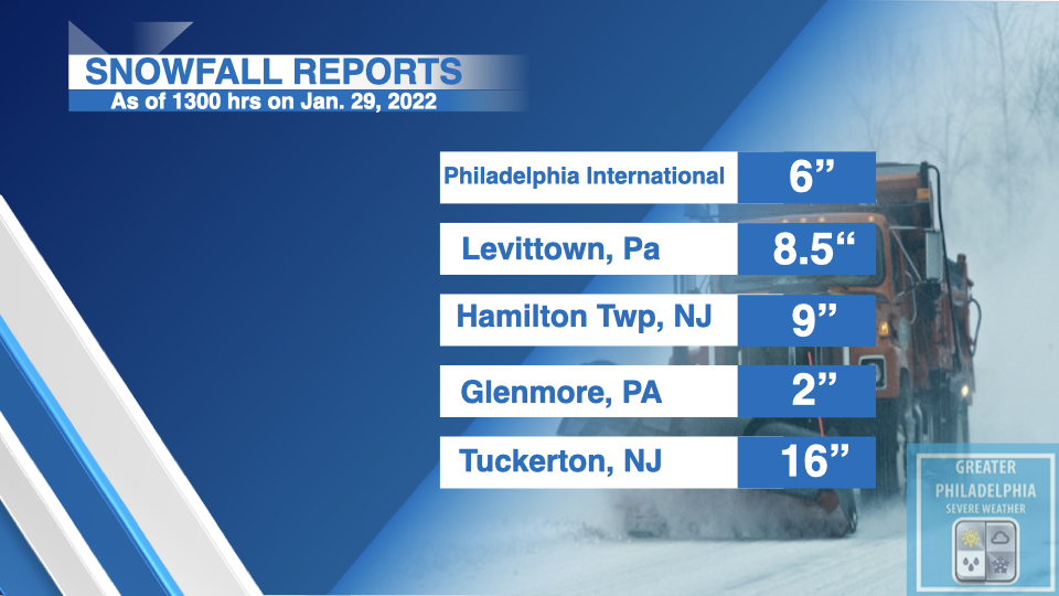
Here are the unofficial snowfall totals that are being reported via social media as well as the NWS. Snow will began to taper off this afternoon. Across the Philly/i95 area a general 6-12″ has fallen depending on location. Our final calls are inline with that has fallen across most of the area.
The following are UNOFFICIAL totals reported via social media and NWS. These totals were as of 11am this morning. We will update these late today.
As we start to see the snow move into the area. We will use this pinned thread for current observations as well as updates throughout the storm. Use the #GPSWSnow22
When submitting your reports, Please include the following information:
City, State and County Latitude and Longitude (If known) Date and time of weather event Type of Weather Observed Amount of Precip.
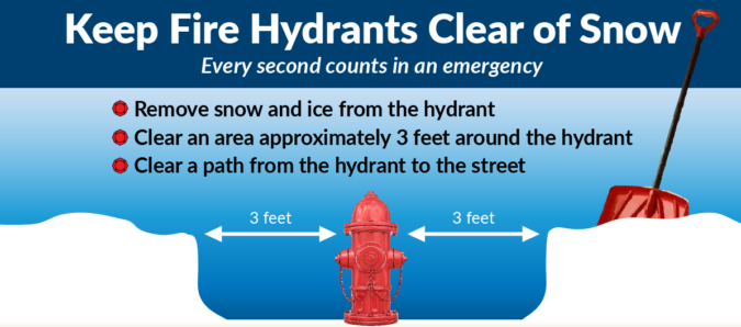
When shoveling a fire hydrant it is important to shovel not only the access to the hydrant from the roadway, but also 3-feet around the fire hydrant. Remember the “3 rules for 3 feet”:
1.) Access: When arriving at a hydrant, the “hydrant fire fighter” grabs the hydrant bag with all of the hydrant tools and adapters, and the large diameter supply hose that will get the water to the fire truck. The fire fighter must pull the supply hose for the back of the truck and will “wrap the hydrant” until the truck drives off. This keeps the supply hose anchored at the hydrant and keeps hose from getting drug down the roadway behind the pumper as it drives away.
2.) Room to Work: When affixing adapters, and “charging the hydrant” or turning on the hydrant, adapters and wrenches have a tendency to fall victim to gravity. This problem can be compounded by these items getting lost in the snow. Three feet is vital to quickly find a dropped piece of hardware.
3.) Safety: Some may ask, “Why do I need to shovel the back of the hydrant?” “They can get to the front of the hydrant.” When “charging the hydrant” or turning on the hydrant, for safety reason, the fire fighter MUST stand behind the hydrant. They will NEVER stand in front of the hydrant or to the side of the hydrant. If a hydrant cap, coupling or adapter were to not be securely affixed or become damaged, the water pressure could blow the cap, coupling or adapter off, causing injury to the fire fighter. Once again, having all sides (front, right, left and BACK) is vital for proper and safe hydrant operations.
If you have a hydrant on your property, we ask that you shovel your hydrant to help your local fire department. If you are unable to shovel your hydrant due to health reasons, etc., attempt to educate your neighbors about this “Adopt a Hydrant” program and ask them for assistance. If you have a neighbor who is elderly, or who otherwise can not shovel a fire hydrant, please offer to help shovel the hydrant on their property. In any event, we would like to stress, please seek permission to access another’s property.
A MAJOR winter storm is about to bring over a foot of snow across many locations. In addition to heavy snow we will see winds over 40mph, wind chills below zero. The snow we are seeing now is NOT apart of this massive storm.
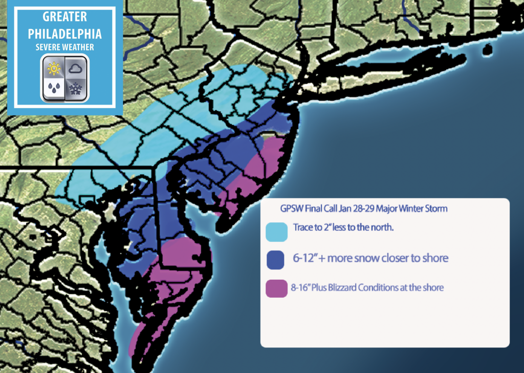
Our final calls are posted below.
If you do NOT have to travel on Late tonight through Sunday morning, please stay off the roads to allow road crews to clear the roads. Also keep fire hydrants clear on your property.
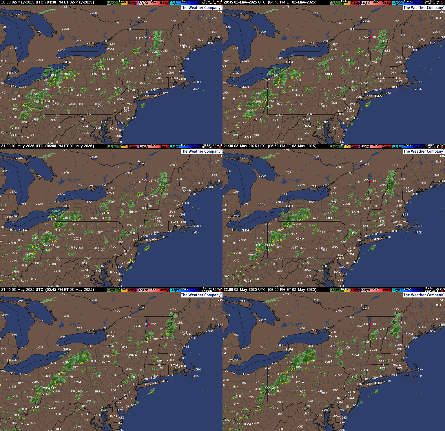
The latest radar is showing the “appetizer” snow event we are seeing now.
LIVE Current Radar
The latest NWS Watches, Warnings and Advisories you can view them here
A Winter Storm Warning will go into effect at 7pm until 7pm Saturday night.
Wind Chill: Saturday night wind chills will be below zero!
Timing: Snow will start to move into the area after 5pm and taper off around 4/5pm Saturday afternoon.
Hazards: TRAVEL will be a mess! STAY off the roads when the snow comes.
Power Outages: Areas in the blizzard warning could see power outages as could inland areas due wind gusts over 40mph and closer to 50mph across the shore points.
HOW MUCH SNOW AT YOUR HOUSE!
The following is a LIST of possible snow in each of these towns. If you do not see your town listed, but see the one close to you follow those amounts. Generally i95 corridor (Phila, Lower Bucks, Trenton) will see 6-12″+. North and west will see sharp cutoffs and shore points will see over 12″ with pockets of 18″. The further north and west of the shore you with the smaller amount.
Reading, PA
C-2”
Allentown, PA
C-2”
Bethlehem, PA
C-2”
Philadelphia, PA
6-12”
Atlantic City, NJ
14”+
Camden, NJ
6-12”
Vineland, NJ
8-16”
Trenton, NJ
8-12”+
New Brunswick, NJ
8-16”
Perth Amboy, NJ
12-18”
Sayreville, NJ
12-18”
Wilmington, DE
4-12”
Bucks County
Bristol, PA
8-12”
Quakertown, PA
1-3”
Morrisville, PA
6-12”
Perkasie, PA
2-4”
Chester County
West Chester, PA
1-3”
Phoenixville, PA
1-3”
Coatesville, PA
1-3”
Downingtown, PA
1-3”
Delaware County
Chester, PA
2-4”
Yeadon, PA
2-4”
Darby, PA
2-4”
Lansdowne, PA
2-4”
Camden County
Camden, NJ
6-12”
Lindenwold, NJ
6-12”
Collingswood, NJ
4-8”
Ocean County
Point Pleasant, NJ
8-16”
Beachwood, NJ
8-16”
Point Pleasant Beach, NJ
8-16”
South Toms River, NJ
8-16”
Norristown, PA
3-8”
Pottstown, PA
2-6”
Lansdale, PA
2-6”
Conshohocken, PA
3-6”
Local townships have started issue snow emergencies. To view the latest snow emergencies CLICK HERE .
As you know by now a Significant Winter Storm will bring heavy snow to parts of the area. North and West of Philadelphia will see sharp cutoffs. The other main issue will be severe winds that could cause power outages. Use today and the first part of Friday to PREPARE for this storm.
At this point my thinking on this winter storm is close to the i95 area will see 6″+ less the further north you are. Vineland NJ east to the shore will see 8″+ with the jackpot zones being at the NJ shore.
TIMING: Snow arrives after 6pm Friday night. The heaviest will be 2am-11am Saturday morning. The snow will wrap up by dinnertime on Saturday afternoon.
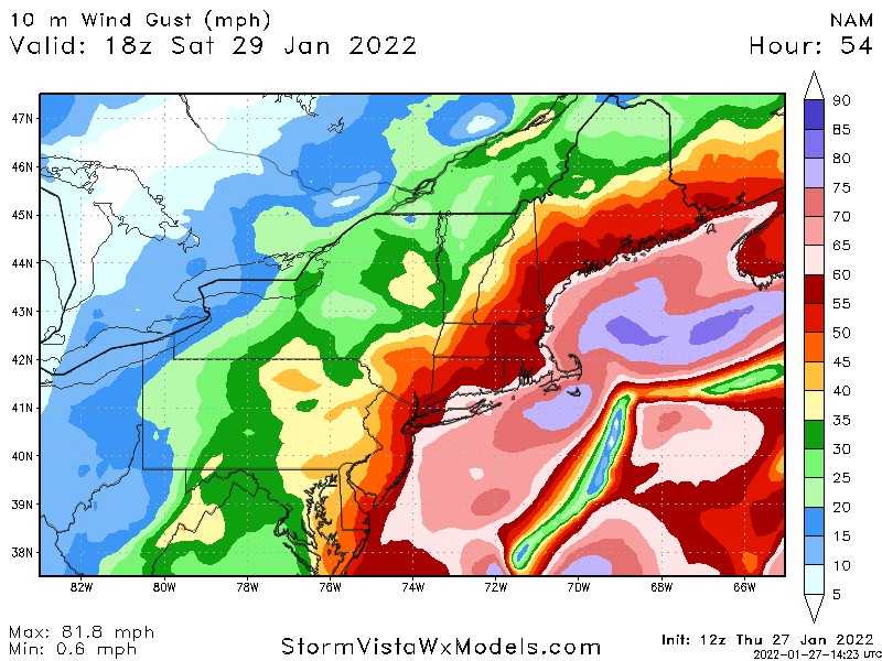
WINDS: Winds could gust as high as 40 MPH along i95 with gust over 60mph possible near the shore.
The latest NWS Watches and Warnings
WINTER STORM WATCH REMAINS IN EFFECT FROM FRIDAY EVENING
THROUGH SATURDAY EVENING...

* WHAT...Heavy snow possible. Total snow accumulations of 4 to
  10 inches possible. Winds could gust as high as 40 mph.

* WHERE...Portions of central, northern and southern New Jersey,
  southeast Pennsylvania, northeast Maryland and central and
  northern Delaware.

* WHEN...From Friday evening through Saturday evening.

* IMPACTS...Travel could be very difficult.

* ADDITIONAL DETAILS...Snow is expected to begin Friday evening in
  Delmarva and southern New Jersey, spreading northward overnight
  into Saturday morning. Snow may be heavy at times through early
  Saturday afternoon before diminishing late in the day. Winds may
  generate areas of blowing snow and low visibilities at times.
  The storm total snow forecast remains a bit uncertain as there
  will likely be a sharp cutoff in the northwest extent of the
  highest snowfall totals, so stay tuned to the latest forecasts.

PRECAUTIONARY/PREPAREDNESS ACTIONS...

Monitor the latest forecasts for updates on this winter storm.
The latest NWS Watches and Warnings.
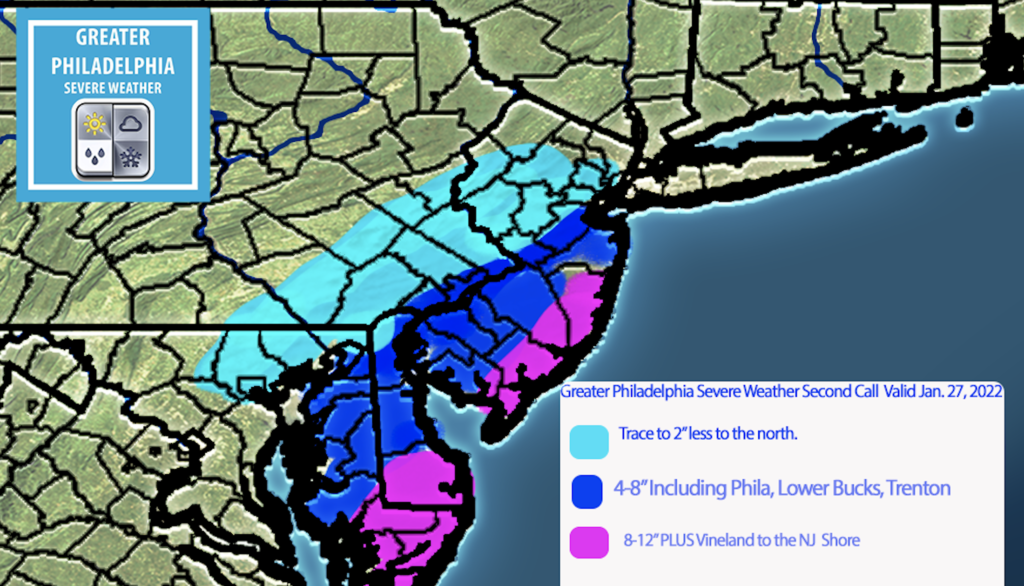
GPSW 2nd Call Map
North and West of the city T-2″ Trenton, Phila, Princeton, Delaware 4-8″+ some areas may see over 6″ in this area SNJ, Shorepoints 8-12″ + some areas could see more.
At this time I feel the area in darker blue could jump up to a 6-10″ during our next call. We will have a final map out if needed mid day tomorrow.
This morning the NWS has issued Winter Storm Watches for parts of the area. The Winter Storm Watches are for the i95 corridor in our area. We will see sharp cut offs to the west. You can view the latest NWS alerts on our webpage at https://greaterphilaseverewx.com/active-alerts/
The winds will be a MAJOR issue and we could see power outages. If the models continue to forecast these high winds don’t be surprised if Blizzard Watches/Warnings are issued for locations down the shore.
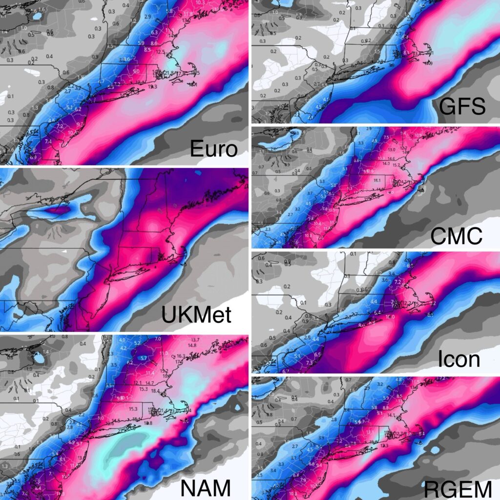
The overnight models have came back to the west and currently the GFS is the outlier with most of the models coming back west, the CMC is the furthest west. While these are not forecast below they are what the models are showing.
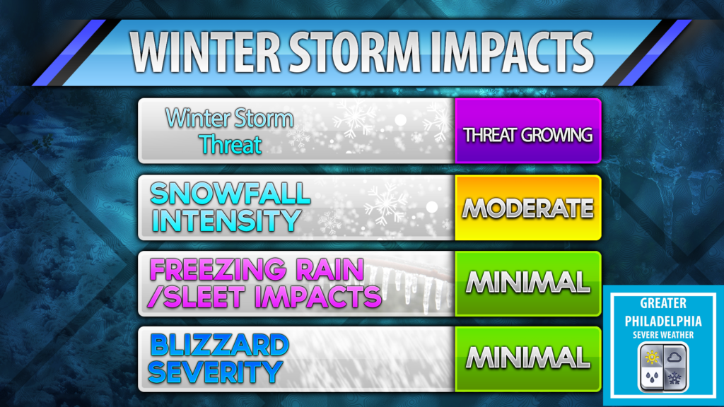
At this hour confidence is continuing to grow that parts of the east coast will see a major winter storm. This storm is capable of bringing feet of snow to some and blizzard conditions. This storm will impact most major cities on the east coast. The models continue to show a nor’easter with blockbuster potential for the weekend, mainly late Friday through Saturday, We still can’t answer how much you will get in your backyard, so please don’t ask! We will see snow but how much is the big question.
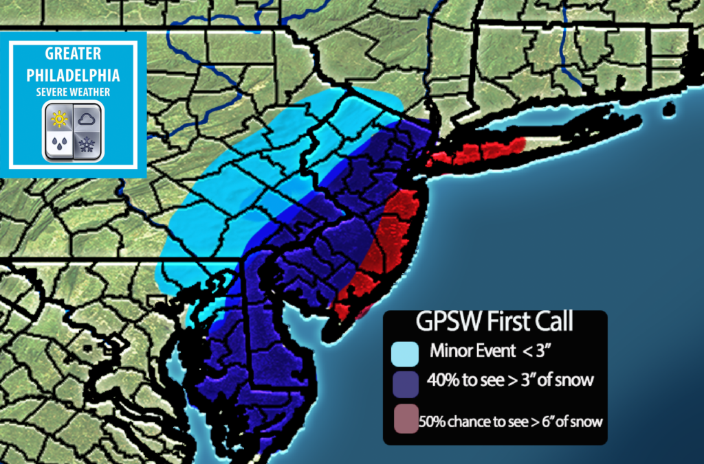
At this time this is our thinking. Our map shows who has the best chance of seeing less than 3″, more then 3″ and greatest chance for seeing over 6″.
At this time the i95 corridor around Philly we are looking at 3-6″ but any trend west will increase those numbers and any trend will decrease those numbers. Currently we are seeing a east trend. We hope to have those numbers somewhat finalized by tomorrow afternoon. Our second call map WILL have localized snow totals.
While we are not set on the snowtotals at this time, we do feel confident in saying who we feel will see at least those numbers above.
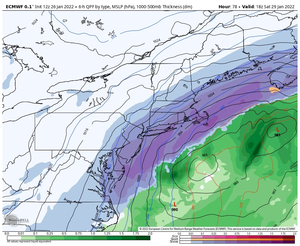
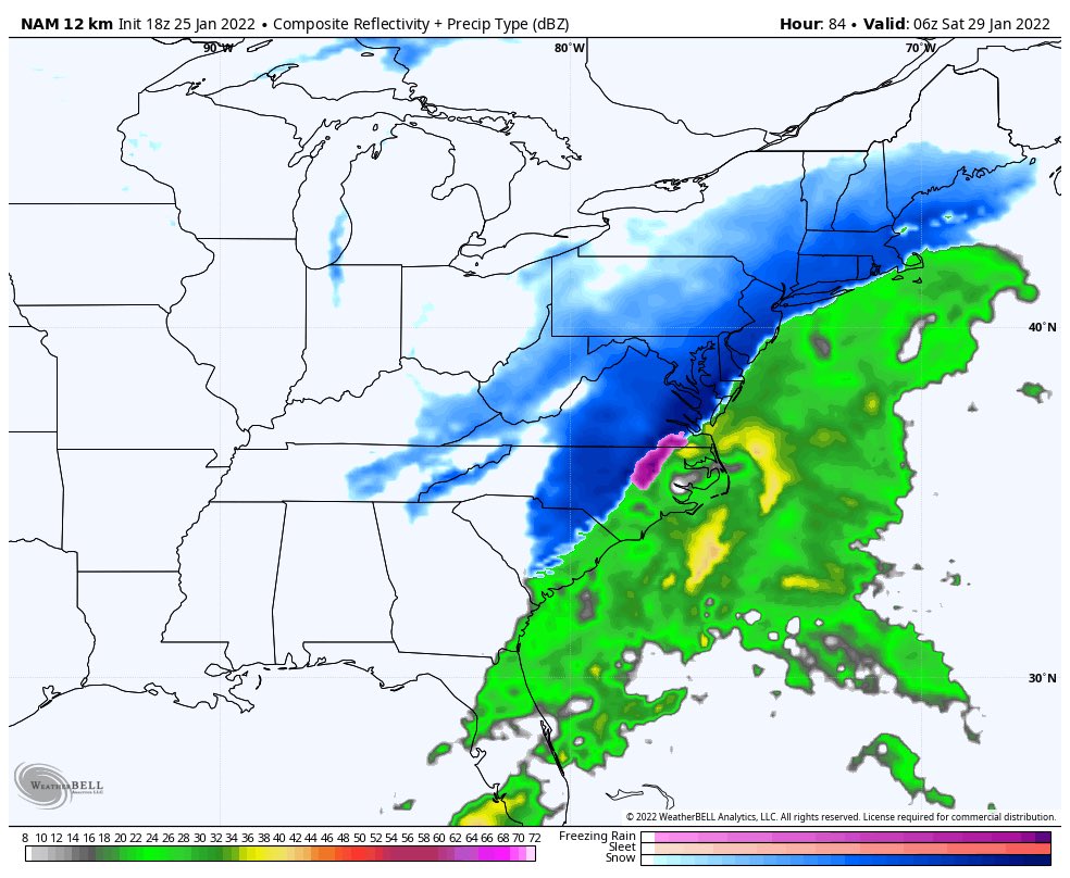
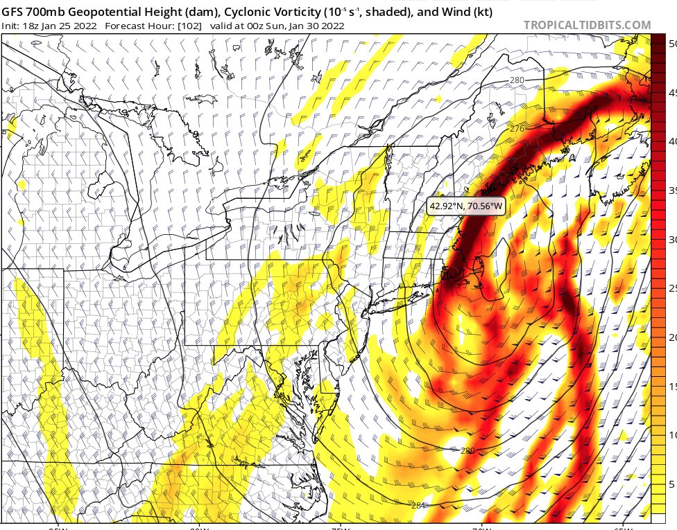
Now what the models are showing:
The latest Euro showing 6-18+ inches of snow depending on location. These totals cut down the further east you get.
So after this afternoons Euro run, the GFS and NAM look like they want to join in on the fun. While the GFS and NAM are not showing totals that the Euro did, they are showing a potential major winter storm for Baltimore to Maine. At this point confidence is growing but not locked in 100% just yet. This afternoons trends are HUGE for team snow.
Also we are seeing the “B” word being thrown around, we are not going to throw that out just yet. Someone along the East Coast could see those conditions. If we keep seeing these trends tomorrow afternoon it will be time to prepare for significant storm. Until then we will bring you updates throughout the night and into tomorrow.
At this point timing looks to be Friday afternoon until Saturday afternoon.
The 18z nam which is OUT of its normal range is painting a picture that lines with this afternoons euro run. While we the nam is out of range it does look very good for snow lovers. We will have an update tomorrow on the NAM once it gets into its range.
The GFS has moved a bit west which is great for snow lovers. We are going to keep a close eye on this to see if it catches up with the Euro/NAM.
We have added new features to our website, check them out in the menu bar above!