FLOOD ADVISORY IN EFFECT UNTIL 1130 AM EDT THIS MORNING

* WHAT...Flooding caused by excessive rainfall is expected.

* WHERE...Portions of New Jersey...and southeast Pennsylvania...
  including the following counties...in New Jersey...Burlington,
  Camden, Hunterdon, Mercer, Monmouth, and Somerset. In southeast
  Pennsylvania...Bucks, Delaware, Montgomery, and Philadelphia.

* WHEN...Until 1130 AM EDT.

* IMPACTS...Minor flooding in low-lying and poor drainage areas.

* ADDITIONAL DETAILS...
  - At 842 AM EDT, Doppler radar indicated moderate to heavy
    rainfall across the area. Between 0.5 and 1 inch of rain has
    already fallen, with an additional 0.5 to 1.0 inches
    possible. Minor flooding is ongoing or expected to begin
    shortly across portions of the advisory area.
  - Some locations that may experience flooding include...
    Philadelphia, Trenton, Camden, Gloucester City, Cherry Hill,
    Bensalem, Evesham, Mount Laurel, Ewing, Norristown,
    Willingboro, and Medford.
  - This includes the following highways...
    New Jersey Turnpike between exits 4 and 8.
    Pennsylvania Turnpike between mile markers 327 and 359.
    Interstate 95 in Pennsylvania between mile markers 17 and 40.
    Interstate 76 in Pennsylvania between mile markers 328 and
    351.
    Interstate 76 in New Jersey between mile markers 1 and 3.
    Interstate 295 in New Jersey between mile markers 28 and 76.
    Interstate 195 in New Jersey between mile markers 0 and 11.
    Interstate 676 in Pennsylvania between mile markers 0 and 1.
  - http://www.weather.gov/safety/flood

PRECAUTIONARY/PREPAREDNESS ACTIONS...

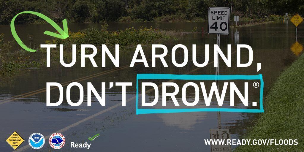
Be aware of your surroundings and do not drive on flooded roads.

Much needed rain on the way. 1-2″ will fall in some areas

Some much needed rain is on the way to end this warm and humid day. Some localized heavy rainfall is expected to develop on Monday and linger into Tuesday night. Parts of the area will see 1-2″ of heavy rainfall. This is great news are the area is under a Drought Watch (https://greaterphilaseverewx.com/dep-declares-drought-watch-for-36-counties-in-pa-asks-for-voluntary-water-conservation%ef%bf%bc/)

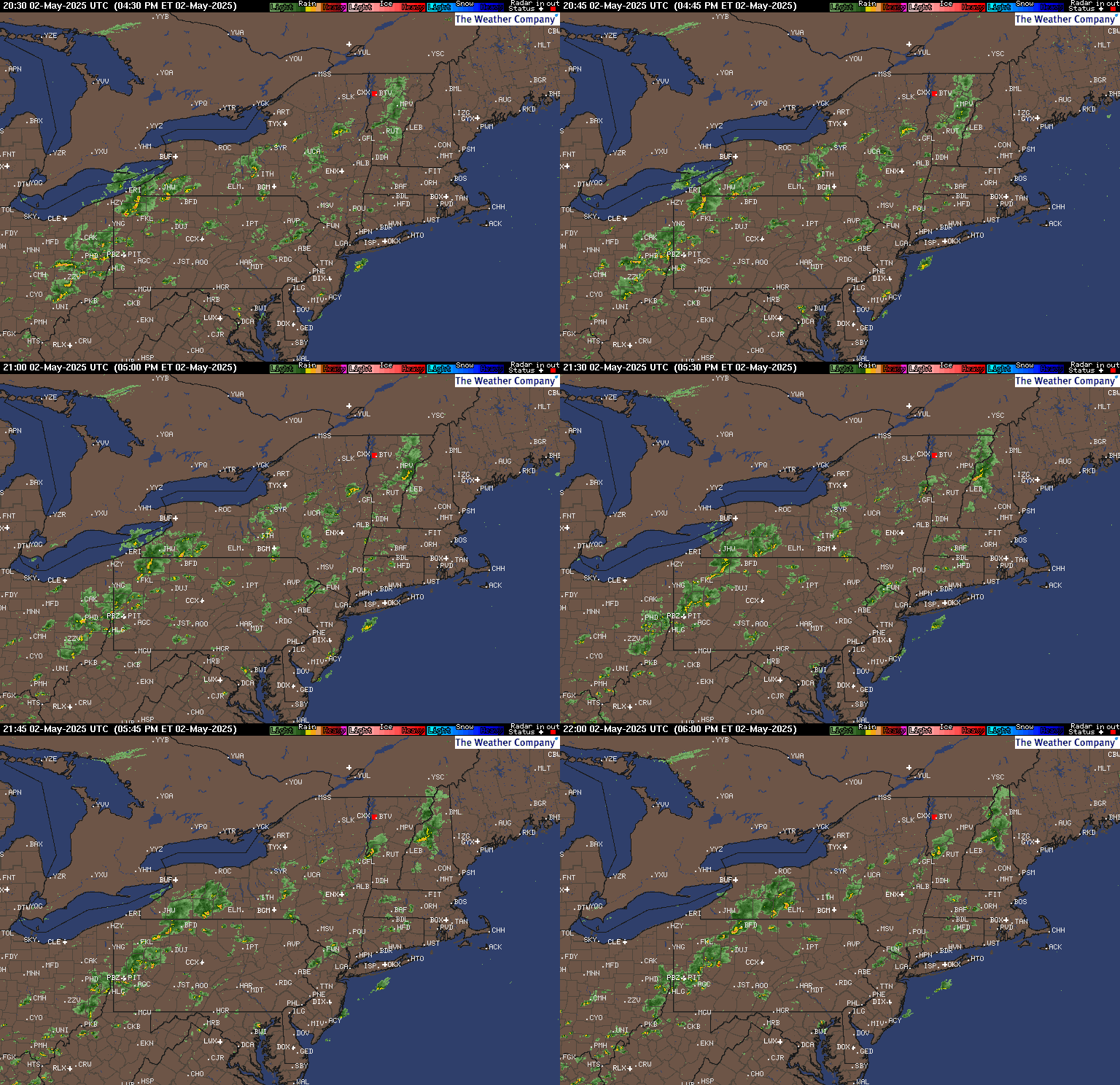
Below is the current radar which shows storms developing to our north and west at this hour. The heavy rain will move in on Monday. If the NWS issue any watches or warnings we will bring them to you. Below is the latest forecast from the NWS pertaining this system.

2022 Hurricane Season is heating up

Today is June 1st, the first day of Hurricane Season in the Atlantic. As of this moment there are two disturbances in the Atlantic Basin one in the Gulf of Mexico and one northeast of the Bahamas.

Right now there is a 70% change that the disturbance in the Gulf of Mexico will become Tropical Storm Alex. Either way if it becomes a tropical storm or not. This disturbance will bring heavy rainfall to parts of South Florida towards the end of this week.We will keep a close eye on these systems and bring you the latest this Hurricane Season for any threats to the US and our region.


2022 Hurricane names:

The sequence of names for 2022 will be: Alex, Colin, Bonnie, Danielle, Earl, Fiona, Gaston, Hermine, Ian, Julia, Karl, Lisa, Martin, Nicole, Owen, Paula, Richard, Shary, Tobias, Virginie and Walter.


.

Severe Weather Outlook: Tornado Watch Issued

This afternoon confidence has increased for the potential for severe weather into this evening. Most of the area from i-95 northwest is now in a SLIGHT risk. The key factors today will be damaging winds, hail and tornados are also possible.

The NWS has issued a TORNADO WATCH for the entire area until 7pm.

This graphic displays Tornado Watch watch number 251 plotted on a map. The watch is in effect until 7:00 PM EDT. The watch includes parts of Delaware, Maryland, New Jersey, Pennsylvania, Virginia and West Virginia. The threats associated with this watch are a couple tornadoes possible, isolated hail up to two inch size possible and scattered gusts up to 70 mph likely. There are 17,446,077 people in the watch along with 4520 schools and 311 hospitals.


Here is a link to our current weather alerts. https://greaterphilaseverewx.com/active-alerts/

CURRENT RADAR


Our team will bring you the latests updates as the storms move closer to the area.

A Freeze Warning has been issued until 8am Friday morning

A Freeze Warning Has Been Issued until 8am. Protect any plants that you might have outside if you live within the freeze warning.

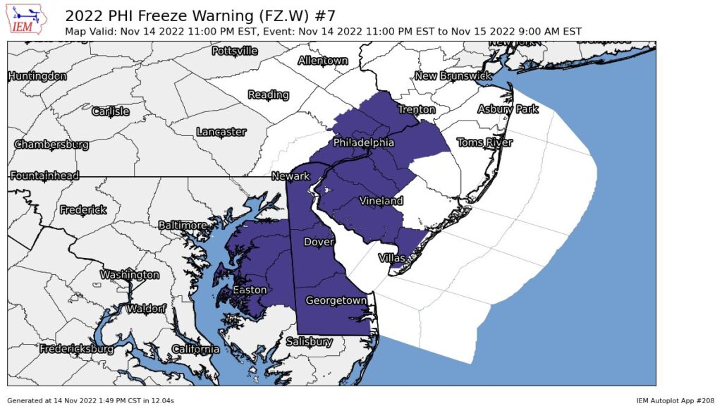
FREEZE WARNING IN EFFECT FROM 1 AM TO 8 AM EDT FRIDAY...

* WHAT...Low temperatures between 30 and 32 degrees expected.

* WHERE...Much of New Jersey, southeast Pennsylvania and northern
  Delaware.

* WHEN...From 1 AM to 8 AM EDT Friday.

* IMPACTS...Frost and freeze conditions will kill crops and
  other sensitive vegetation.

* ADDITIONAL DETAILS...If winds do not diminish overnight, some
  areas may not get below freezing.

PRECAUTIONARY/PREPAREDNESS ACTIONS...

Take steps now to protect tender plants from the cold

FROST ADVISORY HAS BEEN ISSUED LATE SUNDAY NIGHT INTO EARLY MONDAY MORNING

FROST ADVISORY IN EFFECT FROM SUNDAY NIGHT TO 9 AM
EDT MONDAY...

* WHAT...Minimum temperatures ranging from 33 to 36 degrees will
  result in frost formation.

* WHERE...Portions of central, northern and southern New Jersey,
  east central and southeast Pennsylvania and northern Delaware.

* WHEN...From midnight Sunday night to 9 AM EDT Monday.

* IMPACTS...Frost could kill sensitive outdoor vegetation if left
  uncovered.

PRECAUTIONARY/PREPAREDNESS ACTIONS...

Take steps now to protect tender plants from the cold.

Wind Advisory Now In Effect. Winter Storm Warnings and Advisories continue until later this evening.

WIND ADVISORY REMAINS IN EFFECT UNTIL 1 AM EST SUNDAY...

* WHAT...Northwest winds 15 to 25 mph with gusts up to 50 mph
  expected.

* WHERE...Portions New Jersey, southeast Pennsylvania, the eastern
  shores of Maryland, and Delaware.

* WHEN...Until 1 AM EST Sunday.

* IMPACTS...Gusty winds could blow around unsecured objects.
  Tree limbs could be blown down and a few power outages may
  result.

* ADDITIONAL DETAILS...Strong winds develop late this morning
  morning and continue into the afternoon. There may be a lull
  this evening before winds increase once again.

PRECAUTIONARY/PREPAREDNESS ACTIONS...

Use extra caution when driving, especially if operating a high
profile vehicle. Secure outdoor objects.

Current Observations

Please post current observations as you see them. This is a fast moving system that will bring 1-2″/hr snowfall rates. This afternoon we will see temps dropping fast. Use caution if driving after the snow stops as most surfaces will freeze.

Wind Advisory in effect until 1am and SLIGHT Chance of Severe Weather

The SPC has placed the area in a SLIGHT chance of severe weather for this afternoon and evening. We will see a line of storms develop with some thunderstorms. These storms will be capable of producing wind guts up to 60 mph.


You can view the latest SPC information on our website at https://greaterphilaseverewx.com/severe-weather-center/

WIND ADVISORY IN EFFECT FROM NOON TODAY TO 1 AM EST TUESDAY...

* WHAT...Southwest winds 20 to 30 mph with gusts of 40 to 50 mph
  expected shifting to northwest this evening with gusts of 40 to
  50 mph.

* WHERE...Portions of central, northern, northwest and southern
  New Jersey, east central, northeast and southeast
  Pennsylvania, northeast Maryland and central, northern and
  southern Delaware.

* WHEN...From noon today to 1 AM EST Tuesday.

* IMPACTS...Gusty winds could blow around unsecured objects.
  Tree limbs could be blown down and a few power outages may
  result.

* ADDITIONAL DETAILS...A line of showers with a few embedded
  thunderstorms will move across the area late this afternoon into
  this evening along a cold front and could contain winds briefly
  gusting up to 60 mph in places.


Our team will bring you the latest info as these storms move across the area this afternoon and evening.