Winter Storm Watch has been issued for Sunday until Tuesday.
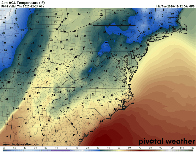
We are tracking a Major Winter Storm that will bring Snow, Sleet and Freezing Rain to parts of the area. While we are still working to determine a final track. At this hour we can say that confidence is growing that this storm will cause impact to our area Sunday afternoon until Tuesday morning. While the snow will begin on Sunday afternoon. A large amount of snow could fall between Sunday night and Monday, with additional snowfall through Tuesday as the storm strengthens as it moves to our north. Some areas could see as much as a foot of snow come Tuesday.
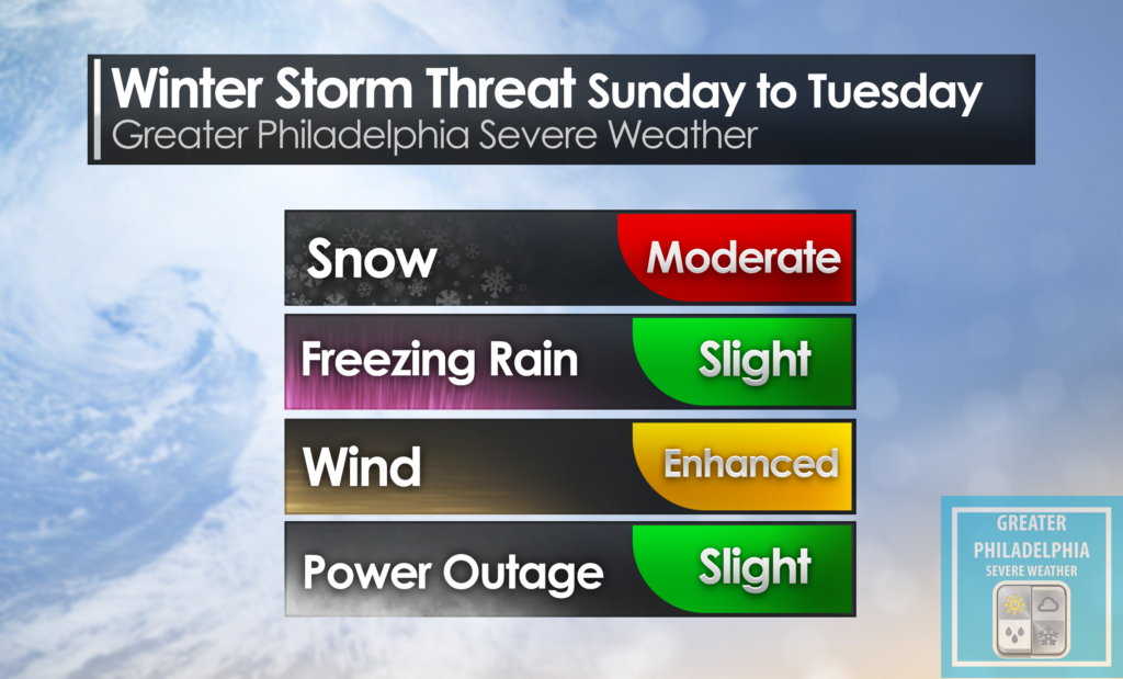
SNOW– At this time we are going with a MODERATE threat of snow over the timeframe stated above.
Freezing Rain– SLIGHT chance locations within the area could see freezing rain/wintery mix. If this does happen it would be locations closest to the shore points.
WIND/POWER Outages– ENHANCE Threat of gusty winds and SLIGHT chance of power outages throughout the storm. Areas to the north could see blizzard warnings due to high winds as the storm cranks off the coast. Confidence is LOW that we will see blizzard warnings issued for our area at this time.
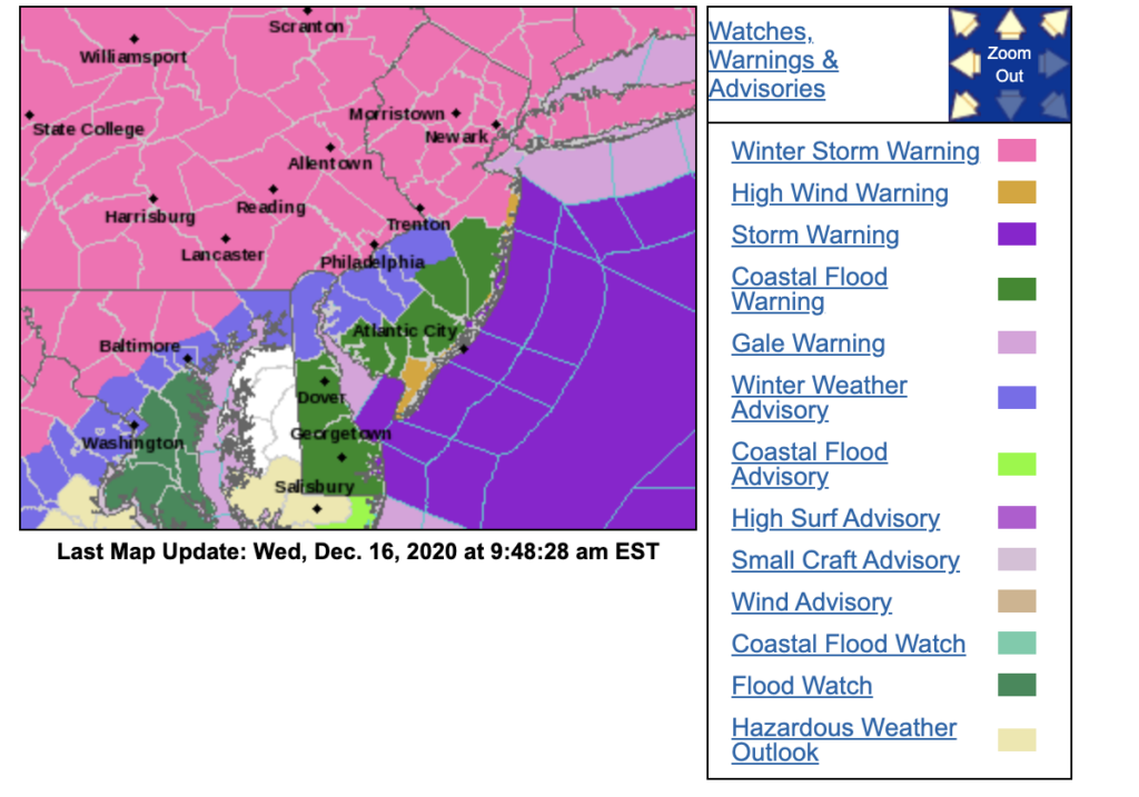
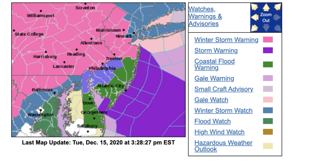
WINTER STORM WATCH IN EFFECT FROM SUNDAY AFTERNOON THROUGH
LATE MONDAY NIGHT...

* WHAT...Heavy snow possible. Total snow accumulations over 7
  inches possible. Winds could gust as high as 50 mph creating
  significant blowing and drifting of snow.

* WHERE...Portions of central, northern and southern New Jersey
  and southeast Pennsylvania.

* WHEN...From Sunday afternoon through late Monday night.

* IMPACTS...Travel could be very difficult. The hazardous
  conditions could impact the Monday evening commute.

* ADDITIONAL DETAILS...Snow will develop west to east late Sunday
  and last through late Monday or early Tuesday. A period of
  wintry mix or rain could occur Sunday night and Monday morning,
  especially along and near the coast, before turning back to snow
  Monday afternoon. The highest snowfall rates are most likely to
  occur late Monday.
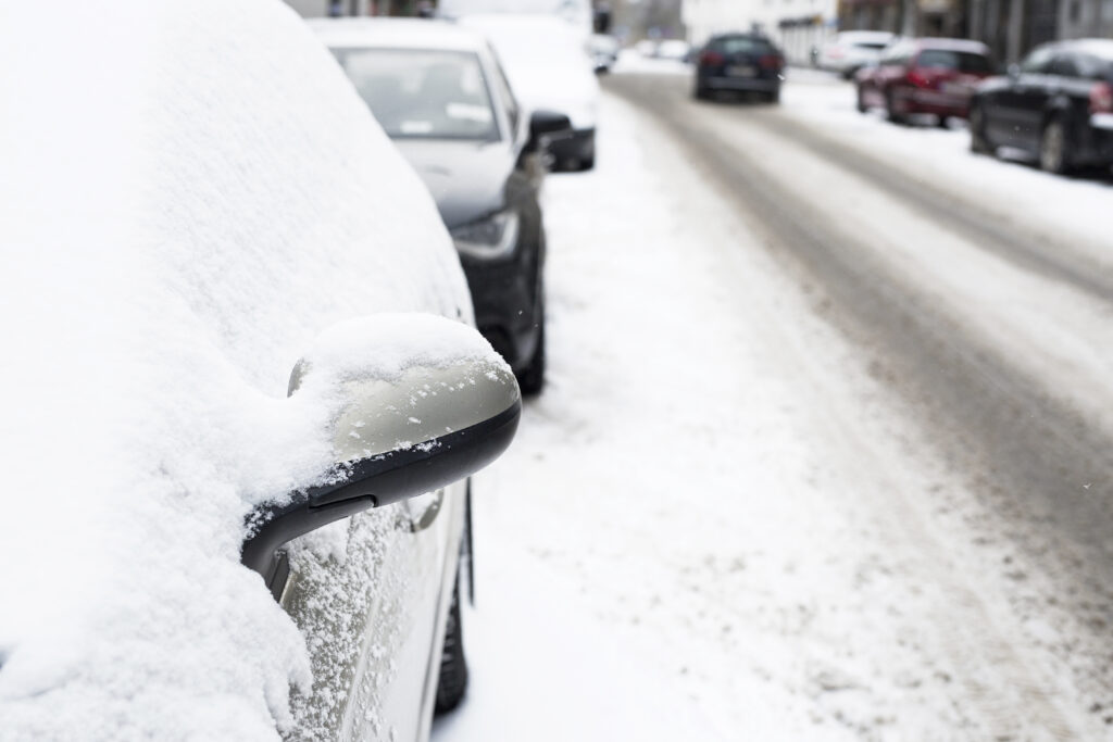
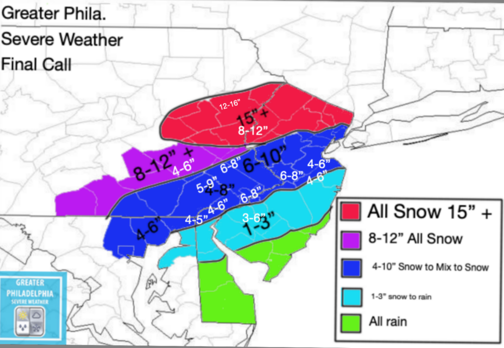
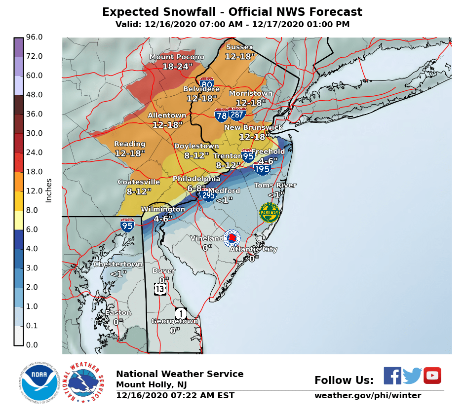
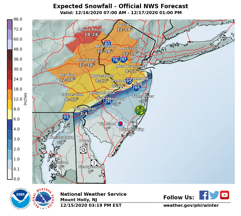
SNOW MAP- We will have a snow map released mid day tomorrow. Our team is working around the clock to bring you the latest information on this upcoming storm. Now is a great time to prepare for a long duration winter storm.
PLEASE remember while this storm is a long duration, it does NOT mean we will have a substantial amount of snow.