Increasing clouds, with a high near 41. West wind around 5 mph becoming south in the afternoon.
Thursday Night
A slight chance of rain and snow showers before 10pm, then a slight chance of rain showers. Mostly cloudy, then gradually becoming mostly clear, with a low around 31. Breezy, with a south wind 10 to 20 mph becoming west after midnight. Winds could gust as high as 30 mph.
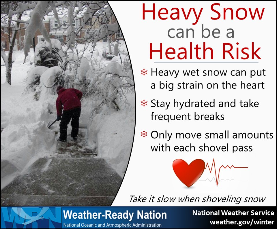
As the snow is falling, are you prepared to shovel? Did you know that wet heavy snow like we have right now is called “Heart Attack Snow”. Heavy, wet snow is often called “heart attack snow,” because the great effort required to move it can increase your risk of having a heart attack. Repeatedly lifting a shovel full of heavy snow can be more strenuous than running on a treadmill.
7 Ways to Prevent a Heart Attack While Shoveling Snow
Don’t shovel first thing in the morning. Most heart attacks occur first thing in the morning, when your blood is most likely to clot. Give yourself time to get up and moving before going out and grabbing the shovel. You’ll also give the sun a chance to warm up things a bit.
Warm up before shoveling. Shoveling snow is exercise. It’s hard work. Take a few minutes before to stretch, move about and get the ‘blood flowing’ before undertaking any strenuous activity, including shoveling snow.
Use a smaller shovel. A shovel full of wet snow is especially heavy when the shovel is big. It may take a little longer, but many small loads will be better than fewer heavy ones.
Dress appropriately. Cover your hands, head and mouth. Covering your mouth with a scarf will help you inhale warmer air and can help avoid respiratory problems.
Shovel in shifts. If you need a rest, take a rest. Taking 15 minute breaks can help lessen the load on your heart.
Watch for warning signs. Tightness in the chest, lightheadedness and dizziness are all signs of a heart attack. If you suspect you’re having a heart attack, call 911.
Prepare for winter workouts by staying active all year round; 30 minutes a day of regular exercise is good for nearly every aspect of your health. Of course, talk with your doctors about beginning an exercise program.
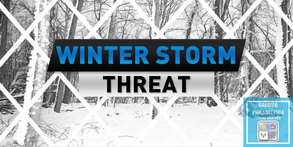
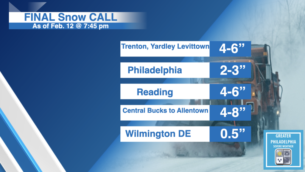
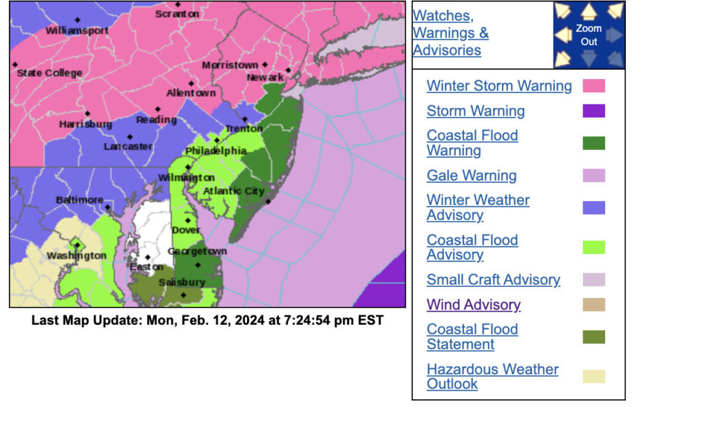
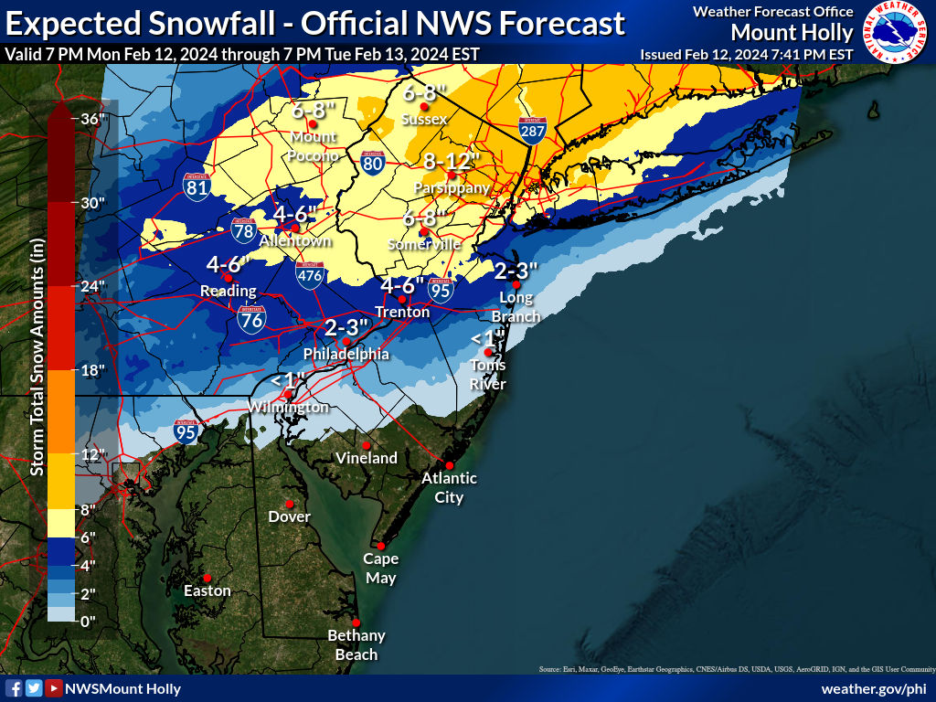
The National Weather Service has upgraded the area to a Winter Storm WARNING. Schools are starting to close or goto all virtual for tomorrow. We will see snow fall rates of 1″ per hour at some points during the day. Use Caution if driving in the morning. A General 4-6″ will fall across the areas north of Philadelphia. Less towards Philly and more to the north. Our final call is below. Sharp cut offs are possible with this storm. If the storm wiggles NORTH or SOUTH totals can and will change. This has been a tough storm to forecast. The SNOW will be a wet heavy snow. Please use caution when shoveling and take breaks. The NWS Map is at the end of the post
WINTER STORM WARNING: * WHAT…Heavy snow expected. Total snow accumulations of 4 to 7 inches. Winds gusting as high as 40 mph.
* WHERE…In New Jersey, Middlesex, Western Monmouth and Mercer. In Pennsylvania, Lower Bucks.
* WHEN…From midnight tonight to 3 PM EST Tuesday.
* IMPACTS…Travel could be very difficult. The hazardous conditions could impact the morning commute.
* ADDITIONAL DETAILS…Briefly heavy snow will be possible around the time of the morning commute, with snowfall rates of up to 1 inch per hour possible. There is uncertainty regarding snow amounts and how efficiently the snow will accumulate on roads, given mild temperatures with precipitation starting as rain overnight.
PRECAUTIONARY/PREPAREDNESS ACTIONS… If you must travel, keep an extra flashlight, food, and water in your vehicle in case of an emergency. The latest road conditions for the state you are calling from can be obtained by calling 5 1 1.
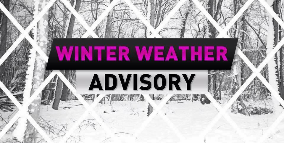
The National Weather Service Has Issued A WINTER WEATHER ADVISORY for 2-4″ of Snow
WINTER WEATHER ADVISORY IN EFFECT FROM 3 AM TO 3 PM EST
TUESDAY...

* WHAT...Rain will change over to snow very early Tuesday morning. Total snow accumulations of 2 to 4 inches. Winds gusting as high as 35 mph.

* WHERE...In New Jersey, Middlesex and Mercer. In Pennsylvania, Western Montgomery, Eastern Montgomery and Lower Bucks.

* WHEN...From 3 AM to 3 PM EST Tuesday.

* IMPACTS...Plan on slippery road conditions. The hazardous conditions could impact the morning commute.

* ADDITIONAL DETAILS...Briefly heavy snow will be possible around the time of the morning commute, with snowfall rates of one half to 1 inch per hour possible. There is uncertainty regarding snow amounts and how efficiently the snow will accumulate on roads, given mild temperatures with precipitation starting as rain
overnight.

PRECAUTIONARY/PREPAREDNESS ACTIONS...

Slow down and use caution while traveling.

The latest road conditions for the state you are calling from can
be obtained by calling 5 1 1.