Jan
05
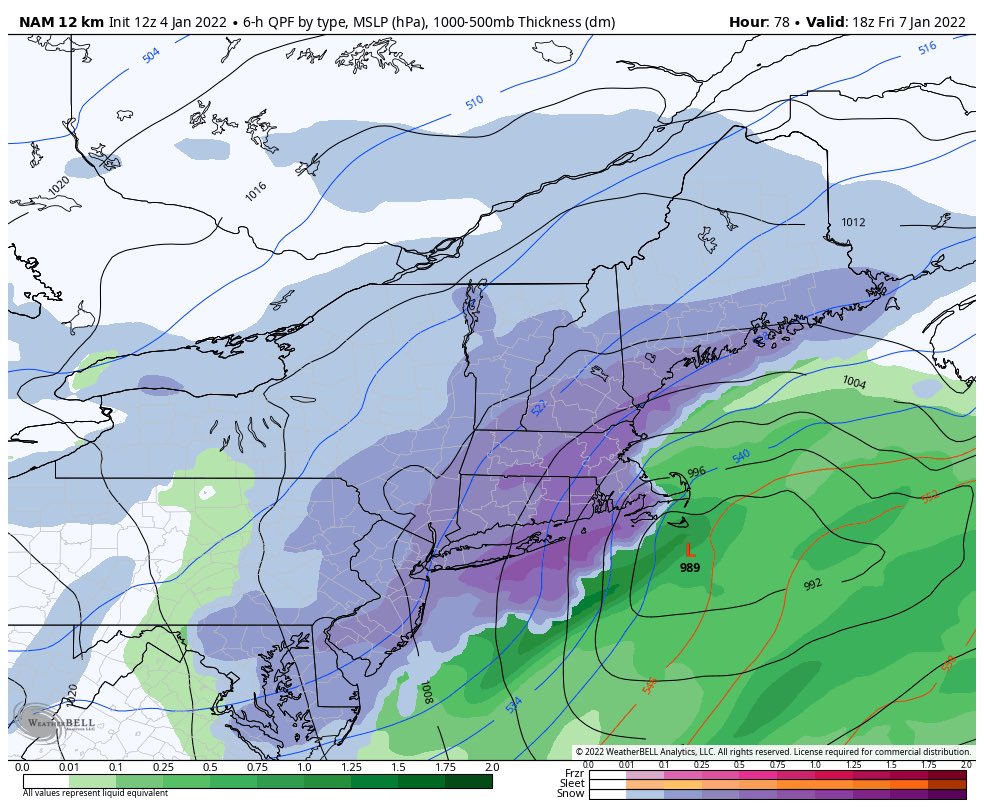
Fast Moving Winter Storm To Blanket The Area. FIRST Calls Included
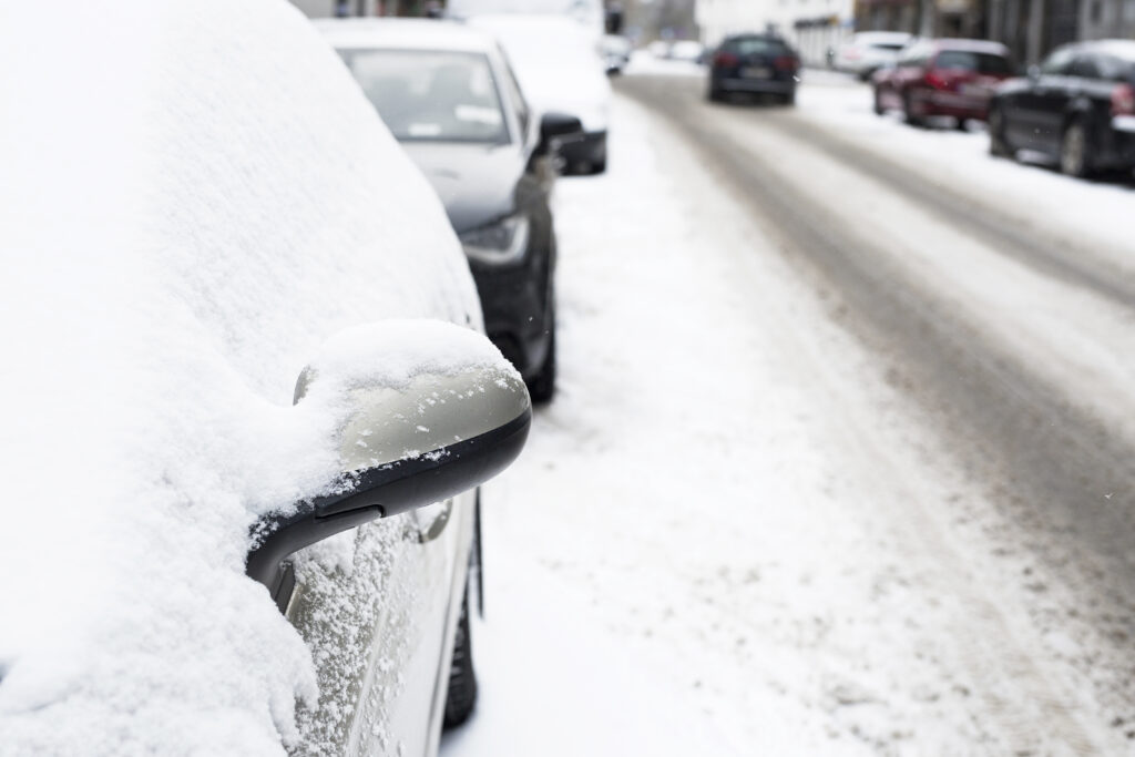
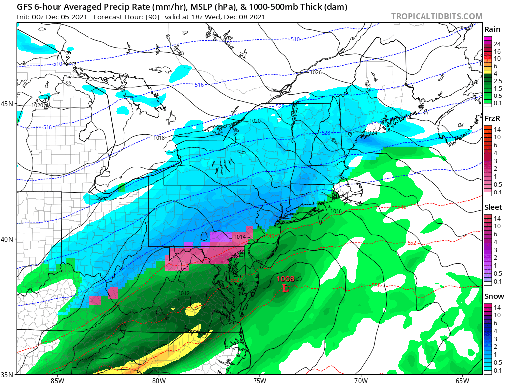
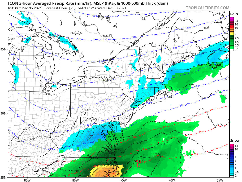
As we prepare for the next winter storm that will bring light minor/moderate snow to the area. This is a super fast moving storm and will mostly fall while you are sleeping. While the snow will fall at night it will stick to most surfaces. IF we need to make changes to this forecast I will update a final call map early Thursday.
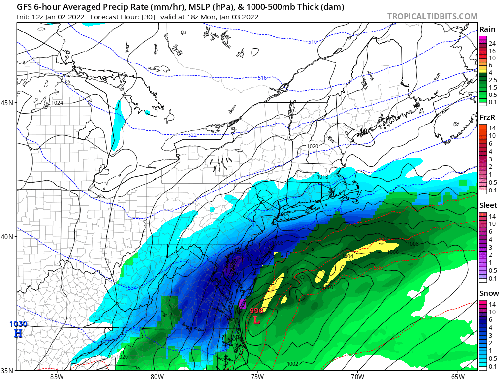
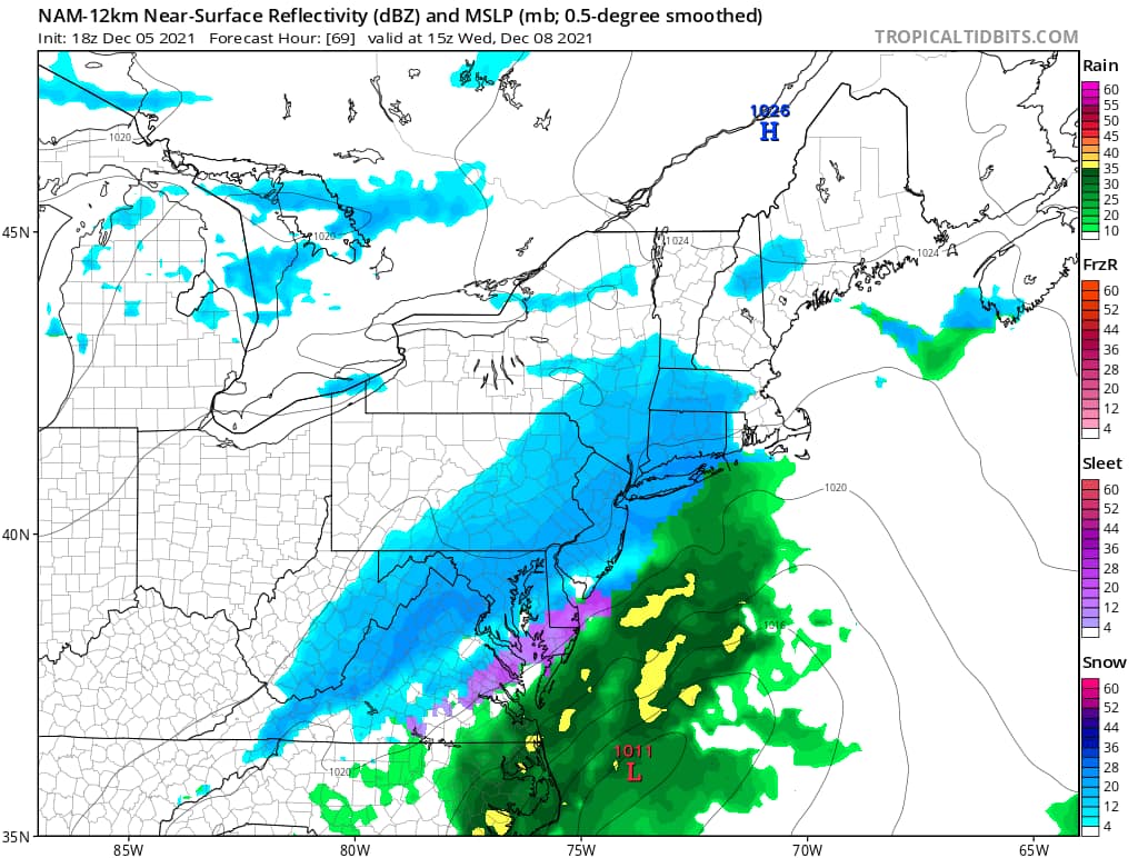
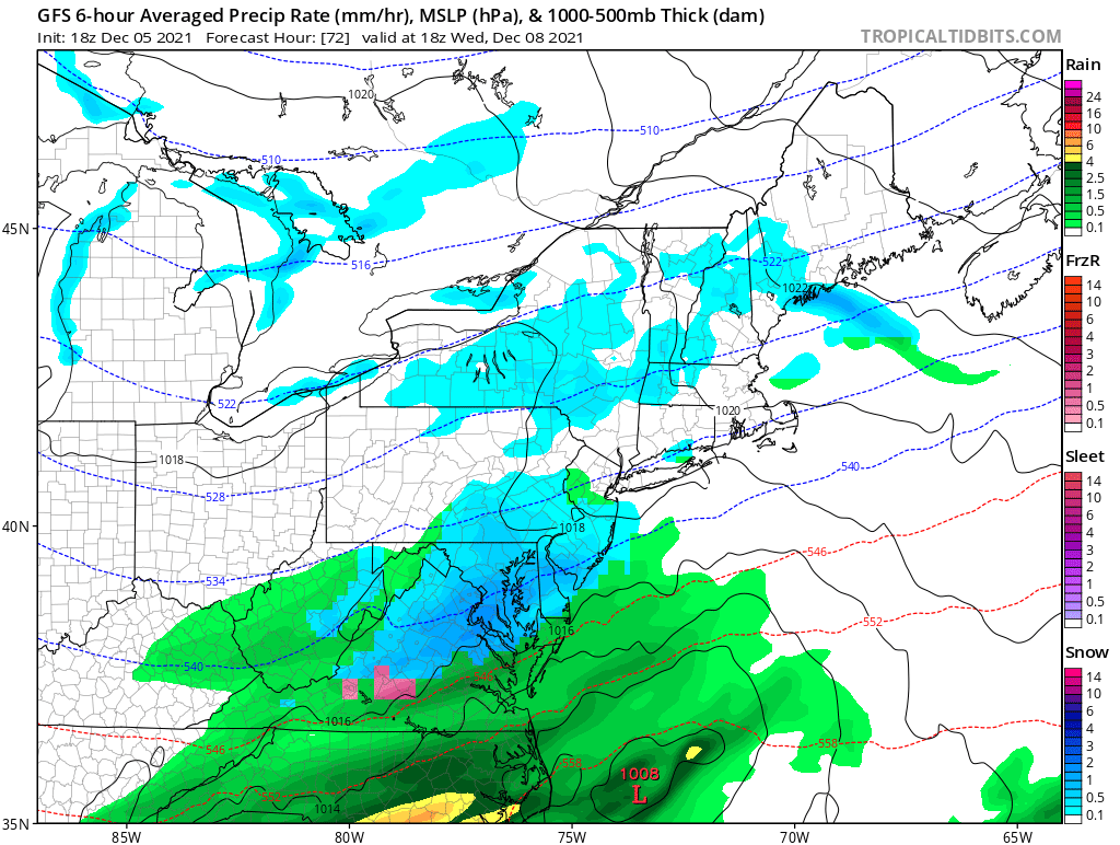
TIMING:
Starting around 10/11pm from the west moving east. The snow should begin to fall in the Philly Metro area after midnight. Snow will be out by mid morning at this point.
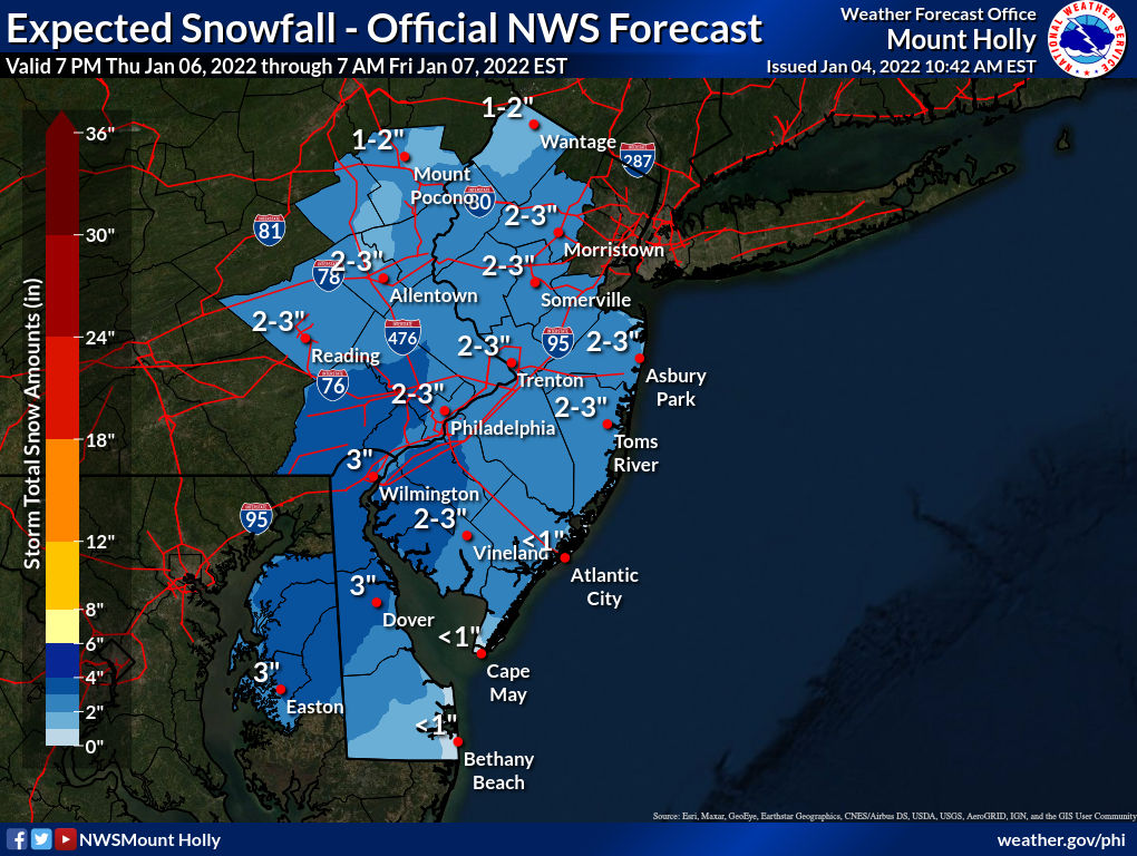
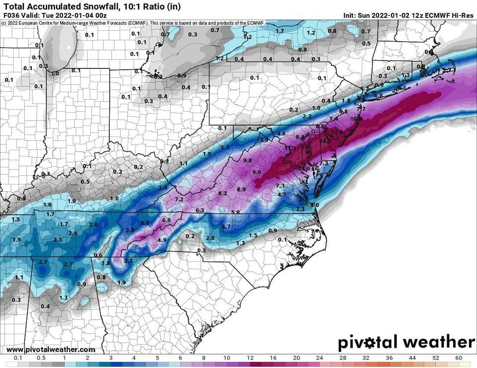
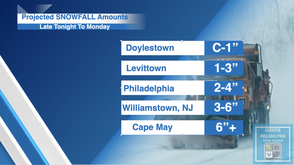
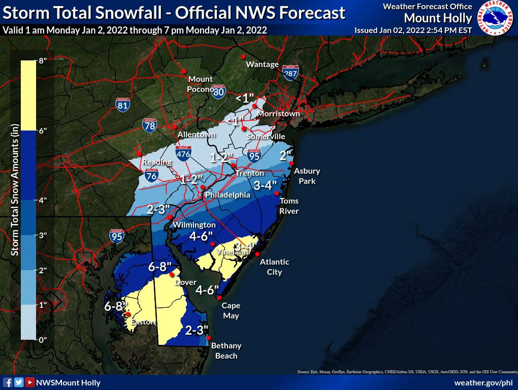
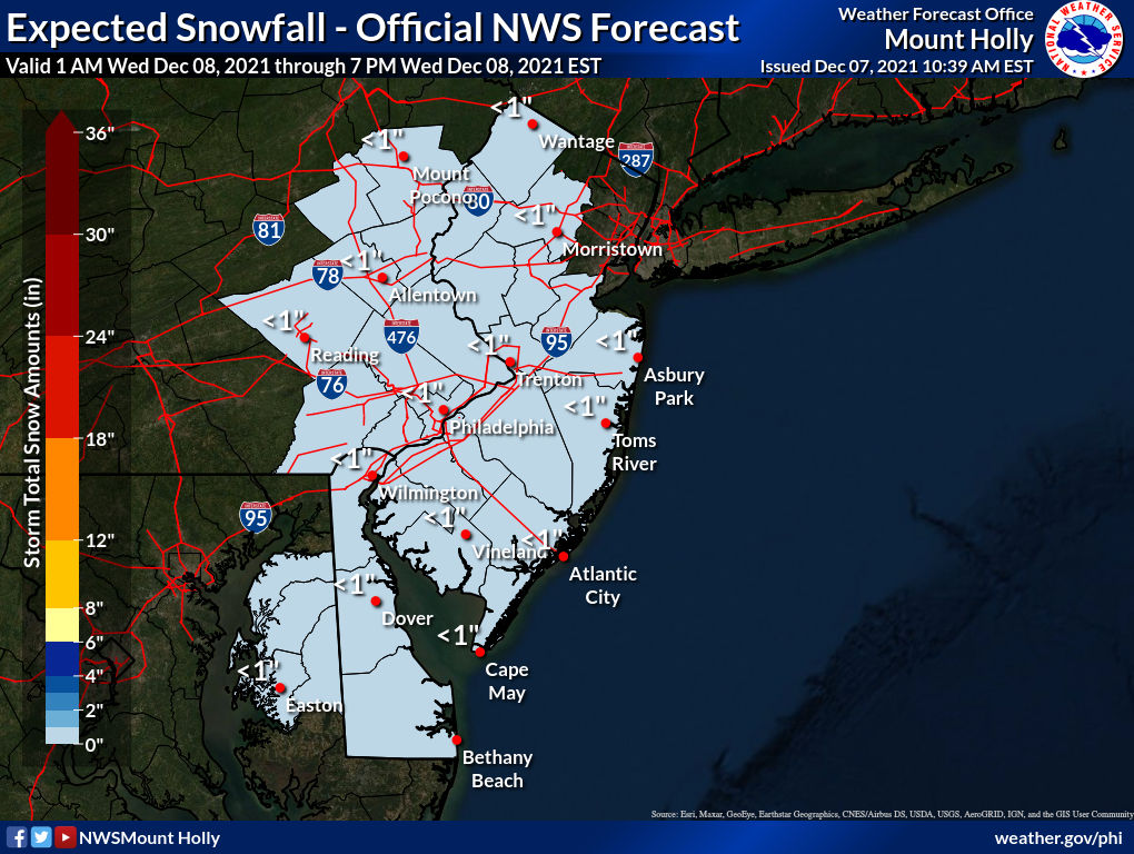
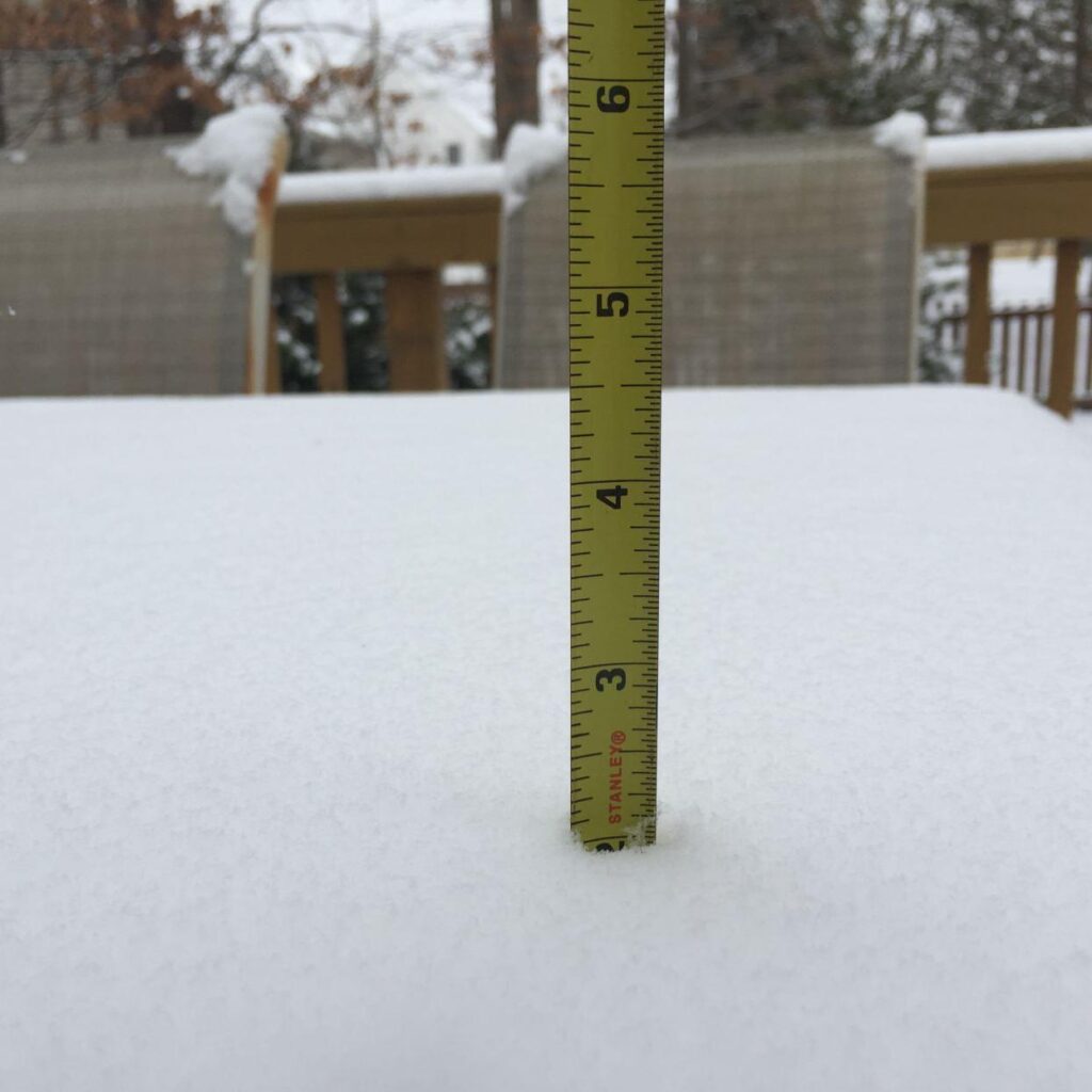
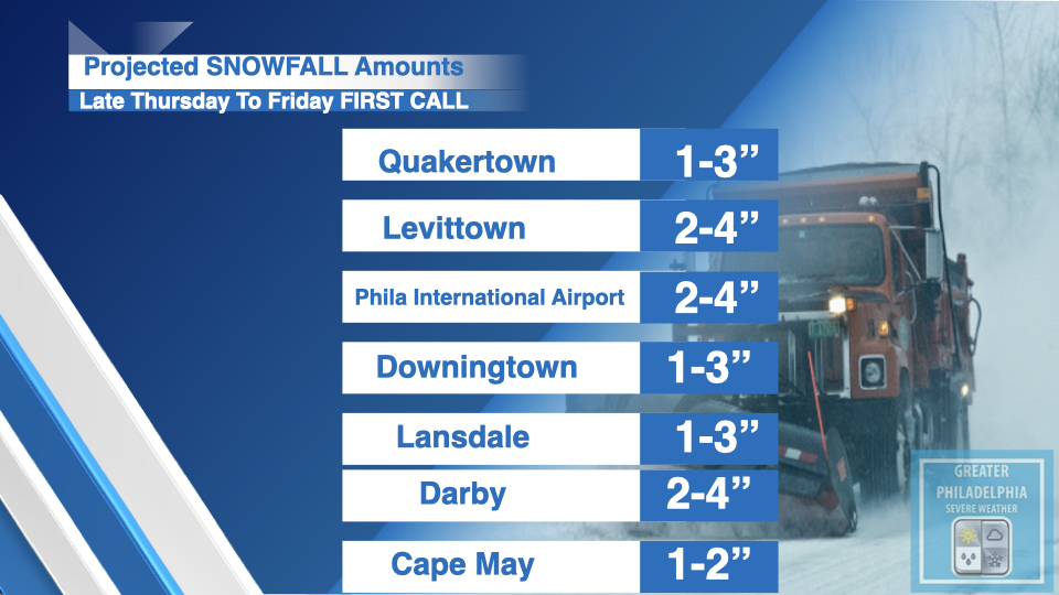
Snowfall Amounts:
Philadelphia Metro and South NJ 2-4″
North and West of the City 1-3″
| Reading, PA | 1-3” |
| Birdsboro, PA | 1-3” |
| Bristol, PA | 2-4” |
| Quakertown, PA | 1-3” |
| Morrisville, PA | 2-4” |
| Perkasie, PA | 1-3” |
| Lehighton, PA | 1-2” |
| Lansford, PA | 1-3” |
| West Chester, PA | 2-4” |
| Phoenixville, PA | 2-4” |
| Coatesville, PA | 2-4” |
| Downingtown, PA | 2-4” |
| Chester, PA | 2-4” |
| Yeadon, PA | 2-4” |
| Darby, PA | 2-4” |
| Atlantic City, NJ | 3-6” |
| Pleasantville, NJ | 2-4” |
| Burlington, NJ | 2-4” |
| Palmyra, NJ | 2-4” |
| Camden, NJ | 2-4” |