BREAKING: 7 Killed and over 19 Injured in Plane Crash in Philadelphia near Roosevelt Mall
Saturday Feb. 1 Updates:
Mayor Parker stated 6 souls killed from the plane, and at least one person has been killed from a vehicle on the ground. Those numbers will rise. At least 19 people have been treated at local hospitals. Support from local all the way to The White House have been in contact with the mayor and Investigators on scene. Please avoid the area.
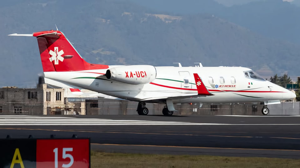
10:45pm UPDATE: Shriners Children’s Philadelphia confirmed one of their pediatric patients who was returning to Mexico, along with her mother, were among the six people on board a medical jet that crashed.
9:50 update: per Mayor Parker if you see any debris call 911 so investigators can secure evidence, shelter is available Samuel Fels High School 5500 Langdon St. NTSB, FAA, state local and federal officers are on the scene.
Gov. Josh Shapiro “We saw the best of Philly, neighbors helping neighbors” 45 Pa State Troopers on the ground at the scene. Members of PennDot, DEP and other federal agencies are on site. Shapiro has spoken to US Sec of Transportation Duffy who has members of the FAA and NTSB enroute to Philly at this time.
President Trump made a statement thanking the first responders.
8:00 pm- THE FAA has released the following statement:
FAA Statement
This information is preliminary and subject to change. A Learjet 55 crashed around 6:30 p.m. local time on Friday, Jan. 31, after departing from Northeast Philadelphia Airport. There were two people on board. The plane was en route to Springfield- Branson National Airport in Missouri. The FAA and NTSB will investigate. The NTSB will lead the investigation and will provide
all updates. • Contact local authorities for the names and medical
conditions of the people on board.
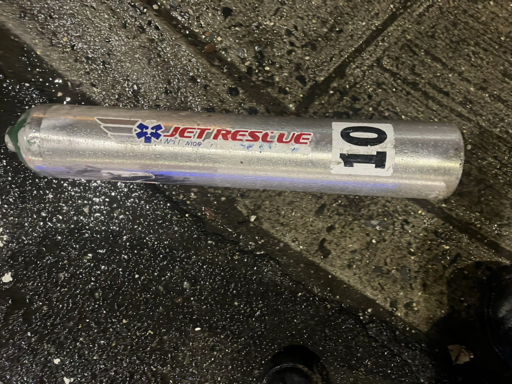
7:30 pm – The Jet is a medical transport jet. A LeerJet55. That took off from Northeast Philadelphia airport heading to MO. At least 2 people were on board
6:50 pm – Per Police Radio, Human Remains have been found in one of the buildings. Could be the pilot.
Original Story:
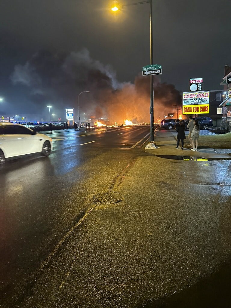
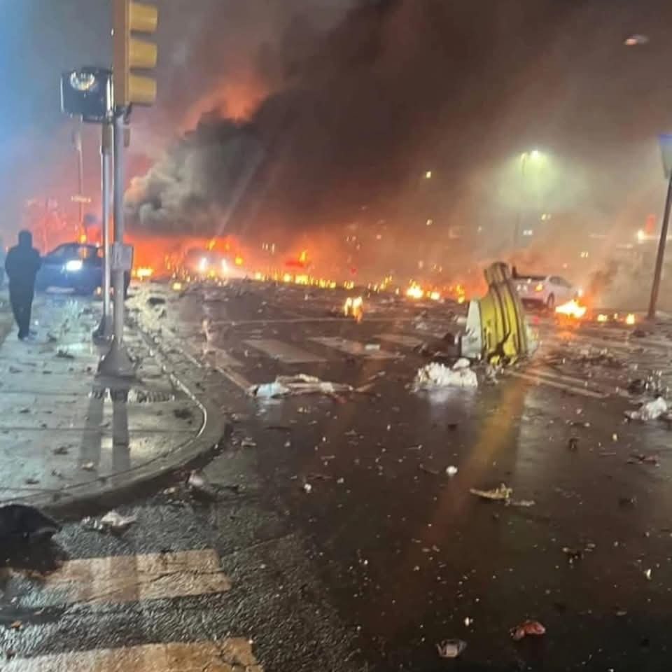
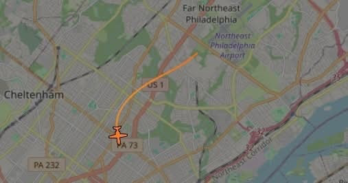
After 6pm Friday evening, Emergency crews were responding to a report of an explosion in Northeast Philadelphia after a plane crashed in the area of Roosevelt Boulevard and Cottman Avenue.
Multiple casualties have been reported, It is reported that two people were on the plane.
Multiple homes are on fire in the area of Cottman Avenue and Roosevelt Boulevard following the crash, fire officials said.
Details will be posted as they come in.
VIDEO OF THE CRASH.