BREAKING: Tropical Storm Watches and Warnings are issued across East Coast
A tropical storm warning was issued Thursday from coastal North Carolina to Delaware ahead of a potential tropical cyclone that’s headed toward the East Coast.
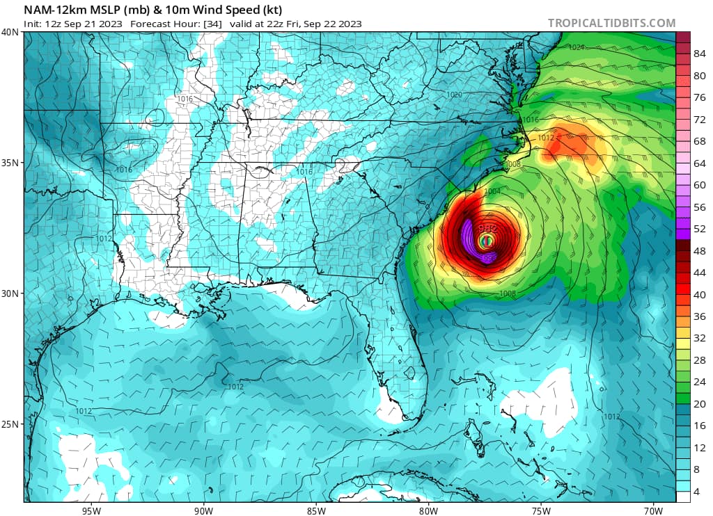
The National Hurricane Center announced “Potential Tropical Cyclone Sixteen” on Thursday morning. The disturbance was located about 370 miles (595 kilometers) southeast of Charleston, South Carolina, forecasters said, and moving north at 9 mph (15 kph). Maximum sustained winds were 35 mph (55 kph).
The hurricane center defines a potential tropical cyclone as a disturbance that poses a threat for tropical storm or hurricane conditions to land within 48 hours. The current system could reach the North Carolina coast around Friday night or early Saturday.
The tropical storm warning is in effect from Cape Fear, North Carolina, to Fenwick Island, Delaware. It also includes the Chesapeake Bay south of Smith Point, and Albemarle and Pamlico Sounds.
A storm surge watch was also issued from Surf City, North Carolina, to Chincoteague, Virginia. The hurricane center said storm surge between 2 and 4 feet (.6 to 1.2 meters) was expected.
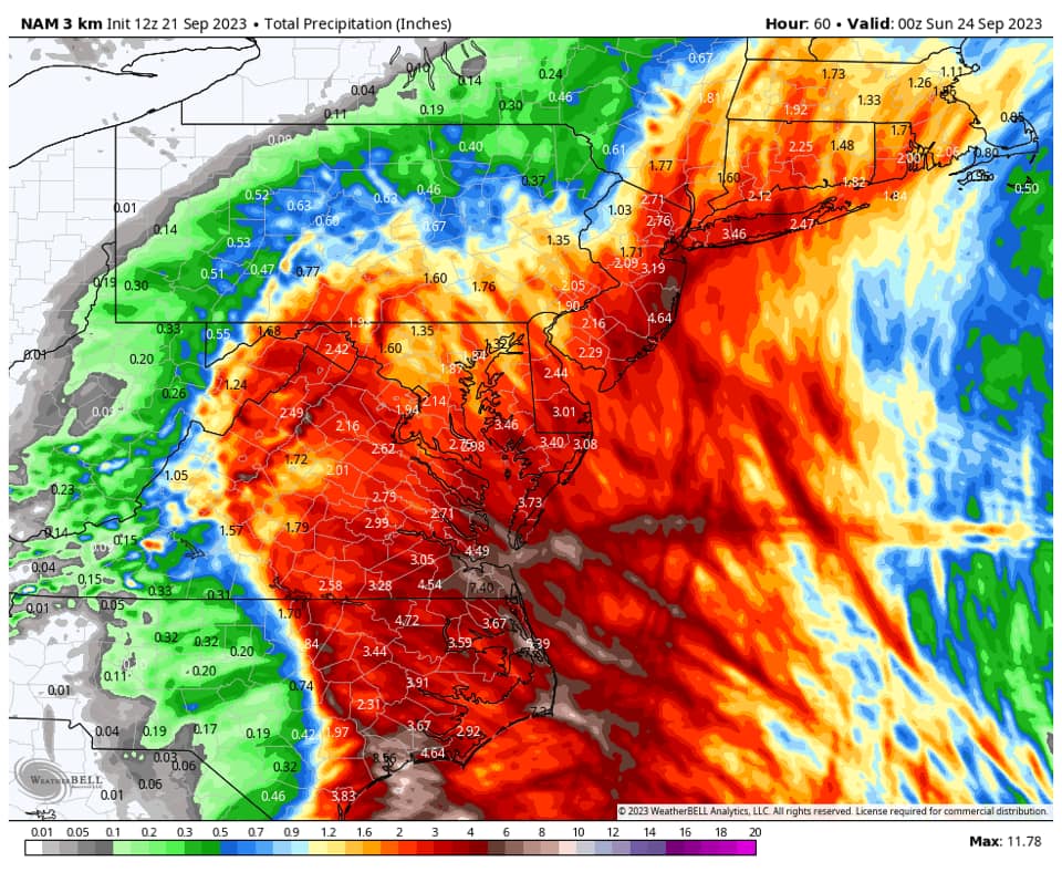
Our team will bring you the latest on the this storm. Next update will be at 5pm. Below are images from the NAM model. We are keeping close eye on this storm and will bring you the latest tonight.