Feb
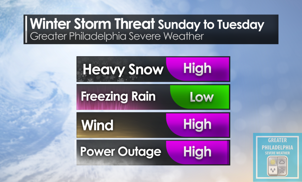
13
The Winter Weather Advisory is now in effect until 10am Sunday
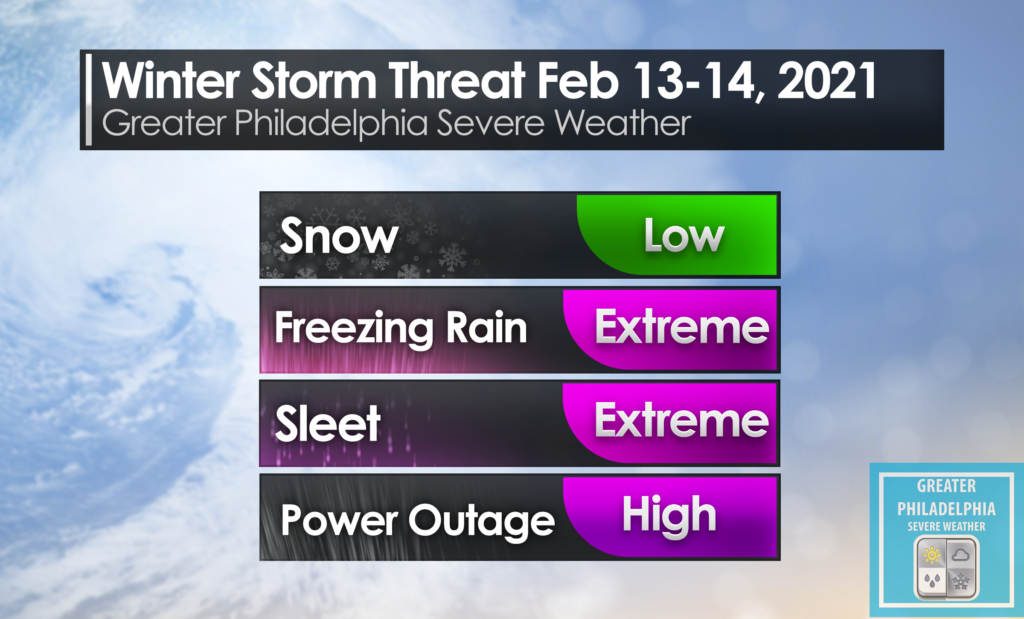
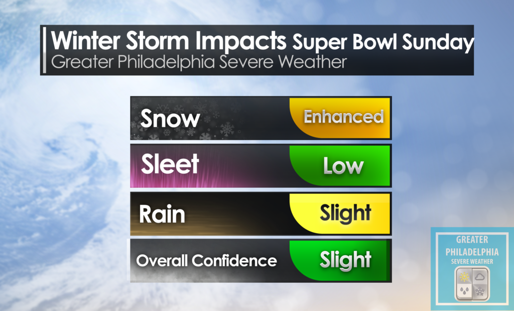
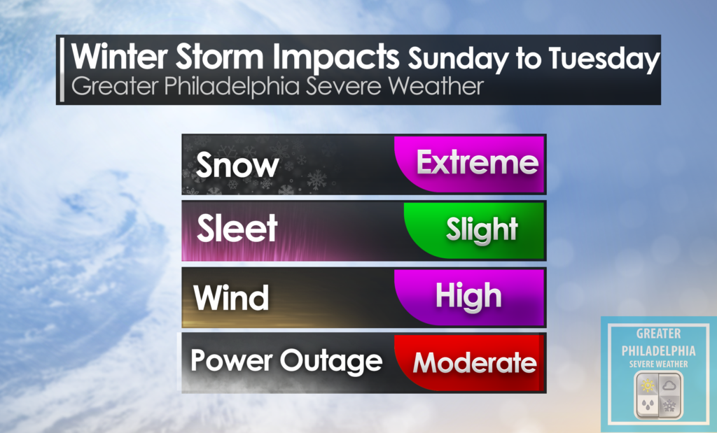
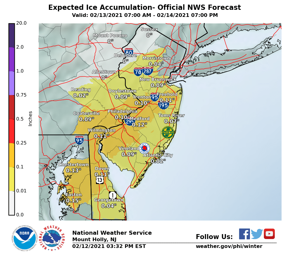
WINTER WEATHER ADVISORY NOW IN EFFECT FROM 1 PM THIS AFTERNOON
TO 10 AM EST SUNDAY...

* WHAT...Mixed precipitation expected. Total snow accumulations of
  less than one inch and ice accumulations of around one tenth of
  an inch.

* WHERE...Portions of central, northern, northwest and southern
  New Jersey and southeast Pennsylvania.

* WHEN...From 1 PM this afternoon to 10 AM EST Sunday.

* IMPACTS...Difficult travel conditions are possible due to icy
  roadways, especially Saturday afternoon through Saturday night.

PRECAUTIONARY/PREPAREDNESS ACTIONS...

Slow down and use caution while traveling.

A wintry mix will move into the region this morning. Within the advisory area, expect a change to freezing rain this afternoon continuing into tonight. Precipitation is expected to taper off late tonight into early Sunday morning

This is the first of several systems which will affect the region with potential wintry precipitation into the new week. The main periods we are concerned about are Monday night into Tuesday and again Wednesday night through Friday