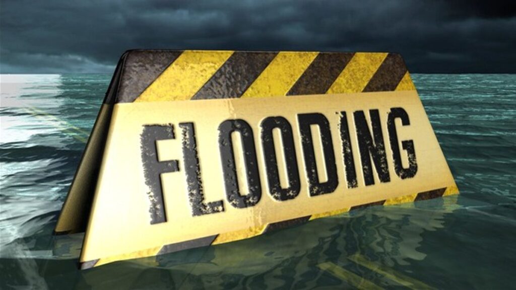
STORM ALERT: Heavy Rain, Flash Flooding and Power Outages Possible
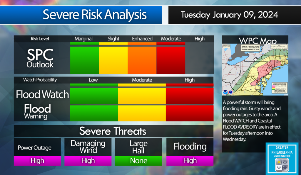
A powerful storm will be 2-3″ upwards of 4″ to the area starting early afternoon on Tuesday into Wednesday. The Philadelphia area will see 40-50 mph winds with gust to 60 mph. Shore points could see wind gust over 65 mph. This storm will cause localized flooding. Expect power outages.
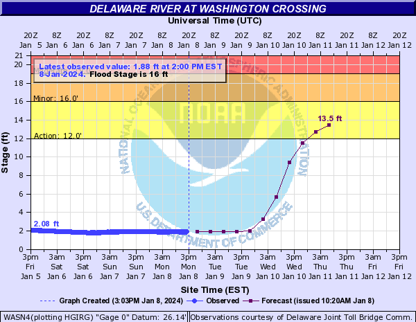
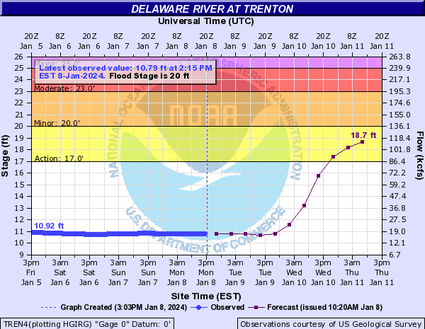
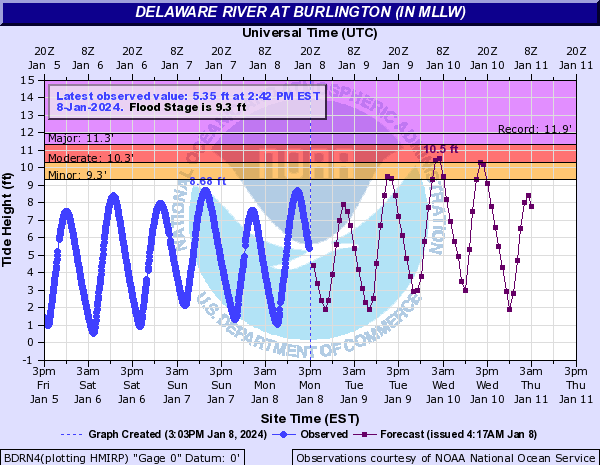
The following are the projected RIVER FLOOD STAGE for The Delaware at Washington Crossing, Trenton and Burlington.
Flood Stage
Watches and Warnings:
WIND ADVISORY:

WIND ADVISORY IN EFFECT FROM 5 PM TUESDAY TO 3 AM EST WEDNESDAY.
WHEN…From 5 PM Tuesday to 3 AM EST Wednesday.
IMPACTS…Gusty winds could blow around unsecured objects. Tree limbs could be blown down and a few power outages may result.
ADDITIONAL DETAILS…
Saturated ground after multiple rounds of heavy rainfall over the last month has made trees more vulnerable to becoming uprooted with strong winds.
PRECAUTIONARY/PREPAREDNESS ACTIONS...
Use extra caution when driving, especially if operating a high profile vehicle. Secure outdoor objects.
FLOOD WATCH IN EFFECT FROM TUESDAY AFTERNOON THROUGH WEDNESDAY AFTERNOON.
WHEN…
From Tuesday afternoon through Wednesday afternoon.
IMPACTS…
Excessive runoff may result in flooding of rivers, creeks, streams, and other low-lying and flood-prone locations. *
ADDITIONAL DETAILS –
Rainfall of 1 to 3 inches possible Tuesday through early Wednesday, with the heaviest rain falling Tuesday night. The ground remains very saturated following multiple rounds of heavy rainfall over the last month. A period of higher hourly rainfall rates is possible during Tuesday night which would enhance the potential for flooding, particularly in the urban areas. Tidal inundation combined with runoff in coastal areas may significantly elevate the flood risk, especially if occurring during times of high tide.
COASTAL FLOOD WATCH IN EFFECT FROM TUESDAY EVENING THROUGH LATE TUESDAY NIGHT…
WHERE...
In New Jersey, Mercer, Gloucester, Camden and Northwestern Burlington. In Pennsylvania, Delaware, Philadelphia and Lower Bucks. * WHEN…From Tuesday evening through late Tuesday night.
IMPACTS…
At this level, widespread roadway flooding occurs along tidal waterways. Some roads become impassable. Minor damage to vulnerable structures may begin to occur.
ADDITIONAL DETAILS.
Tidal flooding could be significantly enhanced by an influx of fresh water runoff due to heavy rain Tuesday night.
PRECAUTIONARY/PREPAREDNESS ACTIONS…
If travel is required, allow extra time as some roads may be closed. Do not drive around barricades or through water of unknown depth. Take the necessary actions to protect flood-prone property
